
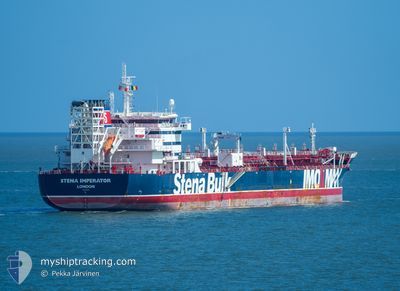
STENA IMPERATOR
Tanker
Current Trip
| Time Travelled | 18 h, 44 mins |
|---|---|
| Remaining Time | --- |
| Distance Travelled | 211.84 nm |
| Remaining Distance | --- |
| AVG Speed | 10.9 Knop |
| MAX Speed | 12.8 Knop |
| AVG Wind | 12.3 knots |
| MAX Wind | 16.8 knots |
| MIN Temp | 13.2°C / 55.76°F |
| MAX Temp | 17.8°C / 64.04°F |
| Djupgående | 8 m |
| Position mottagen | 1 m sen |
Current Position
| Longitud | -126.04924° |
|---|---|
| Latitude | 38.61020° |
| Status | Under way using engine |
| Fart | 12.1 Knop |
| Kurs | 295.6° |
| Område | North Pacific Ocean |
| Station | T-AIS |
| Position mottagen | 1 m sen |
Information
The current position of STENA IMPERATOR is in North Pacific Ocean with coordinates 38.61020° / -126.04924° as reported on 2025-06-10 19:58 by AIS to our vessel tracker app. The vessel's current speed is 12.1 Knop and is heading at the port of ULSAN. The estimated time of arrival as calculated by MyShipTracking vessel tracking app is 2025-06-26 16:15 LT
The vessel STENA IMPERATOR (IMO: 9797383, MMSI: 232007939) is a Tanker It's sailing under the flag of [GB] United Kingdom.
In this page you can find informations about the vessels current position, last detected port calls, and current voyage information. If the vessels is not in coverage by AIS you will find the latest position.
The current position of STENA IMPERATOR is detected by our AIS receivers and we are not responsible for the reliability of the data. The last position was recorded while the vessel was in Coverage by the Ais receivers of our vessel tracking app.
The current draught of STENA IMPERATOR as reported by AIS is 8 meters
Weather
| Temperature | 13.4°C / 56.12°F |
|---|---|
| Wind Speed | 12 knots |
| Direction | 322° NW |
| Pressure | 1018 hPa |
| Humidity | 93.7 % |
| Cloud Coverage | 7 % |
Featured Company
Last Port Calls
| Port | Arrival | Departure | Time In Port |
|---|---|---|---|
| 2025-06-07 05:06 | 2025-06-10 01:16 | 2 d | |
| 2025-05-14 00:01 | 2025-05-19 22:34 | 5 d | |
| 2025-05-09 04:02 | 2025-05-09 23:02 | 18 h | |
| 2025-05-04 05:43 | 2025-05-06 04:22 | 1 d | |
| 2025-04-30 10:54 | 2025-05-01 04:17 | 17 h | |
| 2025-04-22 08:26 | 2025-04-24 02:34 | 1 d | |
| 2025-04-20 04:32 | 2025-04-21 04:19 | 23 h | |
| 2025-04-06 15:42 | 2025-04-08 06:06 | 1 d |
Most Visited Ports (Last year)
| Port | Arrivals | |
|---|---|---|
| 4 | ||
| 4 | ||
| 3 | ||
| 2 | ||
| 2 | ||
| 2 |
Last Trips
| Origin | Departure | Destination | Arrival | Distance | |
|---|---|---|---|---|---|
| 2025-05-20 07:34 | 2025-06-06 22:06 | 5038.12 nm | |||
| 2025-05-10 07:02 | 2025-05-14 09:01 | 895.79 nm | |||
| 2025-05-06 13:22 | 2025-05-09 12:02 | 883.85 nm | |||
| 2025-05-01 12:17 | 2025-05-04 14:43 | 890.41 nm | |||
| 2025-04-24 10:34 | 2025-04-30 18:54 | 1701.55 nm | |||
| 2025-04-21 12:19 | 2025-04-22 16:26 | 69.62 nm | |||
| 2025-04-08 14:06 | 2025-04-20 12:32 | 95.91 nm | |||
| 2025-03-29 07:01 | 2025-04-06 23:42 | 2600.34 nm |
Events
| Tid | Event | Detaljer | Position / Dest | Information |
|---|---|---|---|---|
| 2025-06-10 19:51 | Status ändrad | Under way using engine Default |
38.59917 / -126.02037
USRD4>KRUSN
|
Fart: 11.5 kn Kurs: 298° |
| 2025-06-10 19:45 | Status ändrad | Default Under way using engine |
38.59087 / -125.99933
USRD4>KRUSN
|
Fart: 11.8 kn Kurs: 296.8° |
| 2025-06-10 19:19 | Status ändrad | Under way using engine Default |
38.55099 / -125.90653
USRD4>KRUSN
|
Fart: 11.9 kn Kurs: 300° |
| 2025-06-10 19:08 | Status ändrad | Default Under way using engine |
38.53194 / -125.86430
USRD4>KRUSN
|
Fart: 11.9 kn Kurs: 301.3° |
| 2025-06-10 19:00 | Status ändrad | Under way using engine Default |
38.51926 / -125.83562
USRD4>KRUSN
|
Fart: 11.8 kn Kurs: 300° |
| 2025-06-10 18:54 | Status ändrad | Default Under way using engine |
38.50990 / -125.81410
USRD4>KRUSN
|
Fart: 11.5 kn Kurs: 299.5° |
| 2025-06-10 18:42 | Status ändrad | Under way using engine Default |
38.49132 / -125.77147
USRD4>KRUSN
|
Fart: 11.8 kn Kurs: 298° |
| 2025-06-10 18:36 | Status ändrad | Default Under way using engine |
38.48083 / -125.74704
USRD4>KRUSN
|
Fart: 11.6 kn Kurs: 296.4° |
| 2025-06-10 18:22 | Status ändrad | Under way using engine Default |
38.46032 / -125.69801
USRD4>KRUSN
|
Fart: 12 kn Kurs: 297° |
| 2025-06-10 18:20 | Status ändrad | Default Under way using engine |
38.45611 / -125.68806
USRD4>KRUSN
|
Fart: 12.1 kn Kurs: 297.1° |