
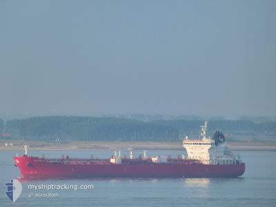
STI PIMLICO
Tanker A
Current Trip
| Time Travelled | 1 day |
|---|---|
| Remaining Time | 1 day |
| Distance Travelled | 312.46 nm |
| Remaining Distance | 666.90 nm |
| AVG Speed | 12.6 Knop |
| MAX Speed | 14.6 Knop |
| AVG Wind | 17.6 knots |
| MAX Wind | 30 knots |
| MIN Temp | 11.8°C / 53.24°F |
| MAX Temp | 14.6°C / 58.28°F |
| Djupgående | 8.4 m |
| Position mottagen | 2 h, 17 m sen |
Current Position
| Longitud | -6.12628° |
|---|---|
| Latitude | 35.95243° |
| Status | Under way using engine |
| Fart | 14.3 Knop |
| Kurs | 267.4° |
| Område | North Atlantic Ocean |
| Station | T-AIS |
| Position mottagen | 2 h, 17 m sen |
Info
Information
The current position of STI PIMLICO is in North Atlantic Ocean with coordinates 35.95243° / -6.12628° as reported on 2025-02-04 03:29 by AIS to our vessel tracker app. The vessel's current speed is 14.3 Knop and is heading at the port of LAS PALMAS. The estimated time of arrival as calculated by MyShipTracking vessel tracking app is 2025-02-06 03:55 LT
The vessel STI PIMLICO (IMO: 9686871, MMSI: 538005398) is a Tanker A It's sailing under the flag of [MH] Marshall Is.
In this page you can find informations about the vessels current position, last detected port calls, and current voyage information. If the vessels is not in coverage by AIS you will find the latest position.
The current position of STI PIMLICO is detected by our AIS receivers and we are not responsible for the reliability of the data. The last position was recorded while the vessel was in Coverage by the Ais receivers of our vessel tracking app.
The current draught of STI PIMLICO as reported by AIS is 8.4 meters
Weather
| Temperature | 14.4°C / 57.92°F |
|---|---|
| Wind Speed | 19 knots |
| Direction | 65° ENE |
| Pressure | 1024.3 hPa |
| Humidity | 70.9 % |
| Cloud Coverage | 51 % |
Featured Company
Last Port Calls
| Port | Arrival | Departure | Time In Port |
|---|---|---|---|
| 2025-02-01 02:23 | 2025-02-03 03:37 | 2 d | |
| 2025-01-23 19:47 | 2025-01-25 16:51 | 1 d | |
| 2025-01-20 07:09 | 2025-01-21 02:57 | 19 h | |
| 2025-01-12 07:41 | 2025-01-12 16:29 | 8 h | |
| 2025-01-11 08:53 | 2025-01-11 17:57 | 9 h | |
| 2025-01-08 07:00 | 2025-01-09 05:04 | 22 h | |
| 2025-01-07 13:05 | |||
| 2024-12-31 19:08 | 2025-01-02 14:18 | 1 d | |
| 2024-12-27 13:50 | 2024-12-29 09:08 | 1 d | |
| 2024-12-20 07:12 | 2024-12-21 16:02 | 1 d |
Most Visited Ports (Last year)
| Port | Arrivals | |
|---|---|---|
| 6 | ||
| 4 | ||
| 4 | ||
| 3 | ||
| 2 | ||
| 2 |
Last Trips
| Origin | Departure | Destination | Arrival | Distance | |
|---|---|---|---|---|---|
| 2025-01-25 17:51 | 2025-02-01 03:23 | 630.97 nm | |||
| 2025-01-21 03:57 | 2025-01-23 20:47 | 739.43 nm | |||
| 2025-01-12 17:29 | 2025-01-20 08:09 | 549.86 nm | |||
| 2025-01-11 18:57 | 2025-01-12 08:41 | 8.24 nm | |||
| 2025-01-09 06:04 | 2025-01-11 09:53 | 626.94 nm | |||
| 2025-01-07 14:05 | 2025-01-08 08:00 | 196.50 nm | |||
| 2024-12-29 12:08 | 2024-12-31 21:08 | 630.93 nm | |||
| 2024-12-21 18:02 | 2024-12-27 16:50 | 665.14 nm | |||
| 2024-12-10 11:40 | 2024-12-20 09:12 | 1243.24 nm | |||
| 2024-12-08 09:48 | 2024-12-09 08:01 | 7.23 nm |
Events
| Tid | Event | Detaljer | Position / Dest | Information |
|---|---|---|---|---|
| 2025-02-04 03:35 | Status ändrad | Default Under way using engine |
35.95249 / -6.15577
ESLPA
|
Fart: 14.3 kn Kurs: 267.4° |
| 2025-02-04 03:29 | Byter havsområde | Spanish part of the North Atlantic Ocean Moroccan part of the North Atlantic Ocean |
35.95243 / -6.12628
North Atlantic Ocean
ESLPA
|
Fart: 14.3 kn Kurs: 267.4° |
| 2025-02-04 03:29 | UTANFÖR täckningsområde |
35.95243 / -6.12628
North Atlantic Ocean
ESLPA
|
Fart: 14.3 kn Kurs: 267.4° |
|
| 2025-02-04 03:29 | Status ändrad | Under way using engine Default |
35.95244 / -6.12579
ESLPA
|
Fart: 13.9 kn Kurs: 268° |
| 2025-02-04 03:14 | Status ändrad | Default Under way using engine |
35.95443 / -6.05308
ESLPA
|
Fart: 14.1 kn Kurs: 273.5° |
| 2025-02-04 02:56 | Byter havsområde | Moroccan part of the North Atlantic Ocean Moroccan part of the Strait of Gibraltar |
35.95055 / -5.96780
North Atlantic Ocean
ESLPA
|
Fart: 14.3 kn Kurs: 271.9° |
| 2025-02-04 02:31 | Byter havsområde | Moroccan part of the Strait of Gibraltar Spanish part of the Strait of Gibraltar |
35.94847 / -5.84356
Strait of Gibraltar
ESLPA
|
Fart: 14.4 kn Kurs: 270° |
| 2025-02-04 02:25 | Status ändrad | Under way using engine Default |
35.94829 / -5.81673
ESLPA
|
Fart: 14.6 kn Kurs: 271° |
| 2025-02-04 02:19 | Status ändrad | Default Under way using engine |
35.94797 / -5.78358
ESLPA
|
Fart: 15.2 kn Kurs: 271.3° |
| 2025-02-04 00:35 | Byter havsområde | Spanish part of the Strait of Gibraltar Gibraltarian part of the Alboran Sea |
36.01735 / -5.33884
Strait of Gibraltar
ESLPA
|
Fart: 12.2 kn Kurs: 251.7° |