
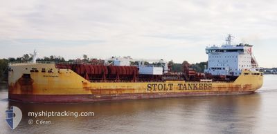
STOLT INTEGRITY
Tanker B
Current Trip
| Time Travelled | 8 h, 6 mins |
|---|---|
| Remaining Time | 1 day |
| Distance Travelled | 3.26 nm |
| Remaining Distance | 818.06 nm |
| AVG Speed | 4.9 Knop |
| MAX Speed | 5.9 Knop |
| AVG Wind | 3.5 knots |
| MAX Wind | 5 knots |
| MIN Temp | 3.7°C / 38.66°F |
| MAX Temp | 5.7°C / 42.26°F |
| Djupgående | 8.8 m |
| Position mottagen | 1 d sen |
Current Position
| Longitud | 129.38037° |
|---|---|
| Latitude | 35.12020° |
| Status | Under way using engine |
| Fart | 7.6 Knop |
| Kurs | 15.1° |
| Område | Japan Sea |
| Station | T-AIS |
| Position mottagen | 1 d sen |
Info
Information
The current position of STOLT INTEGRITY is in Japan Sea with coordinates 35.12020° / 129.38037° as reported on 2025-02-10 18:51 by AIS to our vessel tracker app. The vessel's current speed is 7.6 Knop and is heading at the port of TAICHUNG. The estimated time of arrival as calculated by MyShipTracking vessel tracking app is 2025-02-14 01:55 LT
The vessel STOLT INTEGRITY (IMO: 9680097, MMSI: 319106900) is a Tanker B It's sailing under the flag of [KY] Cayman Is.
In this page you can find informations about the vessels current position, last detected port calls, and current voyage information. If the vessels is not in coverage by AIS you will find the latest position.
The current position of STOLT INTEGRITY is detected by our AIS receivers and we are not responsible for the reliability of the data. The last position was recorded while the vessel was in Coverage by the Ais receivers of our vessel tracking app.
The current draught of STOLT INTEGRITY as reported by AIS is 8.8 meters
Weather
| Temperature | 5.7°C / 42.26°F |
|---|---|
| Wind Speed | 7 knots |
| Direction | 311° NW |
| Pressure | 1010 hPa |
| Humidity | 88 % |
| Cloud Coverage | 100 % |
Featured Company
Last Port Calls
| Port | Arrival | Departure | Time In Port |
|---|---|---|---|
| 2025-02-10 22:37 | 2025-02-12 00:45 | 1 d | |
| 2025-02-06 04:18 | 2025-02-07 00:26 | 20 h | |
| 2025-02-05 03:37 | 2025-02-05 17:37 | 13 h | |
| 2025-02-04 00:38 | 2025-02-04 15:10 | 14 h | |
| 2025-01-25 11:20 | 2025-01-27 02:25 | 1 d | |
| 2025-01-24 02:13 | 2025-01-24 20:37 | 18 h | |
| 2025-01-20 17:12 | 2025-01-21 08:19 | 15 h | |
| 2025-01-14 03:23 | 2025-01-15 13:39 | 1 d | |
| 2025-01-12 13:37 | 2025-01-14 01:48 | 1 d | |
| 2025-01-05 23:08 | 2025-01-06 12:41 | 13 h |
Most Visited Ports (Last year)
| Port | Arrivals | |
|---|---|---|
| 6 | ||
| 6 | ||
| 5 | ||
| 4 | ||
| 4 | ||
| 3 |
Last Trips
| Origin | Departure | Destination | Arrival | Distance | |
|---|---|---|---|---|---|
| 2025-02-07 08:26 | 2025-02-11 07:37 | 884.75 nm | |||
| 2025-02-06 01:37 | 2025-02-06 12:18 | 66.12 nm | |||
| 2025-02-04 23:10 | 2025-02-05 11:37 | 133.55 nm | |||
| 2025-01-27 09:25 | 2025-02-04 08:38 | 1698.53 nm | |||
| 2025-01-25 03:37 | 2025-01-25 18:20 | 12.37 nm | |||
| 2025-01-21 16:19 | 2025-01-24 09:13 | 768.70 nm | |||
| 2025-01-15 21:39 | 2025-01-21 01:12 | 91.56 nm | |||
| 2025-01-14 09:48 | 2025-01-14 11:23 | 13.85 nm | |||
| 2025-01-06 20:41 | 2025-01-12 21:37 | 1636.37 nm | |||
| 2025-01-05 16:25 | 2025-01-06 07:08 | 138.93 nm |
Events
| Tid | Event | Detaljer | Position / Dest | Information |
|---|---|---|---|---|
| 2025-02-12 01:41 | STOPPAR förflyttning | 3.1 nm, East of ONSAN |
35.42708 / 129.43912
TW TXG
|
Fart: 0.2 kn Kurs: 231° |
| 2025-02-12 00:45 | AVGÅTT HAMN |
|
35.44816 / 129.38475
TW TXG
|
Fart: 6.4 kn Kurs: 97° |
| 2025-02-12 00:40 | STARTAR förflyttning |
35.44925 / 129.37413
[KR] ONSAN
|
Fart: 7.4 kn Kurs: 103° |
|
| 2025-02-10 22:37 | STOPPAR förflyttning |
35.45641 / 129.35167
[KR] ONSAN
|
Fart: Kurs: 281° |
|
| 2025-02-10 22:37 | ANLÄNDER HAMN |
|
35.45641 / 129.35167
[KR] ONSAN
|
Fart: 1 kn Kurs: 283° |
| 2025-02-10 18:57 | Status ändrad | Default Under way using engine |
35.13341 / 129.38448
TW TXG
|
Fart: 7.6 kn Kurs: 15.1° |
| 2025-02-10 18:51 | Status ändrad | Under way using engine Default |
35.12020 / 129.38037
TW TXG
|
Fart: 7.5 kn Kurs: 16° |
| 2025-02-10 18:51 | UTANFÖR täckningsområde |
35.12020 / 129.38037
Japan Sea
|
Fart: 7.6 kn Kurs: 15.1° |
|
| 2025-02-10 18:41 | Status ändrad | Default Under way using engine |
35.10094 / 129.37357
TW TXG
|
Fart: 10.7 kn Kurs: 16.3° |
| 2025-02-10 18:32 | Status ändrad | Under way using engine Default |
35.07641 / 129.36471
TW TXG
|
Fart: 11.8 kn Kurs: 20° |