
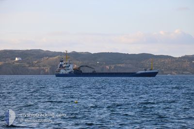
TAXIARCHIS M
General Cargo
Current Trip
| Time Travelled | 5 days |
|---|---|
| Remaining Time | 8 h, 4 mins |
| Distance Travelled | 65.75 nm |
| Remaining Distance | 72.73 nm |
| AVG Speed | 7.6 Knop |
| MAX Speed | 10.5 Knop |
| AVG Wind | 28.2 knots |
| MAX Wind | 33 knots |
| MIN Temp | 7.3°C / 45.14°F |
| MAX Temp | 9.6°C / 49.28°F |
| Djupgående | 4.3 m |
| Position mottagen | Nu |
Current Position
| Longitud | 24.95041° |
|---|---|
| Latitude | 37.63244° |
| Status | Under way using engine |
| Fart | 8.7 Knop |
| Kurs | 313.2° |
| Område | Aegean Sea |
| Station | T-AIS |
| Position mottagen | Nu |
Info
Information
The current position of TAXIARCHIS M is in Aegean Sea with coordinates 37.63244° / 24.95041° as reported on 2025-02-10 11:55 by AIS to our vessel tracker app. The vessel's current speed is 8.7 Knop and is heading at the port of MILAKI. The estimated time of arrival as calculated by MyShipTracking vessel tracking app is 2025-02-10 20:00 LT
The vessel TAXIARCHIS M (IMO: 7711907, MMSI: 240477700) is a General Cargo that was built in 1979 ( 46 År gammal ). It's sailing under the flag of [GR] Greece.
In this page you can find informations about the vessels current position, last detected port calls, and current voyage information. If the vessels is not in coverage by AIS you will find the latest position.
The current position of TAXIARCHIS M is detected by our AIS receivers and we are not responsible for the reliability of the data. The last position was recorded while the vessel was in Coverage by the Ais receivers of our vessel tracking app.
The current draught of TAXIARCHIS M as reported by AIS is 4.3 meters
Weather
| Temperature | 7.9°C / 46.22°F |
|---|---|
| Wind Speed | 26 knots |
| Direction | 10° N |
| Pressure | 1025.4 hPa |
| Humidity | 64.8 % |
| Cloud Coverage | 75 % |
Featured Company
Last Port Calls
| Port | Arrival | Departure | Time In Port |
|---|---|---|---|
| 2025-02-04 02:28 | 2025-02-05 08:31 | 1 d | |
| 2025-02-02 14:31 | 2025-02-03 16:09 | 1 d | |
| 2025-02-01 05:16 | 2025-02-01 16:38 | 11 h | |
| 2025-01-30 09:57 | 2025-01-31 15:06 | 1 d | |
| 2025-01-29 07:43 | 2025-01-29 20:16 | 12 h | |
| 2025-01-28 05:12 | 2025-01-28 18:51 | 13 h | |
| 2025-01-23 12:15 | 2025-01-25 09:13 | 1 d | |
| 2025-01-20 20:10 | 2025-01-22 17:09 | 1 d | |
| 2025-01-19 14:48 | 2025-01-20 09:31 | 18 h | |
| 2025-01-17 05:44 | 2025-01-17 18:30 | 12 h |
Last Trips
| Origin | Departure | Destination | Arrival | Distance | |
|---|---|---|---|---|---|
| 2025-02-03 18:09 | 2025-02-04 04:28 | 88.09 nm | |||
| 2025-02-01 18:38 | 2025-02-02 16:31 | 108.12 nm | |||
| 2025-01-31 17:06 | 2025-02-01 07:16 | 105.43 nm | |||
| 2025-01-29 22:16 | 2025-01-30 11:57 | 91.28 nm | |||
| 2025-01-28 20:51 | 2025-01-29 09:43 | 101.36 nm | |||
| 2025-01-25 11:13 | 2025-01-28 07:12 | 109.08 nm | |||
| 2025-01-22 19:09 | 2025-01-23 14:15 | 105.75 nm | |||
| 2025-01-20 11:31 | 2025-01-20 22:10 | 90.71 nm | |||
| 2025-01-17 20:30 | 2025-01-19 16:48 | 94.66 nm | |||
| 2025-01-16 04:19 | 2025-01-17 07:44 | 92.00 nm |
Events
| Tid | Event | Detaljer | Position / Dest | Information |
|---|---|---|---|---|
| 2025-02-10 09:10 | ETA ändrat | 2025/02/10 20:00 2025/02/10 02:00 |
37.36380 / 25.27476
MILAKI
|
Fart: 9.6 kn Kurs: 213.5° |
| 2025-02-10 09:09 | Djupgående ändrat | 4.3 6.7 |
37.36655 / 25.27692
MILAKI
|
Fart: 9.7 kn Kurs: 203.9° |
| 2025-02-10 09:09 | Destination ändrad | MILAKI MYKONOS |
37.36655 / 25.27692
MILAKI
|
Fart: 9.7 kn Kurs: 203.9° |
| 2025-02-10 09:09 | ETA ändrat | 2025/02/10 02:00 2025/02/04 02:00 |
37.36655 / 25.27692
MILAKI
|
Fart: 9.7 kn Kurs: 203.9° |
| 2025-02-10 09:08 | Status ändrad | Under way using engine At anchor |
37.36730 / 25.27745
MYKONOS
|
Fart: 9.7 kn Kurs: 202.8° |
| 2025-02-10 08:43 | STARTAR förflyttning | 2.69 nm, East of DELOS |
37.39993 / 25.32062
MYKONOS
|
Fart: 3.2 kn Kurs: 289° |
| 2025-02-05 12:07 | Status ändrad | At anchor Under way using engine |
37.40276 / 25.32389
MYKONOS
|
Fart: 1.3 kn Kurs: 43° |
| 2025-02-05 11:57 | STOPPAR förflyttning | 2.78 nm, South of MYKONOS OLD PORT |
37.40305 / 25.32377
MYKONOS
|
Fart: 0.3 kn Kurs: 37° |
| 2025-02-05 11:35 | STARTAR förflyttning | 2.5 nm, East of DELOS |
37.39329 / 25.31649
MYKONOS
|
Fart: 3.5 kn Kurs: 35° |
| 2025-02-05 09:30 | STOPPAR förflyttning | 2.36 nm, East of DELOS |
37.40102 / 25.31354
MYKONOS
|
Fart: 0.1 kn Kurs: 31° |