
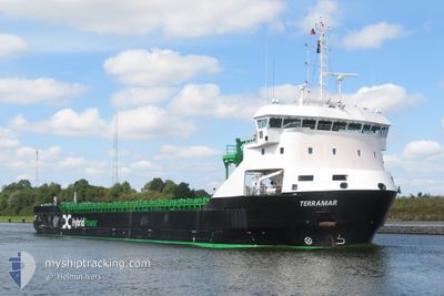
TERRAMAR
Cargo
Current Trip
| Time Travelled | 3 days |
|---|---|
| Remaining Time | 2 days |
| Distance Travelled | 452.64 nm |
| Remaining Distance | 707.39 nm |
| AVG Speed | 6.3 Knop |
| MAX Speed | 12.6 Knop |
| AVG Wind | 24.9 knots |
| MAX Wind | 34 knots |
| MIN Temp | -0.2°C / 31.64°F |
| MAX Temp | 8.9°C / 48.02°F |
| Djupgående | 4.4 m |
| Position mottagen | 1 h, 27 m sen |
Current Position
| Longitud | -1.02465° |
|---|---|
| Latitude | 50.31919° |
| Status | Under way using engine |
| Fart | 7.3 Knop |
| Kurs | 249.6° |
| Område | English Channel |
| Station | T-AIS |
| Position mottagen | 1 h, 27 m sen |
Info
Information
The current position of TERRAMAR is in English Channel with coordinates 50.31919° / -1.02465° as reported on 2026-01-09 22:41 by AIS to our vessel tracker app. The vessel's current speed is 7.3 Knop and is heading at the port of VIANA DO CASTELO. The estimated time of arrival as calculated by MyShipTracking vessel tracking app is 2026-01-12 21:45 LT
The vessel TERRAMAR (IMO: 9951874, MMSI: 210695000) is a Cargo It's sailing under the flag of [CY] Cyprus.
In this page you can find informations about the vessels current position, last detected port calls, and current voyage information. If the vessels is not in coverage by AIS you will find the latest position.
The current position of TERRAMAR is detected by our AIS receivers and we are not responsible for the reliability of the data. The last position was recorded while the vessel was in Coverage by the Ais receivers of our vessel tracking app.
The current draught of TERRAMAR as reported by AIS is 4.4 meters
Weather
| Temperature | 6.3°C / 43.34°F |
|---|---|
| Wind Speed | 26 knots |
| Direction | 326° NW |
| Pressure | 1005.8 hPa |
| Humidity | 76.3 % |
| Cloud Coverage | 99 % |
Featured Company
Last Port Calls
| Port | Arrival | Departure | Time In Port |
|---|---|---|---|
| 2026-01-05 17:37 | 2026-01-06 14:31 | 20 h | |
| 2025-12-30 14:47 | 2026-01-05 16:31 | 6 d | |
| 2025-12-05 11:21 | 2025-12-05 22:58 | 11 h | |
| 2025-11-17 13:07 | 2025-11-20 01:07 | 2 d | |
| 2025-11-10 10:14 | 2025-11-12 08:24 | 1 d | |
| 2025-11-05 04:36 | |||
| 2025-11-01 17:01 |
Last Trips
| Origin | Departure | Destination | Arrival | Distance | |
|---|---|---|---|---|---|
| 2026-01-05 16:31 | 2026-01-05 17:37 | 3.73 nm | |||
| 2025-11-12 08:24 | 2025-11-17 13:07 | 1101.74 nm | |||
| 2025-11-01 17:01 | 2025-11-05 04:36 | 748.21 nm |
Events
| Tid | Event | Detaljer | Position / Dest | Information |
|---|---|---|---|---|
| 2026-01-09 22:41 | UTANFÖR täckningsområde |
50.31919 / -1.02465
English Channel
PT VDC
|
Fart: 7.3 kn Kurs: 249.6° |
|
| 2026-01-09 17:53 | I täckningsområde |
50.57033 / .15142
English Channel
PT VDC
|
Fart: 10 kn Kurs: 254.1° |
|
| 2026-01-09 11:33 | UTANFÖR täckningsområde |
51.00000 / 1.30221
English Channel
PT VDC
|
Fart: 11.3 kn Kurs: 229.1° |
|
| 2026-01-09 10:55 | Byter havsområde | United Kingdom part of the English Channel United Kingdom part of the North Sea |
51.08754 / 1.44180
English Channel
PT VDC
|
Fart: 12.2 kn Kurs: 217° |
| 2026-01-09 09:04 | ETA ändrat | 2026/01/14 18:00 2026/01/11 09:00 |
51.41109 / 1.51707
PT VDC
|
Fart: 12.2 kn Kurs: 122.3° |
| 2026-01-09 09:03 | Status ändrad | Under way using engine At anchor |
51.41109 / 1.51707
PT VDC
|
Fart: 12.1 kn Kurs: 121.6° |
| 2026-01-09 08:38 | STARTAR förflyttning | 5.11 nm, North of RAMSGATE |
51.41069 / 1.42326
PT VDC
|
Fart: 3.3 kn Kurs: 344° |
| 2026-01-08 07:31 | Status ändrad | At anchor Under way using engine |
51.41483 / 1.42304
PT VDC
|
Fart: 0.2 kn Kurs: 256° |
| 2026-01-08 07:10 | STOPPAR förflyttning | 5.31 nm, North of RAMSGATE |
51.41402 / 1.42086
PT VDC
|
Fart: 0.3 kn Kurs: 258° |
| 2026-01-08 03:35 | Upptäckt i hav | United Kingdom part of the North Sea |
51.68783 / 2.03089
North Sea
PT VDC
|
Fart: 7.6 kn Kurs: 222.7° |