
THEODELA
Tanker
Current Trip
| Trip Time | 19 h, 19 mins |
|---|---|
| Trip Distance | 201.24 nm |
| AVG Speed | 11.6 Knop |
| MAX Speed | 14 Knop |
| Djupgående | 3 m |
| AVG Wind | 7.5 knots |
| MAX Wind | 17 knots |
| MIN Temp | 3.9°C / 39.02°F |
| MAX Temp | 8.3°C / 46.94°F |
| Position mottagen | 1 d sen |
Current Position
| Longitud | 4.00563° |
|---|---|
| Latitude | 51.47328° |
| Status | Under way using engine |
| Fart | 7 Knop |
| Kurs | 177.4° |
| Område | North Sea |
| Station | T-AIS |
| Position mottagen | 1 d sen |
Info
Information
The current position of THEODELA is in North Sea with coordinates 51.47328° / 4.00563° as reported on 2025-12-15 01:17 by AIS to our vessel tracker app. The vessel's current speed is 7 Knop and is currently inside the port of HANSWEERT.
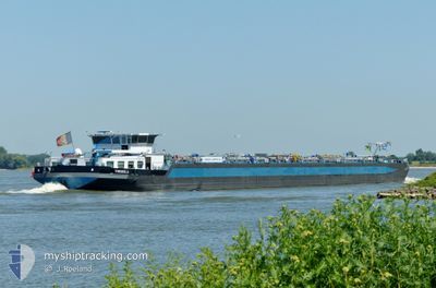
The vessel THEODELA (MMSI: 205415190) is a Tanker It's sailing under the flag of [BE] Belgium.
In this page you can find informations about the vessels current position, last detected port calls, and current voyage information. If the vessels is not in coverage by AIS you will find the latest position.
The current position of THEODELA is detected by our AIS receivers and we are not responsible for the reliability of the data. The last position was recorded while the vessel was in Coverage by the Ais receivers of our vessel tracking app.
The current draught of THEODELA as reported by AIS is 3 meters
Weather
| Temperature | 9°C / 48.2°F |
|---|---|
| Wind Speed | 11 knots |
| Direction | 173° S |
| Pressure | 1009.4 hPa |
| Humidity | 88.2 % |
| Cloud Coverage | 100 % |
Featured Company
Last Port Calls
| Port | Arrival | Departure | Time In Port |
|---|---|---|---|
| 2025-12-15 02:28 | |||
| 2025-12-13 11:52 | 2025-12-14 07:09 | 19 h | |
| 2025-12-13 02:16 | 2025-12-13 10:05 | 7 h | |
| 2025-12-12 15:20 | 2025-12-12 16:15 | 54 m | |
| 2025-12-11 06:11 | 2025-12-11 10:09 | 3 h | |
| 2025-12-10 12:59 | 2025-12-11 04:36 | 15 h | |
| 2025-12-09 11:31 | 2025-12-10 11:50 | 1 d | |
| 2025-12-07 12:06 | 2025-12-08 12:49 | 1 d | |
| 2025-12-06 13:28 | 2025-12-06 14:32 | 1 h | |
| 2025-12-05 20:38 | 2025-12-05 21:01 | 23 m |
Last Trips
| Origin | Departure | Destination | Arrival | Distance | |
|---|---|---|---|---|---|
| 2025-12-14 07:09 | 2025-12-15 02:28 | 201.24 nm | |||
| 2025-12-13 10:05 | 2025-12-13 11:52 | 4.76 nm | |||
| 2025-12-12 16:15 | 2025-12-13 02:16 | 44.49 nm | |||
| 2025-12-11 10:09 | 2025-12-12 15:20 | 144.44 nm | |||
| 2025-12-11 04:36 | 2025-12-11 06:11 | 13.17 nm | |||
| 2025-12-10 11:50 | 2025-12-10 12:59 | 12.36 nm | |||
| 2025-12-08 12:49 | 2025-12-09 11:31 | 200.10 nm | |||
| 2025-12-06 14:32 | 2025-12-07 12:06 | 99.35 nm | |||
| 2025-12-05 21:01 | 2025-12-06 13:28 | 101.42 nm | |||
| 2025-12-05 18:20 | 2025-12-05 20:38 | 13.20 nm |
Events
| Tid | Event | Detaljer | Position / Dest | Information |
|---|---|---|---|---|
| 2025-12-15 01:56 | STOPPAR förflyttning |
51.44422 / 4.01208
[NL] HANSWEERT
|
Fart: Kurs: -1° |
|
| 2025-12-15 01:41 | STARTAR förflyttning |
51.45043 / 4.01187
[NL] HANSWEERT
|
Fart: 4.6 kn Kurs: -1° |
|
| 2025-12-15 01:28 | STOPPAR förflyttning |
51.45667 / 4.00928
[NL] HANSWEERT
|
Fart: Kurs: -1° |
|
| 2025-12-15 01:28 | ANLÄNDER HAMN |
|
51.45667 / 4.00928
[NL] HANSWEERT
|
Fart: 3.9 kn Kurs: -1° |
| 2025-12-15 01:21 | Status ändrad | Default Under way using engine |
51.46546 / 4.00671
TERNEUZEN
|
Fart: 7 kn Kurs: 177.4° |
| 2025-12-15 01:17 | UTANFÖR täckningsområde |
51.47328 / 4.00563
North Sea
[NL] HANSWEERT
|
Fart: 7 kn Kurs: 177.4° |
|
| 2025-12-15 00:08 | Status ändrad | Under way using engine Default |
51.60693 / 4.02667
TERNEUZEN
|
Fart: 10.4 kn Kurs: 235° |
| 2025-12-14 23:38 | Status ändrad | Default Under way using engine |
51.66100 / 4.12981
TERNEUZEN
|
Fart: 8.2 kn Kurs: 264.6° |
| 2025-12-14 23:31 | Status ändrad | Under way using engine Default |
51.66171 / 4.15532
TERNEUZEN
|
Fart: 4.5 kn Kurs: -1° |
| 2025-12-14 23:31 | STARTAR förflyttning | 2.46 nm, East of BRUINISSE |
51.66171 / 4.15532
TERNEUZEN
|
Fart: 6.9 kn Kurs: 268.4° |