
TO CALLISTO
Passengers Ship
Current Position
| Longitud | 23.57569° |
|---|---|
| Latitude | 37.96048° |
| Status | Under way using engine |
| Fart | |
| Kurs | --- |
| Område | Aegean Sea |
| Station | T-AIS |
| Position mottagen | 1 m sen |
Info
Information
The current position of TO CALLISTO is in Aegean Sea with coordinates 37.96048° / 23.57569° as reported on 2026-01-06 09:36 by AIS to our vessel tracker app. The vessel's current speed is 0 Knop and is currently inside the port of PERAMA.
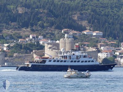
The vessel TO CALLISTO (IMO: 5416553, MMSI: 341166001) is a Passengers Ship that was built in 1963 ( 63 År gammal ). It's sailing under the flag of [KN] St Kitts Nevis.
In this page you can find informations about the vessels current position, last detected port calls, and current voyage information. If the vessels is not in coverage by AIS you will find the latest position.
The current position of TO CALLISTO is detected by our AIS receivers and we are not responsible for the reliability of the data. The last position was recorded while the vessel was in Coverage by the Ais receivers of our vessel tracking app.
The current draught of TO CALLISTO as reported by AIS is 3.2 meters
Weather
| Temperature | 16.4°C / 61.52°F |
|---|---|
| Wind Speed | 16 knots |
| Direction | 178° S |
| Pressure | 1014.6 hPa |
| Humidity | 71.9 % |
| Cloud Coverage | 7 % |
Featured Company
Last Port Calls
Last Trips
| Origin | Departure | Destination | Arrival | Distance |
|---|
Events
| Tid | Event | Detaljer | Position / Dest | Information |
|---|---|---|---|---|
| 2026-01-06 09:17 | ETA ändrat | 2026/01/01 08:00 2026/08/18 08:00 |
37.96050 / 23.57568
[GR] PERAMA
|
Fart: Kurs: 511° |
| 2026-01-06 08:37 | ETA ändrat | 2026/08/18 08:00 2026/01/01 08:00 |
37.96046 / 23.57568
[GR] PERAMA
|
Fart: Kurs: 511° |
| 2026-01-06 08:25 | ETA ändrat | 2026/01/01 08:00 2026/08/18 08:00 |
37.96050 / 23.57567
[GR] PERAMA
|
Fart: Kurs: 511° |
| 2026-01-06 05:43 | ETA ändrat | 2026/08/18 08:00 2026/01/01 08:00 |
37.96048 / 23.57567
[GR] PERAMA
|
Fart: Kurs: 511° |
| 2026-01-06 05:31 | ETA ändrat | 2026/01/01 08:00 2026/08/18 08:00 |
37.96048 / 23.57567
[GR] PERAMA
|
Fart: Kurs: 511° |
| 2026-01-06 04:55 | ETA ändrat | 2026/08/18 08:00 2026/01/01 08:00 |
37.96048 / 23.57566
[GR] PERAMA
|
Fart: Kurs: 511° |
| 2026-01-06 04:49 | ETA ändrat | 2026/01/01 08:00 2026/08/18 08:00 |
37.96050 / 23.57569
[GR] PERAMA
|
Fart: Kurs: 511° |
| 2026-01-05 23:43 | ETA ändrat | 2026/08/18 08:00 2026/01/01 08:00 |
37.96048 / 23.57567
[GR] PERAMA
|
Fart: Kurs: 511° |
| 2026-01-05 23:31 | ETA ändrat | 2026/01/01 08:00 2026/08/18 08:00 |
37.96045 / 23.57567
[GR] PERAMA
|
Fart: Kurs: 511° |
| 2026-01-05 18:49 | ETA ändrat | 2026/08/18 08:00 2026/01/01 08:00 |
37.96049 / 23.57565
[GR] PERAMA
|
Fart: Kurs: 511° |