

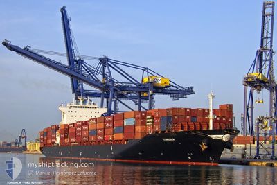
TONGALA
Container Ship

Current Trip
| Time Travelled | 3 days |
|---|---|
| Remaining Time | 52 mins |
| Distance Travelled | 1502.23 nm |
| Remaining Distance | 19.83 nm |
| AVG Speed | 16.3 Knop |
| MAX Speed | 18.6 Knop |
| AVG Wind | 14.2 knots |
| MAX Wind | 25 knots |
| MIN Temp | 17.2°C / 62.96°F |
| MAX Temp | 22.8°C / 73.04°F |
| Djupgående | 12.1 m |
| Position mottagen | 12 m sen |
Current Position
| Longitud | -17.61726° |
|---|---|
| Latitude | 14.74309° |
| Status | Under way using engine |
| Fart | 17.8 Knop |
| Kurs | 149.7° |
| Område | North Atlantic Ocean |
| Station | T-AIS |
| Position mottagen | 12 m sen |
Information
The current position of TONGALA is in North Atlantic Ocean with coordinates 14.74309° / -17.61726° as reported on 2025-05-30 18:25 by AIS to our vessel tracker app. The vessel's current speed is 17.8 Knop and is heading at the port of DAKAR. The estimated time of arrival as calculated by MyShipTracking vessel tracking app is 2025-05-30 19:30 LT
The vessel TONGALA (IMO: 9278105, MMSI: 636013644) is a Container Ship that was built in 2004 ( 21 År gammal ). It's sailing under the flag of [LR] Liberia.
In this page you can find informations about the vessels current position, last detected port calls, and current voyage information. If the vessels is not in coverage by AIS you will find the latest position.
The current position of TONGALA is detected by our AIS receivers and we are not responsible for the reliability of the data. The last position was recorded while the vessel was in Coverage by the Ais receivers of our vessel tracking app.
The current draught of TONGALA as reported by AIS is 12.1 meters
Weather
| Temperature | 22.7°C / 72.86°F |
|---|---|
| Wind Speed | 11 knots |
| Direction | 309° NW |
| Pressure | 1011.3 hPa |
| Humidity | 85.3 % |
| Cloud Coverage | 51 % |


Featured Company
Last Port Calls
| Port | Arrival | Departure | Time In Port |
|---|---|---|---|
| 2025-05-26 15:41 | 2025-05-27 02:55 | 11 h | |
| 2025-05-24 08:57 | 2025-05-25 07:47 | 22 h | |
| 2025-05-20 13:01 | 2025-05-21 14:48 | 1 d | |
| 2025-05-17 15:33 | 2025-05-18 21:27 | 1 d | |
| 2025-05-15 11:55 | 2025-05-16 15:04 | 1 d | |
| 2025-05-14 12:58 | 2025-05-15 00:35 | 11 h | |
| 2025-05-01 17:16 | 2025-05-03 22:48 | 2 d | |
| 2025-04-27 02:56 | 2025-04-28 08:36 | 1 d | |
| 2025-04-20 22:34 | 2025-04-22 00:43 | 1 d | |
| 2025-04-16 00:50 | 2025-04-16 15:08 | 14 h |
Last Trips
| Origin | Departure | Destination | Arrival | Distance | |
|---|---|---|---|---|---|
| 2025-05-25 07:47 | 2025-05-26 15:41 | 66.33 nm | |||
| 2025-05-21 14:48 | 2025-05-24 08:57 | 1020.25 nm | |||
| 2025-05-18 21:27 | 2025-05-20 13:01 | 474.88 nm | |||
| 2025-05-16 15:04 | 2025-05-17 15:33 | 289.46 nm | |||
| 2025-05-15 00:35 | 2025-05-15 11:55 | 126.48 nm | |||
| 2025-05-03 22:48 | 2025-05-14 12:58 | 3665.55 nm | |||
| 2025-04-28 08:36 | 2025-05-01 17:16 | 1179.76 nm | |||
| 2025-04-22 00:43 | 2025-04-27 02:56 | 1530.32 nm | |||
| 2025-04-16 15:08 | 2025-04-20 22:34 | 254.07 nm | |||
| 2025-04-12 01:12 | 2025-04-16 00:50 | 1071.80 nm |
Events
| Tid | Event | Detaljer | Position / Dest | Information |
|---|---|---|---|---|
| 2025-05-30 18:33 | Status ändrad | Default Under way using engine |
14.70880 / -17.59472
ESALG>SNDKR
|
Fart: 17.8 kn Kurs: 149.7° |
| 2025-05-30 17:26 | Status ändrad | Under way using engine Default |
15.03365 / -17.61924
ESALG>SNDKR
|
Fart: 17.7 kn Kurs: 181° |
| 2025-05-30 17:11 | Status ändrad | Default Under way using engine |
15.11014 / -17.61906
ESALG>SNDKR
|
Fart: 18 kn Kurs: 178.5° |
| 2025-05-30 16:45 | Status ändrad | Under way using engine Default |
15.23990 / -17.62312
ESALG>SNDKR
|
Fart: 17.7 kn Kurs: 178° |
| 2025-05-30 16:43 | Status ändrad | Default Under way using engine |
15.25222 / -17.62360
ESALG>SNDKR
|
Fart: 17.8 kn Kurs: 178° |
| 2025-05-30 15:04 | Byter havsområde | Senegalese part of the North Atlantic Ocean Mauritanian part of the North Atlantic Ocean |
15.75706 / -17.63255
North Atlantic Ocean
ESALG>SNDKR
|
Fart: 17.9 kn Kurs: 179.2° |
| 2025-05-30 15:04 | Status ändrad | Under way using engine Default |
15.75857 / -17.63256
ESALG>SNDKR
|
Fart: 17.8 kn Kurs: 180° |
| 2025-05-30 15:04 | I täckningsområde |
15.75706 / -17.63255
North Atlantic Ocean
ESALG>SNDKR
|
Fart: 17.9 kn Kurs: 179.2° |
|
| 2025-05-30 13:43 | Status ändrad | Default Under way using engine |
16.16697 / -17.63019
ESALG>SNDKR
|
Fart: 18.1 kn Kurs: 177.8° |
| 2025-05-30 13:38 | UTANFÖR täckningsområde |
16.19191 / -17.63130
North Atlantic Ocean
ESALG>SNDKR
|
Fart: 18.1 kn Kurs: 177.8° |