
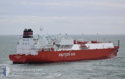
TRAIANO KNUTSEN
Tanker
Current Trip
| Time Travelled | --- |
|---|---|
| Remaining Time | 17 h, 6 mins |
| Distance Travelled | 8094.04 nm |
| Remaining Distance | 576.55 nm |
| AVG Speed | 10.8 Knop |
| MAX Speed | 14.8 Knop |
| AVG Wind | 14.1 knots |
| MAX Wind | 30 knots |
| MIN Temp | 5.1°C / 41.18°F |
| MAX Temp | 25.5°C / 77.9°F |
| Djupgående | 9.4 m |
| Position mottagen | 3 d sen |
Current Position
| Longitud | -79.59593° |
|---|---|
| Latitude | 25.43081° |
| Status | Under way using engine |
| Fart | 10.2 Knop |
| Kurs | 189.9° |
| Område | North Atlantic Ocean |
| Station | T-AIS |
| Position mottagen | 3 d sen |
Info
Information
The current position of TRAIANO KNUTSEN is in North Atlantic Ocean with coordinates 25.43081° / -79.59593° as reported on 2025-01-29 01:51 by AIS to our vessel tracker app. The vessel's current speed is 10.2 Knop and is heading at the port of CORPUS CHRISTI. The estimated time of arrival as calculated by MyShipTracking vessel tracking app is 2025-02-01 16:08 LT
The vessel TRAIANO KNUTSEN (IMO: 9854765, MMSI: 257575000) is a Tanker It's sailing under the flag of [NO] Norway.
In this page you can find informations about the vessels current position, last detected port calls, and current voyage information. If the vessels is not in coverage by AIS you will find the latest position.
The current position of TRAIANO KNUTSEN is detected by our AIS receivers and we are not responsible for the reliability of the data. The last position was recorded while the vessel was in Coverage by the Ais receivers of our vessel tracking app.
The current draught of TRAIANO KNUTSEN as reported by AIS is 9.4 meters
Weather
| Temperature | 23.3°C / 73.94°F |
|---|---|
| Wind Speed | 14 knots |
| Direction | 18° NNE |
| Pressure | 1020 hPa |
| Humidity | 60.6 % |
| Cloud Coverage | 53 % |
Featured Company
Last Port Calls
Most Visited Ports (Last year)
| Port | Arrivals | |
|---|---|---|
| 3 | ||
| 2 | ||
| 2 | ||
| 1 | ||
| 1 |
Last Trips
| Origin | Departure | Destination | Arrival | Distance |
|---|
Events
| Tid | Event | Detaljer | Position / Dest | Information |
|---|---|---|---|---|
| 2025-01-29 02:04 | Status ändrad | Default Under way using engine |
25.39553 / -79.59984
USCRP
|
Fart: 10.2 kn Kurs: 189.9° |
| 2025-01-29 01:51 | UTANFÖR täckningsområde |
25.43081 / -79.59593
North Atlantic Ocean
USCRP
|
Fart: 10.2 kn Kurs: 189.9° |
|
| 2025-01-28 22:11 | Status ändrad | Under way using engine Default |
26.07240 / -79.44400
USCRP
|
Fart: 10.7 kn Kurs: 192° |
| 2025-01-28 21:57 | I täckningsområde |
26.07240 / -79.44400
North Atlantic Ocean
USCRP
|
Fart: 11 kn Kurs: 192.2° |
|
| 2025-01-28 19:23 | Status ändrad | Default Under way using engine |
26.29081 / -78.95878
USCRP
|
Fart: 12.1 kn Kurs: 279.5° |
| 2025-01-28 19:17 | UTANFÖR täckningsområde |
26.29341 / -78.93635
North Atlantic Ocean
USCRP
|
Fart: 12.1 kn Kurs: 279.5° |
|
| 2025-01-28 19:05 | Status ändrad | Under way using engine Default |
26.28231 / -78.89147
USCRP
|
Fart: 12.5 kn Kurs: 285° |
| 2025-01-28 19:03 | Status ändrad | Default Under way using engine |
26.28067 / -78.88460
USCRP
|
Fart: 12.5 kn Kurs: 285° |
| 2025-01-28 19:00 | Status ändrad | Under way using engine Default |
26.27834 / -78.87517
USCRP
|
Fart: 12.5 kn Kurs: 285° |
| 2025-01-28 18:35 | Status ändrad | Default Under way using engine |
26.25579 / -78.78168
USCRP
|
Fart: 12.2 kn Kurs: 287.1° |