
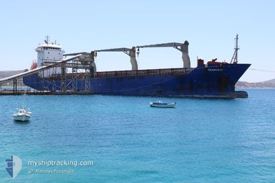
TRANSBAY
General Cargo
Current Trip
| Time Travelled | 20 h, 17 mins |
|---|---|
| Remaining Time | --- |
| Distance Travelled | 65.11 nm |
| Remaining Distance | --- |
| AVG Speed | 10.7 Knop |
| MAX Speed | 12.5 Knop |
| AVG Wind | 5.4 knots |
| MAX Wind | 11 knots |
| MIN Temp | -4.3°C / 24.26°F |
| MAX Temp | -1.9°C / 28.58°F |
| Djupgående | 6.9 m |
| Position mottagen | 18 h, 57 m sen |
Current Position
| Longitud | 20.61005° |
|---|---|
| Latitude | 63.53148° |
| Status | Under way using engine |
| Fart | 12 Knop |
| Kurs | 108.8° |
| Område | Gulf of Bothnia |
| Station | T-AIS |
| Position mottagen | 18 h, 57 m sen |
Info
Information
The current position of TRANSBAY is in Gulf of Bothnia with coordinates 63.53148° / 20.61005° as reported on 2025-03-11 14:44 by AIS to our vessel tracker app. The vessel's current speed is 12 Knop and is heading at the port of ANTIRIO. The estimated time of arrival as calculated by MyShipTracking vessel tracking app is 2025-03-11 23:00 LT
The vessel TRANSBAY (IMO: 9187033, MMSI: 636019599) is a General Cargo that was built in 1999 ( 26 År gammal ). It's sailing under the flag of [LR] Liberia.
In this page you can find informations about the vessels current position, last detected port calls, and current voyage information. If the vessels is not in coverage by AIS you will find the latest position.
The current position of TRANSBAY is detected by our AIS receivers and we are not responsible for the reliability of the data. The last position was recorded while the vessel was in Coverage by the Ais receivers of our vessel tracking app.
The current draught of TRANSBAY as reported by AIS is 6.9 meters
Weather
| Temperature | -3.5°C / 25.7°F |
|---|---|
| Wind Speed | 3 knots |
| Direction | 98° E |
| Pressure | 1007.4 hPa |
| Humidity | 73.9 % |
| Cloud Coverage | 100 % |
Featured Company
Last Trips
| Origin | Departure | Destination | Arrival | Distance | |
|---|---|---|---|---|---|
| 2025-03-07 20:09 | 2025-03-08 23:13 | 159.06 nm | |||
| 2025-02-04 13:02 | 2025-03-04 16:25 | 4488.64 nm | |||
| 2025-01-28 07:35 | 2025-01-31 10:05 | 765.17 nm | |||
| 2025-01-05 07:21 | 2025-01-24 10:13 | 4696.27 nm | |||
| 2024-12-30 21:25 | 2025-01-01 16:33 | 293.16 nm |
Events
| Tid | Event | Detaljer | Position / Dest | Information |
|---|---|---|---|---|
| 2025-03-11 19:30 | STOPPAR förflyttning | 7 nm, North West of PIETARSAARI |
63.75783 / 22.44967
FIPRS >
|
Fart: 0.2 kn Kurs: 19° |
| 2025-03-11 14:50 | Status ändrad | Default Under way using engine |
63.52606 / 20.65544
FIPRS >
|
Fart: 12 kn Kurs: 108.8° |
| 2025-03-11 14:44 | UTANFÖR täckningsområde |
63.53148 / 20.61005
Gulf of Bothnia
FIPRS >
|
Fart: 12 kn Kurs: 108.8° |
|
| 2025-03-11 13:32 | Djupgående ändrat | 6.9 6.4 |
63.69092 / 20.33175
FIPRS >
|
Fart: 6.1 kn Kurs: 216.5° |
| 2025-03-11 13:32 | Destination ändrad | FIPRS > SEUME > |
63.69092 / 20.33175
FIPRS >
|
Fart: 6.1 kn Kurs: 216.5° |
| 2025-03-11 13:32 | ETA ändrat | 2025/03/11 21:00 2025/03/08 21:00 |
63.69092 / 20.33175
FIPRS >
|
Fart: 6.1 kn Kurs: 216.5° |
| 2025-03-11 13:28 | STARTAR förflyttning | 0.81 nm, North West of HOLMSUND |
63.69481 / 20.33737
SEUME >
|
Fart: 3.1 kn Kurs: 206° |
| 2025-03-11 13:24 | AVGÅTT HAMN |
|
63.69538 / 20.33697
SEUME >
|
Fart: 2.5 kn Kurs: 88° |
| 2025-03-11 13:22 | Status ändrad | Under way using engine Moored |
63.69566 / 20.34109
[SE] HOLMSUND
|
Fart: 1.8 kn Kurs: 40° |
| 2025-03-11 13:15 | Status ändrad | Moored Default |
63.69662 / 20.34473
[SE] HOLMSUND
|
Fart: Kurs: 5° |