
TRIO BUSE
General Cargo
Current Trip
| Time Travelled | 9 days |
|---|---|
| Remaining Time | 10 h, 52 mins |
| Distance Travelled | 499.04 nm |
| Remaining Distance | 137.96 nm |
| AVG Speed | 10.4 Knop |
| MAX Speed | 13.4 Knop |
| AVG Wind | 9.6 knots |
| MAX Wind | 20 knots |
| MIN Temp | 1°C / 33.8°F |
| MAX Temp | 19.6°C / 67.28°F |
| Djupgående | 3.6 m |
| Position mottagen | 10 h, 55 m sen |
Current Position
| Longitud | 23.85247° |
|---|---|
| Latitude | 37.25099° |
| Status | Under way using engine |
| Fart | 11.4 Knop |
| Kurs | 207.8° |
| Område | Aegean Sea |
| Station | T-AIS |
| Position mottagen | 10 h, 55 m sen |
Info
Information
The current position of TRIO BUSE is in Aegean Sea with coordinates 37.25099° / 23.85247° as reported on 2025-03-21 14:57 by AIS to our vessel tracker app. The vessel's current speed is 11.4 Knop and is heading at the port of LAVRIO. The estimated time of arrival as calculated by MyShipTracking vessel tracking app is 2025-03-22 14:44 LT
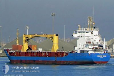
The vessel TRIO BUSE (IMO: 9210048, MMSI: 314788000) is a General Cargo that was built in 2000 ( 25 År gammal ). It's sailing under the flag of [BB] Barbados.
In this page you can find informations about the vessels current position, last detected port calls, and current voyage information. If the vessels is not in coverage by AIS you will find the latest position.
The current position of TRIO BUSE is detected by our AIS receivers and we are not responsible for the reliability of the data. The last position was recorded while the vessel was in Coverage by the Ais receivers of our vessel tracking app.
The current draught of TRIO BUSE as reported by AIS is 3.6 meters
Weather
| Temperature | 14.2°C / 57.56°F |
|---|---|
| Wind Speed | 12 knots |
| Direction | 321° NW |
| Pressure | 1024.9 hPa |
| Humidity | 69.8 % |
| Cloud Coverage | --- |
Featured Company
Last Port Calls
| Port | Arrival | Departure | Time In Port |
|---|---|---|---|
| 2025-01-04 16:17 | 2025-03-12 17:38 | ||
| 2025-01-01 22:52 |
Last Trips
| Origin | Departure | Destination | Arrival | Distance | |
|---|---|---|---|---|---|
| 2025-01-01 22:52 | 2025-01-04 16:17 | 49.56 nm |
Events
| Tid | Event | Detaljer | Position / Dest | Information |
|---|---|---|---|---|
| 2025-03-21 15:00 | Status ändrad | Default Under way using engine |
37.24170 / 23.84621
GR LAV
|
Fart: 11.4 kn Kurs: 207.8° |
| 2025-03-21 14:57 | UTANFÖR täckningsområde |
37.25099 / 23.85247
Aegean Sea
|
Fart: 11.4 kn Kurs: 207.8° |
|
| 2025-03-21 13:56 | Status ändrad | Under way using engine Default |
37.43114 / 23.94949
GR LAV
|
Fart: 11.6 kn Kurs: 206° |
| 2025-03-21 13:22 | Status ändrad | Default Under way using engine |
37.52793 / 24.00281
GR LAV
|
Fart: 11.6 kn Kurs: 202.2° |
| 2025-03-21 12:43 | Status ändrad | Under way using engine Default |
37.64789 / 24.06692
GR LAV
|
Fart: 11.8 kn Kurs: 201° |
| 2025-03-21 12:31 | I täckningsområde |
37.64683 / 24.06636
Aegean Sea
|
Fart: 11.7 kn Kurs: 201.5° |
|
| 2025-03-21 12:24 | STARTAR förflyttning | 0.71 nm, East of LAVRIO |
37.70636 / 24.07684
GR LAV
|
Fart: 9.2 kn Kurs: 163° |
| 2025-03-21 09:58 | Status ändrad | Default Under way using engine |
37.71312 / 24.07449
GR LAV
|
Fart: Kurs: 28° |
| 2025-03-21 09:56 | UTANFÖR täckningsområde |
37.71312 / 24.07430
Aegean Sea
|
Fart: Kurs: 289.9° |
|
| 2025-03-21 05:09 | STOPPAR förflyttning | 0.7 nm, East of LAVRIO |
37.71375 / 24.07601
GR LAV
|
Fart: 0.3 kn Kurs: 314° |