
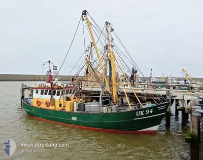
UK94 JAN VAN CEES
Fishing
Current Trip
| Trip Time | 6 h, 11 mins |
|---|---|
| Trip Distance | 44.76 nm |
| AVG Speed | 7.7 Knop |
| MAX Speed | 8.8 Knop |
| Djupgående | 0 m |
| AVG Wind | 6.7 knots |
| MAX Wind | 8 knots |
| MIN Temp | 10.7°C / 51.26°F |
| MAX Temp | 13.5°C / 56.3°F |
| Position mottagen | 1 m sen |
Current Position
| Longitud | 5.60034° |
|---|---|
| Latitude | 52.66015° |
| Status | Engaged in Fishing |
| Fart | |
| Kurs | 90° |
| Område | North Sea |
| Station | T-AIS |
| Position mottagen | 1 m sen |
Information
The current position of UK94 JAN VAN CEES is in North Sea with coordinates 52.66015° / 5.60034° as reported on 2025-04-26 09:02 by AIS to our vessel tracker app. The vessel's current speed is 0 Knop and is currently inside the port of URK.
The vessel UK94 JAN VAN CEES (MMSI: 244792000) is a Fishing It's sailing under the flag of [NL] Netherlands.
In this page you can find informations about the vessels current position, last detected port calls, and current voyage information. If the vessels is not in coverage by AIS you will find the latest position.
The current position of UK94 JAN VAN CEES is detected by our AIS receivers and we are not responsible for the reliability of the data. The last position was recorded while the vessel was in Coverage by the Ais receivers of our vessel tracking app.
Weather
| Temperature | 11.4°C / 52.52°F |
|---|---|
| Wind Speed | 8 knots |
| Direction | 59° ENE |
| Pressure | 1023.7 hPa |
| Humidity | 75.4 % |
| Cloud Coverage | 100 % |
Featured Company
Last Port Calls
| Port | Arrival | Departure | Time In Port |
|---|---|---|---|
| 2025-04-22 12:14 | |||
| 2025-03-28 09:44 | 2025-04-22 06:03 | 24 d | |
| 2025-03-26 13:49 | 2025-03-26 15:18 | 1 h | |
| 2025-03-22 07:01 | 2025-03-24 14:28 | 2 d | |
| 2025-03-19 17:29 | 2025-03-19 18:58 | 1 h | |
| 2025-03-14 11:31 | 2025-03-17 12:18 | 3 d | |
| 2025-03-13 16:19 | 2025-03-14 02:17 | 9 h | |
| 2025-03-12 16:48 | 2025-03-13 03:17 | 10 h | |
| 2025-03-11 18:31 | 2025-03-12 03:28 | 8 h | |
| 2025-03-08 06:37 | 2025-03-10 11:29 | 2 d |
Most Visited Ports (Last year)
| Port | Arrivals | |
|---|---|---|
| 19 | ||
| 14 | ||
| 11 | ||
| 9 | ||
| 5 | ||
| 4 |
Last Trips
| Origin | Departure | Destination | Arrival | Distance | |
|---|---|---|---|---|---|
| 2025-04-22 08:03 | 2025-04-22 14:14 | 44.76 nm | |||
| 2025-03-26 16:18 | 2025-03-28 10:44 | 86.95 nm | |||
| 2025-03-24 15:28 | 2025-03-26 14:49 | 88.05 nm | |||
| 2025-03-19 19:58 | 2025-03-22 08:01 | 111.24 nm | |||
| 2025-03-17 13:18 | 2025-03-19 18:29 | 105.89 nm | |||
| 2025-03-14 03:17 | 2025-03-14 12:31 | 34.54 nm | |||
| 2025-03-13 04:17 | 2025-03-13 17:19 | 34.17 nm | |||
| 2025-03-12 04:28 | 2025-03-12 17:48 | 39.82 nm | |||
| 2025-03-10 12:29 | 2025-03-11 19:31 | 36.54 nm | |||
| 2025-03-06 04:19 | 2025-03-08 07:37 | 62.11 nm |
Events
| Tid | Event | Detaljer | Position / Dest | Information |
|---|---|---|---|---|
| 2025-04-22 12:18 | STOPPAR förflyttning |
52.65935 / 5.60075
[NL] URK
|
Fart: 0.3 kn Kurs: 127° |
|
| 2025-04-22 12:14 | ANLÄNDER HAMN |
|
52.65640 / 5.59946
[NL] URK
|
Fart: 7.3 kn Kurs: 352° |
| 2025-04-22 10:58 | STARTAR förflyttning | 0.21 nm, North West of LELYSTAD |
52.52888 / 5.43487
FISHING..-
|
Fart: 5.2 kn Kurs: 3° |
| 2025-04-22 10:44 | STOPPAR förflyttning | 0.16 nm, West of LELYSTAD |
52.52688 / 5.43453
FISHING..-
|
Fart: 0.1 kn Kurs: 17° |
| 2025-04-22 08:03 | STARTAR förflyttning | 0.22 nm, South East of SCHELLINGWOUDE |
52.37816 / 4.96828
FISHING..-
|
Fart: 6 kn Kurs: 128° |
| 2025-04-22 08:00 | STOPPAR förflyttning | 0.12 nm, South of SCHELLINGWOUDE |
52.37921 / 4.96582
FISHING..-
|
Fart: 0.2 kn Kurs: 133° |
| 2025-04-22 07:56 | STARTAR förflyttning | 0.08 nm, South West of SCHELLINGWOUDE |
52.38055 / 4.96267
FISHING..-
|
Fart: 4.2 kn Kurs: 124° |
| 2025-04-22 07:47 | STOPPAR förflyttning | 0.17 nm, West of SCHELLINGWOUDE |
52.38164 / 4.96019
FISHING..-
|
Fart: 0.2 kn Kurs: 142° |
| 2025-04-22 06:03 | AVGÅTT HAMN |
|
52.46406 / 4.63656
FISHING..-
|
Fart: 7.8 kn Kurs: 97° |
| 2025-04-22 05:50 | STARTAR förflyttning |
52.46411 / 4.59419
[NL] IJMUIDEN
|
Fart: 5.9 kn Kurs: 99° |