
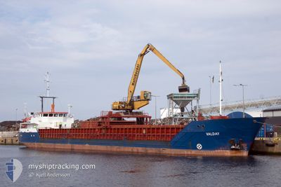
VALDAY
General Cargo
Current Trip
| Time Travelled | 23 h, 51 mins |
|---|---|
| Remaining Time | 21 h, 43 mins |
| Distance Travelled | 189.90 nm |
| Remaining Distance | 238.63 nm |
| AVG Speed | 9.9 Knop |
| MAX Speed | 11 Knop |
| AVG Wind | 17.5 knots |
| MAX Wind | 24 knots |
| MIN Temp | -6.9°C / 19.58°F |
| MAX Temp | 0.6°C / 33.08°F |
| Djupgående | 3 m |
| Position mottagen | 2 h, 23 m sen |
Current Position
| Longitud | 23.10152° |
|---|---|
| Latitude | 59.34264° |
| Status | Under way using engine |
| Fart | 10.2 Knop |
| Kurs | 239.1° |
| Område | Baltic Sea |
| Station | T-AIS |
| Position mottagen | 2 h, 23 m sen |
Info
Information
The current position of VALDAY is in Baltic Sea with coordinates 59.34264° / 23.10152° as reported on 2026-01-03 16:12 by AIS to our vessel tracker app. The vessel's current speed is 10.2 Knop and is heading at the port of RIGA. The estimated time of arrival as calculated by MyShipTracking vessel tracking app is 2026-01-04 18:19 LT
The vessel VALDAY (IMO: 9142576, MMSI: 305094000) is a General Cargo that was built in 1996 ( 30 År gammal ). It's sailing under the flag of [AG] Antigua Barbuda.
In this page you can find informations about the vessels current position, last detected port calls, and current voyage information. If the vessels is not in coverage by AIS you will find the latest position.
The current position of VALDAY is detected by our AIS receivers and we are not responsible for the reliability of the data. The last position was recorded while the vessel was in Coverage by the Ais receivers of our vessel tracking app.
The current draught of VALDAY as reported by AIS is 3 meters
Weather
| Temperature | 0.9°C / 33.62°F |
|---|---|
| Wind Speed | 9 knots |
| Direction | 106° ESE |
| Pressure | 989.7 hPa |
| Humidity | 85.8 % |
| Cloud Coverage | 100 % |
Featured Company
Last Port Calls
| Port | Arrival | Departure | Time In Port |
|---|---|---|---|
| 2026-01-01 16:41 | 2026-01-02 21:45 | 1 d | |
| 2025-12-20 13:08 | 2025-12-22 17:12 | 2 d | |
| 2025-12-14 23:13 | 2025-12-17 14:51 | 2 d | |
| 2025-12-08 19:01 | 2025-12-11 11:25 | 2 d | |
| 2025-12-05 06:22 | 2025-12-05 15:47 | 9 h | |
| 2025-11-28 17:53 | 2025-11-29 22:53 | 1 d | |
| 2025-11-25 07:45 | 2025-11-26 11:25 | 1 d | |
| 2025-11-18 20:07 | 2025-11-19 21:14 | 1 d | |
| 2025-11-15 07:00 | 2025-11-16 13:12 | 1 d | |
| 2025-11-11 14:12 | 2025-11-12 17:32 | 1 d |
Most Visited Ports (Last year)
| Port | Arrivals | |
|---|---|---|
| 20 | ||
| 14 | ||
| 8 | ||
| 7 | ||
| 4 | ||
| 3 |
Last Trips
| Origin | Departure | Destination | Arrival | Distance | |
|---|---|---|---|---|---|
| 2025-12-22 17:12 | 2026-01-01 16:41 | 949.67 nm | |||
| 2025-12-17 14:51 | 2025-12-20 13:08 | 267.76 nm | |||
| 2025-12-11 11:25 | 2025-12-14 23:13 | 728.22 nm | |||
| 2025-12-05 15:47 | 2025-12-08 19:01 | 721.90 nm | |||
| 2025-11-29 22:53 | 2025-12-05 06:22 | 723.98 nm | |||
| 2025-11-26 11:25 | 2025-11-28 17:53 | 47.55 nm | |||
| 2025-11-19 21:14 | 2025-11-25 07:45 | 624.58 nm | |||
| 2025-11-16 13:12 | 2025-11-18 20:07 | 480.00 nm | |||
| 2025-11-12 17:32 | 2025-11-15 07:00 | 479.59 nm | |||
| 2025-11-09 11:40 | 2025-11-11 14:12 | 483.02 nm |
Events
| Tid | Event | Detaljer | Position / Dest | Information |
|---|---|---|---|---|
| 2026-01-03 16:12 | UTANFÖR täckningsområde |
59.34264 / 23.10152
Baltic Sea
LVRIX
|
Fart: 10.2 kn Kurs: 239.1° |
|
| 2026-01-03 15:35 | Byter havsområde | Estonian part of the Baltic Sea Estonian part of the Gulf of Finland |
59.38981 / 23.28132
Baltic Sea
LVRIX
|
Fart: 10.1 kn Kurs: 242.9° |
| 2026-01-03 08:23 | Byter havsområde | Estonian part of the Gulf of Finland Finnish part of the Gulf of Finland |
59.87902 / 25.38933
Gulf of Finland
LVRIX
|
Fart: 10.1 kn Kurs: 262.3° |
| 2026-01-03 06:21 | Upptäckt i hav | Finnish part of the Gulf of Finland |
59.95907 / 26.05957
Gulf of Finland
LVRIX
|
Fart: 10.6 kn Kurs: 257.3° |
| 2026-01-03 05:43 | Byter havsområde | Estonian part of the Gulf of Finland Finnish part of the Gulf of Finland |
59.98981 / 26.27447
Gulf of Finland
LVRIX
|
Fart: 10.1 kn Kurs: 250.8° |
| 2026-01-03 05:31 | Upptäckt i hav | Finnish part of the Gulf of Finland |
59.99872 / 26.33701
Gulf of Finland
LVRIX
|
Fart: 10.3 kn Kurs: 252.7° |
| 2026-01-02 22:39 | Djupgående ändrat | 3 3.4 |
60.07718 / 28.42403
LVRIX
|
Fart: 10.5 kn Kurs: 307.2° |
| 2026-01-02 22:39 | Destination ändrad | LVRIX RULED |
60.07718 / 28.42403
LVRIX
|
Fart: 10.5 kn Kurs: 307.2° |
| 2026-01-02 22:39 | ETA ändrat | 2026/01/04 16:00 2026/01/01 06:00 |
60.07718 / 28.42403
LVRIX
|
Fart: 10.5 kn Kurs: 307.2° |
| 2026-01-02 21:08 | I täckningsområde |
60.04283 / 28.92721
Gulf of Finland
|
Fart: 10 kn Kurs: 273.2° |