
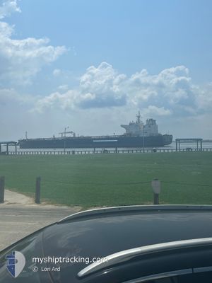
VICTORY VENTURE
Tanker
Current Trip
| Time Travelled | 2 days |
|---|---|
| Remaining Time | 6 h, 44 mins |
| Distance Travelled | 362.31 nm |
| Remaining Distance | 75.75 nm |
| AVG Speed | 7.8 Knop |
| MAX Speed | 12.4 Knop |
| AVG Wind | 10.3 knots |
| MAX Wind | 20.2 knots |
| MIN Temp | 13.5°C / 56.3°F |
| MAX Temp | 19.6°C / 67.28°F |
| Djupgående | 13.6 m |
| Position mottagen | Nu |
Current Position
| Longitud | -118.55103° |
|---|---|
| Latitude | 32.54030° |
| Status | Under way using engine |
| Fart | 11 Knop |
| Kurs | 52.6° |
| Område | North Pacific Ocean |
| Station | T-AIS |
| Position mottagen | Nu |
Info
Information
The current position of VICTORY VENTURE is in North Pacific Ocean with coordinates 32.54030° / -118.55103° as reported on 2025-02-25 08:25 by AIS to our vessel tracker app. The vessel's current speed is 11 Knop and is heading at the port of LOS ANGELES. The estimated time of arrival as calculated by MyShipTracking vessel tracking app is 2025-02-25 07:10 LT
The vessel VICTORY VENTURE (IMO: 9773040, MMSI: 477043500) is a Tanker It's sailing under the flag of [HK] Hong Kong.
In this page you can find informations about the vessels current position, last detected port calls, and current voyage information. If the vessels is not in coverage by AIS you will find the latest position.
The current position of VICTORY VENTURE is detected by our AIS receivers and we are not responsible for the reliability of the data. The last position was recorded while the vessel was in Coverage by the Ais receivers of our vessel tracking app.
The current draught of VICTORY VENTURE as reported by AIS is 13.6 meters
Weather
| Temperature | 14.1°C / 57.38°F |
|---|---|
| Wind Speed | 16 knots |
| Direction | 306° NW |
| Pressure | 1016.9 hPa |
| Humidity | 88.6 % |
| Cloud Coverage | --- |
Featured Company
Last Port Calls
| Port | Arrival | Departure | Time In Port |
|---|---|---|---|
| 2025-02-18 16:30 | 2025-02-22 12:59 | 3 d | |
| 2025-01-22 09:31 | 2025-01-24 11:23 | 2 d | |
| 2024-12-23 10:20 | 2024-12-23 11:29 | 1 h |
Most Visited Ports (Last year)
| Port | Arrivals | |
|---|---|---|
| 6 | ||
| 2 | ||
| 2 | ||
| 1 | ||
| 1 | ||
| 1 |
Events
| Tid | Event | Detaljer | Position / Dest | Information |
|---|---|---|---|---|
| 2025-02-25 01:44 | Djupgående ändrat | 13.6 9 |
31.38366 / -118.66793
LONG BEACH
|
Fart: 10.4 kn Kurs: 353.8° |
| 2025-02-25 01:44 | Destination ändrad | LONG BEACH PAL USWC |
31.38366 / -118.66793
LONG BEACH
|
Fart: 10.4 kn Kurs: 353.8° |
| 2025-02-25 01:44 | ETA ändrat | 2025/02/25 01:36 2025/02/23 08:13 |
31.38366 / -118.66793
LONG BEACH
|
Fart: 10.4 kn Kurs: 353.8° |
| 2025-02-24 22:34 | Status ändrad | Under way using engine Default |
31.14125 / -118.66837
PAL USWC
|
Fart: 3.1 kn Kurs: 359° |
| 2025-02-24 22:31 | Status ändrad | Default Under way using engine |
31.13878 / -118.66872
PAL USWC
|
Fart: 3.2 kn Kurs: 0° |
| 2025-02-24 22:14 | Byter havsområde | United States part of the North Pacific Ocean Mexican part of the North Pacific Ocean |
31.12350 / -118.67138
North Pacific Ocean
|
Fart: 3.3 kn Kurs: 11.1° |
| 2025-02-24 21:56 | Status ändrad | Under way using engine Default |
31.10778 / -118.67419
PAL USWC
|
Fart: 3.1 kn Kurs: 1° |
| 2025-02-24 21:56 | I täckningsområde |
31.11011 / -118.67384
North Pacific Ocean
|
Fart: 3.1 kn Kurs: 5.2° |
|
| 2025-02-24 20:27 | Status ändrad | Default Under way using engine |
31.03659 / -118.69761
PAL USWC
|
Fart: 1.6 kn Kurs: 353° |
| 2025-02-24 20:19 | UTANFÖR täckningsområde |
31.03198 / -118.69970
North Pacific Ocean
|
Fart: 1.6 kn Kurs: 332.3° |