
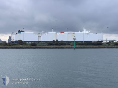
VIKING PASSERO
Vehicles Carrier
Current Trip
OFF ISE BAY
| Time Travelled | 14 h, 20 mins |
|---|---|
| Remaining Time | --- |
| Distance Travelled | 78.48 nm |
| Remaining Distance | --- |
| AVG Speed | 13.1 Knop |
| MAX Speed | 16 Knop |
| AVG Wind | 25.5 knots |
| MAX Wind | 31.8 knots |
| MIN Temp | 7.6°C / 45.68°F |
| MAX Temp | 9.2°C / 48.56°F |
| Djupgående | 7.8 m |
| Position mottagen | 10 h, 51 m sen |
Current Position
| Longitud | 137.36357° |
|---|---|
| Latitude | 34.23381° |
| Status | Under way using engine |
| Fart | 15.4 Knop |
| Kurs | 136.1° |
| Område | Philippine Sea |
| Station | T-AIS |
| Position mottagen | 10 h, 51 m sen |
Info
Information
The current position of VIKING PASSERO is in Philippine Sea with coordinates 34.23381° / 137.36357° as reported on 2025-02-10 09:29 by AIS to our vessel tracker app. The vessel's current speed is 15.4 Knop
The vessel VIKING PASSERO (IMO: 9491886, MMSI: 538009817) is a Vehicles Carrier that was built in 2012 ( 13 År gammal ). It's sailing under the flag of [MH] Marshall Is.
In this page you can find informations about the vessels current position, last detected port calls, and current voyage information. If the vessels is not in coverage by AIS you will find the latest position.
The current position of VIKING PASSERO is detected by our AIS receivers and we are not responsible for the reliability of the data. The last position was recorded while the vessel was in Coverage by the Ais receivers of our vessel tracking app.
The current draught of VIKING PASSERO as reported by AIS is 7.8 meters
Weather
| Temperature | 7.9°C / 46.22°F |
|---|---|
| Wind Speed | 31 knots |
| Direction | 312° NW |
| Pressure | 1020.3 hPa |
| Humidity | 63.1 % |
| Cloud Coverage | 89 % |
Featured Company
Last Port Calls
| Port | Arrival | Departure | Time In Port |
|---|---|---|---|
| 2025-02-08 21:20 | 2025-02-10 06:00 | 1 d | |
| 2025-02-07 21:43 | 2025-02-08 08:43 | 10 h | |
| 2025-01-28 23:17 | 2025-01-29 09:25 | 10 h | |
| 2025-01-24 01:36 | 2025-01-24 15:16 | 13 h | |
| 2025-01-05 16:59 | 2025-01-10 07:38 | 4 d | |
| 2024-12-21 22:28 | 2024-12-23 04:13 | 1 d | |
| 2024-12-18 22:13 | 2024-12-19 18:29 | 20 h | |
| 2024-12-16 13:08 | 2024-12-16 21:02 | 7 h | |
| 2024-12-15 22:31 | 2024-12-16 11:11 | 12 h | |
| 2024-12-10 02:00 | 2024-12-10 18:05 | 16 h |
Most Visited Ports (Last year)
| Port | Arrivals | |
|---|---|---|
| 7 | ||
| 5 | ||
| 4 | ||
| 3 | ||
| 2 | ||
| 2 |
Last Trips
| Origin | Departure | Destination | Arrival | Distance | |
|---|---|---|---|---|---|
| 2025-02-08 17:43 | 2025-02-09 06:20 | 43.39 nm | |||
| 2025-01-29 16:25 | 2025-02-08 06:43 | 2922.94 nm | |||
| 2025-01-24 22:16 | 2025-01-29 06:17 | 1254.21 nm | |||
| 2025-01-10 10:38 | 2025-01-24 08:36 | 4167.75 nm | |||
| 2024-12-23 12:13 | 2025-01-05 19:59 | 3820.32 nm | |||
| 2024-12-20 01:29 | 2024-12-22 06:28 | 810.92 nm | |||
| 2024-12-17 05:02 | 2024-12-19 05:13 | 806.28 nm | |||
| 2024-12-16 19:11 | 2024-12-16 21:08 | 12.91 nm | |||
| 2024-12-10 23:35 | 2024-12-16 06:31 | 1599.15 nm | |||
| 2024-12-01 13:16 | 2024-12-10 07:30 | 2901.74 nm |
Events
| Tid | Event | Detaljer | Position / Dest | Information |
|---|---|---|---|---|
| 2025-02-10 09:35 | Status ändrad | Default Under way using engine |
34.21614 / 137.38512
OFF ISE BAY
|
Fart: 15.4 kn Kurs: 136.1° |
| 2025-02-10 09:29 | UTANFÖR täckningsområde |
34.23381 / 137.36357
Philippine Sea
OFF ISE BAY
|
Fart: 15.4 kn Kurs: 136.1° |
|
| 2025-02-10 09:28 | Status ändrad | Under way using engine Default |
34.23742 / 137.35923
OFF ISE BAY
|
Fart: 15.6 kn Kurs: 136° |
| 2025-02-10 09:17 | Status ändrad | Default Under way using engine |
34.27016 / 137.32077
OFF ISE BAY
|
Fart: 15.6 kn Kurs: 136.7° |
| 2025-02-10 09:10 | Status ändrad | Under way using engine Default |
34.29248 / 137.29485
OFF ISE BAY
|
Fart: 15.7 kn Kurs: 136° |
| 2025-02-10 08:59 | Status ändrad | Default Under way using engine |
34.32695 / 137.25488
OFF ISE BAY
|
Fart: 15.7 kn Kurs: 135.5° |
| 2025-02-10 08:26 | Status ändrad | Under way using engine Default |
34.43268 / 137.13196
OFF ISE BAY
|
Fart: 16 kn Kurs: 136° |
| 2025-02-10 08:16 | I täckningsområde |
34.43268 / 137.13196
Philippine Sea
OFF ISE BAY
|
Fart: 16 kn Kurs: 135.9° |
|
| 2025-02-10 07:05 | Status ändrad | Default Under way using engine |
34.64294 / 137.00848
OFF ISE BAY
|
Fart: 13.7 kn Kurs: 234.9° |
| 2025-02-10 06:59 | UTANFÖR täckningsområde |
34.65563 / 137.02908
Philippine Sea
OFF ISE BAY
|
Fart: 13.7 kn Kurs: 234.9° |