
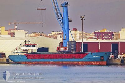
VIKTORIA B
General Cargo
Current Trip
| Time Travelled | 1 day |
|---|---|
| Remaining Time | 1 day |
| Distance Travelled | 127.71 nm |
| Remaining Distance | 124.92 nm |
| AVG Speed | 4.5 Knop |
| MAX Speed | 6.8 Knop |
| AVG Wind | 26.3 knots |
| MAX Wind | 32 knots |
| MIN Temp | 11°C / 51.8°F |
| MAX Temp | 12.6°C / 54.68°F |
| Djupgående | 4.3 m |
| Position mottagen | 1 m sen |
Current Position
| Longitud | 7.54258° |
|---|---|
| Latitude | 43.10884° |
| Status | Under way using engine |
| Fart | 4.6 Knop |
| Kurs | 75° |
| Område | Mediterranean Sea - Western Basin |
| Station | T-AIS |
| Position mottagen | 1 m sen |
Info
Information
The current position of VIKTORIA B is in Mediterranean Sea - Western Basin with coordinates 43.10884° / 7.54258° as reported on 2025-02-09 04:21 by AIS to our vessel tracker app. The vessel's current speed is 4.6 Knop and is heading at the port of LIVORNO. The estimated time of arrival as calculated by MyShipTracking vessel tracking app is 2025-02-10 04:50 LT
The vessel VIKTORIA B (IMO: 9313632, MMSI: 304738000) is a General Cargo that was built in 2005 ( 20 År gammal ). It's sailing under the flag of [AG] Antigua Barbuda.
In this page you can find informations about the vessels current position, last detected port calls, and current voyage information. If the vessels is not in coverage by AIS you will find the latest position.
The current position of VIKTORIA B is detected by our AIS receivers and we are not responsible for the reliability of the data. The last position was recorded while the vessel was in Coverage by the Ais receivers of our vessel tracking app.
The current draught of VIKTORIA B as reported by AIS is 4.3 meters
Weather
| Temperature | 11.2°C / 52.16°F |
|---|---|
| Wind Speed | 21 knots |
| Direction | 53° NE |
| Pressure | 1022.5 hPa |
| Humidity | 75 % |
| Cloud Coverage | 100 % |
Featured Company
Last Port Calls
| Port | Arrival | Departure | Time In Port |
|---|---|---|---|
| 2025-02-07 19:45 | 2025-02-07 20:20 | 35 m | |
| 2025-02-07 19:09 | 2025-02-07 19:45 | 35 m | |
| 2025-02-06 17:02 | 2025-02-06 17:40 | 37 m | |
| 2025-02-06 16:05 | 2025-02-06 16:39 | 34 m | |
| 2025-02-05 06:41 | |||
| 2025-02-01 09:25 | 2025-02-01 10:10 | 44 m | |
| 2025-01-29 08:48 | |||
| 2025-01-29 07:49 | |||
| 2025-01-29 07:49 | |||
| 2025-01-27 12:55 |
Most Visited Ports (Last year)
| Port | Arrivals | |
|---|---|---|
| 16 | ||
| 4 | ||
| 3 | ||
| 3 | ||
| 2 | ||
| 2 |
Last Trips
| Origin | Departure | Destination | Arrival | Distance | |
|---|---|---|---|---|---|
| 2025-02-06 18:40 | 2025-02-07 20:45 | 47.36 nm | |||
| 2025-02-06 18:40 | 2025-02-07 20:09 | 45.68 nm | |||
| 2025-02-06 17:39 | 2025-02-06 18:02 | 0.17 nm | |||
| 2025-02-05 07:41 | 2025-02-06 17:05 | 276.48 nm | |||
| 2025-01-29 09:48 | 2025-02-01 10:25 | 45.63 nm | |||
| 2025-01-15 19:21 | 2025-01-29 08:49 | 1936.22 nm | |||
| 2025-01-15 19:21 | 2025-01-27 13:55 | 1930.61 nm | |||
| 2025-01-09 20:55 | 2025-01-13 17:49 | 652.50 nm | |||
| 2024-12-31 13:50 | 2025-01-08 19:48 | 1450.53 nm | |||
| 2024-12-25 10:58 | 2024-12-30 12:20 | 524.95 nm |
Events
| Tid | Event | Detaljer | Position / Dest | Information |
|---|---|---|---|---|
| 2025-02-08 21:38 | Status ändrad | Under way using engine Default |
43.00398 / 6.93091
ITLIV
|
Fart: 3 kn Kurs: 81° |
| 2025-02-08 21:36 | Status ändrad | Default Under way using engine |
43.00367 / 6.92793
ITLIV
|
Fart: 2.9 kn Kurs: 81° |
| 2025-02-08 21:24 | I täckningsområde |
43.00185 / 6.91475
Mediterranean Sea - Western Basin
ITLIV
|
Fart: 2.9 kn Kurs: 74.9° |
|
| 2025-02-08 20:08 | UTANFÖR täckningsområde |
42.98774 / 6.82908
Mediterranean Sea - Western Basin
ITLIV
|
Fart: 2.9 kn Kurs: 75.5° |
|
| 2025-02-08 20:08 | Status ändrad | Under way using engine Default |
42.98774 / 6.82908
ITLIV
|
Fart: 2.3 kn Kurs: 75° |
| 2025-02-08 19:39 | Status ändrad | Default Under way using engine |
42.98252 / 6.80050
ITLIV
|
Fart: 2.7 kn Kurs: 75° |
| 2025-02-08 19:31 | Status ändrad | Under way using engine Default |
42.98044 / 6.79172
ITLIV
|
Fart: 3.4 kn Kurs: 74° |
| 2025-02-08 19:28 | Status ändrad | Default Under way using engine |
42.97973 / 6.78867
ITLIV
|
Fart: 3.4 kn Kurs: 78° |
| 2025-02-08 18:55 | I täckningsområde |
42.97425 / 6.75467
Mediterranean Sea - Western Basin
ITLIV
|
Fart: 3 kn Kurs: 74.1° |
|
| 2025-02-08 11:44 | UTANFÖR täckningsområde |
42.90230 / 6.25425
Mediterranean Sea - Western Basin
ITLIV
|
Fart: 4.5 kn Kurs: 87.9° |