
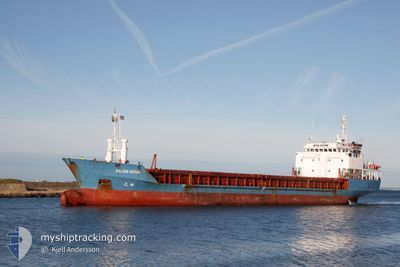
WILSON HUSUM
Limestone Carrier
Current Trip
| Time Travelled | 8 days |
|---|---|
| Remaining Time | --- |
| Distance Travelled | 1185.59 nm |
| Remaining Distance | 674.73 nm |
| AVG Speed | 7.1 Knop |
| MAX Speed | 11.3 Knop |
| AVG Wind | 23.7 knots |
| MAX Wind | 41.9 knots |
| MIN Temp | -0.6°C / 30.92°F |
| MAX Temp | 10.1°C / 50.18°F |
| Djupgående | 5.8 m |
| Position mottagen | 15 d sen |
Current Position
| Longitud | -6.04101° |
|---|---|
| Latitude | 58.21531° |
| Status | Under way using engine |
| Fart | 7.4 Knop |
| Kurs | 2.2° |
| Område | Inner Seas off the West Coast of Scotland |
| Station | T-AIS |
| Position mottagen | 15 d sen |
Info
Information
The current position of WILSON HUSUM is in Inner Seas off the West Coast of Scotland with coordinates 58.21531° / -6.04101° as reported on 2025-02-07 01:47 by AIS to our vessel tracker app. The vessel's current speed is 7.4 Knop and is heading at the port of HUSAVIK.
The vessel WILSON HUSUM (IMO: 9017379, MMSI: 314208000) is a Limestone Carrier that was built in 1998 ( 27 År gammal ). It's sailing under the flag of [BB] Barbados.
In this page you can find informations about the vessels current position, last detected port calls, and current voyage information. If the vessels is not in coverage by AIS you will find the latest position.
The current position of WILSON HUSUM is detected by our AIS receivers and we are not responsible for the reliability of the data. The last position was recorded while the vessel was in Coverage by the Ais receivers of our vessel tracking app.
The current draught of WILSON HUSUM as reported by AIS is 5.8 meters
Weather
| Temperature | 8°C / 46.4°F |
|---|---|
| Wind Speed | 19 knots |
| Direction | 196° SSW |
| Pressure | 1001.8 hPa |
| Humidity | 87.9 % |
| Cloud Coverage | 100 % |
Featured Company
Last Port Calls
| Port | Arrival | Departure | Time In Port |
|---|---|---|---|
| 2025-02-12 07:10 | 2025-02-13 19:14 | 1 d | |
| 2025-02-10 08:17 | 2025-02-10 23:48 | 15 h | |
| 2025-01-16 05:49 | 2025-01-20 06:10 | 4 d | |
| 2025-01-08 07:07 | 2025-01-11 13:31 | 3 d | |
| 2024-12-31 13:54 | 2024-12-31 18:03 | 4 h | |
| 2024-12-18 14:08 | 2024-12-20 20:32 | 2 d | |
| 2024-12-08 13:16 | 2024-12-10 01:12 | 1 d |
Most Visited Ports (Last year)
| Port | Arrivals | |
|---|---|---|
| 3 | ||
| 3 | ||
| 2 | ||
| 2 | ||
| 2 | ||
| 2 |
Last Trips
| Origin | Departure | Destination | Arrival | Distance | |
|---|---|---|---|---|---|
| 2025-02-10 23:48 | 2025-02-12 07:10 | 285.57 nm | |||
| 2025-01-20 07:10 | 2025-02-10 08:17 | 3207.59 nm | |||
| 2025-01-11 14:31 | 2025-01-16 06:49 | 940.93 nm | |||
| 2024-12-31 19:03 | 2025-01-08 08:07 | 1688.68 nm | |||
| 2024-12-20 21:32 | 2024-12-31 14:54 | 2396.68 nm | |||
| 2024-12-10 02:12 | 2024-12-18 15:08 | 1280.04 nm | |||
| 2024-11-28 10:23 | 2024-12-08 14:16 | 1331.75 nm |
Events
| Tid | Event | Detaljer | Position / Dest | Information |
|---|---|---|---|---|
| 2025-02-14 09:12 | STOPPAR förflyttning | 3.83 nm, North East of REYKJAVIK |
64.18262 / -21.77044
ISHUS
|
Fart: 0.3 kn Kurs: 106° |
| 2025-02-13 19:14 | AVGÅTT HAMN |
|
65.07235 / -22.75303
ISHUS
|
Fart: Kurs: 233° |