
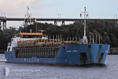
WILSON LOVIISA
General Cargo
Current Trip
| Time Travelled | 4 days |
|---|---|
| Remaining Time | 2 h, 47 mins |
| Distance Travelled | 1057.66 nm |
| Remaining Distance | 58.37 nm |
| AVG Speed | 8.7 Knop |
| MAX Speed | 15.4 Knop |
| AVG Wind | 12.9 knots |
| MAX Wind | 24.7 knots |
| MIN Temp | 2.2°C / 35.96°F |
| MAX Temp | 10.9°C / 51.62°F |
| Djupgående | 4.6 m |
| Position mottagen | 2 h, 7 m sen |
Current Position
| Longitud | 14.14903° |
|---|---|
| Latitude | 54.23697° |
| Status | Under way using engine |
| Fart | 10.7 Knop |
| Kurs | 164.1° |
| Område | Baltic Sea |
| Station | T-AIS |
| Position mottagen | 2 h, 7 m sen |
Info
Information
The current position of WILSON LOVIISA is in Baltic Sea with coordinates 54.23697° / 14.14903° as reported on 2025-02-06 11:35 by AIS to our vessel tracker app. The vessel's current speed is 10.7 Knop and is heading at the port of SZCZECIN. The estimated time of arrival as calculated by MyShipTracking vessel tracking app is 2025-02-06 16:29 LT
The vessel WILSON LOVIISA (IMO: 9213600, MMSI: 314608000) is a General Cargo that was built in 2005 ( 20 År gammal ). It's sailing under the flag of [BB] Barbados.
In this page you can find informations about the vessels current position, last detected port calls, and current voyage information. If the vessels is not in coverage by AIS you will find the latest position.
The current position of WILSON LOVIISA is detected by our AIS receivers and we are not responsible for the reliability of the data. The last position was recorded while the vessel was in Coverage by the Ais receivers of our vessel tracking app.
The current draught of WILSON LOVIISA as reported by AIS is 4.6 meters
Weather
| Temperature | 3.5°C / 38.3°F |
|---|---|
| Wind Speed | 7 knots |
| Direction | 26° NNE |
| Pressure | 1041.8 hPa |
| Humidity | 91 % |
| Cloud Coverage | 13 % |
Featured Company
Last Port Calls
| Port | Arrival | Departure | Time In Port |
|---|---|---|---|
| 2025-01-21 22:06 | 2025-02-01 21:56 | 10 d | |
| 2025-01-10 22:49 | 2025-01-13 20:13 | 2 d | |
| 2025-01-05 10:04 | 2025-01-07 12:09 | 2 d | |
| 2025-01-01 21:08 | 2025-01-02 13:08 | 16 h | |
| 2024-12-27 01:34 | 2024-12-28 07:03 | 1 d | |
| 2024-12-14 15:29 | 2024-12-17 03:59 | 2 d | |
| 2024-12-13 05:21 | 2024-12-13 15:34 | 10 h | |
| 2024-12-04 13:32 | 2024-12-10 05:34 | 5 d | |
| 2024-12-03 09:47 | 2024-12-03 19:12 | 9 h |
Last Trips
| Origin | Departure | Destination | Arrival | Distance | |
|---|---|---|---|---|---|
| 2025-01-13 22:13 | 2025-01-21 22:06 | 1582.50 nm | |||
| 2025-01-07 13:09 | 2025-01-11 00:49 | 712.66 nm | |||
| 2025-01-02 14:08 | 2025-01-05 11:04 | 574.20 nm | |||
| 2024-12-28 08:03 | 2025-01-01 22:08 | 290.58 nm | |||
| 2024-12-17 04:59 | 2024-12-27 02:34 | 816.26 nm | |||
| 2024-12-13 16:34 | 2024-12-14 16:29 | 129.97 nm | |||
| 2024-12-10 06:34 | 2024-12-13 06:21 | 552.27 nm | |||
| 2024-12-03 20:12 | 2024-12-04 14:32 | 104.54 nm | |||
| 2024-11-26 20:26 | 2024-12-03 10:47 | 1026.68 nm |
Events
| Tid | Event | Detaljer | Position / Dest | Information |
|---|---|---|---|---|
| 2025-02-06 13:25 | STOPPAR förflyttning | 3.86 nm, North of SWINOUJSCIE |
53.96883 / 14.24610
GBNPT>>PLSZZ
|
Fart: 0.2 kn Kurs: 292° |
| 2025-02-06 11:45 | Status ändrad | Default Under way using engine |
54.20673 / 14.16515
GBNPT>>PLSZZ
|
Fart: 10.7 kn Kurs: 164.1° |
| 2025-02-06 11:35 | Status ändrad | Under way using engine Default |
54.23697 / 14.14903
GBNPT>>PLSZZ
|
Fart: 10.8 kn Kurs: 126° |
| 2025-02-06 11:35 | UTANFÖR täckningsområde |
54.23697 / 14.14903
Baltic Sea
GBNPT>>PLSZZ
|
Fart: 10.7 kn Kurs: 164.1° |
|
| 2025-02-06 11:08 | Status ändrad | Default Under way using engine |
54.28850 / 14.04798
GBNPT>>PLSZZ
|
Fart: 10.7 kn Kurs: 126.1° |
| 2025-02-06 10:52 | Status ändrad | Under way using engine Default |
54.31567 / 13.98533
GBNPT>>PLSZZ
|
Fart: 10.5 kn Kurs: 128° |
| 2025-02-06 10:47 | Status ändrad | Default Under way using engine |
54.32488 / 13.96558
GBNPT>>PLSZZ
|
Fart: 10.6 kn Kurs: 149.7° |
| 2025-02-06 10:43 | Status ändrad | Under way using engine Default |
54.33508 / 13.95120
GBNPT>>PLSZZ
|
Fart: 10.6 kn Kurs: 150° |
| 2025-02-06 10:41 | Status ändrad | Default Under way using engine |
54.34018 / 13.94620
GBNPT>>PLSZZ
|
Fart: 10.8 kn Kurs: 151.2° |
| 2025-02-06 10:36 | Status ändrad | Under way using engine Default |
54.35297 / 13.93367
GBNPT>>PLSZZ
|
Fart: 10.8 kn Kurs: 150° |