

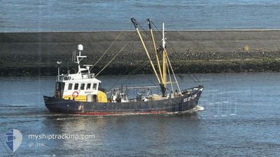
WR 126 VERTROUWEN
Fishing Vessel
Current Trip
Unknown
| Time Travelled | 1 day |
|---|---|
| Remaining Time | --- |
| Distance Travelled | 98.30 nm |
| Remaining Distance | --- |
| AVG Speed | 4.3 Knop |
| MAX Speed | 10.6 Knop |
| AVG Wind | 12.1 knots |
| MAX Wind | 17 knots |
| MIN Temp | 12.8°C / 55.04°F |
| MAX Temp | 20.6°C / 69.08°F |
| Djupgående | 0 m |
| Position mottagen | 1 m sen |
Current Position
| Longitud | 4.56248° |
|---|---|
| Latitude | 52.48045° |
| Status | Engaged in Fishing |
| Fart | 1.5 Knop |
| Kurs | 205° |
| Område | North Sea |
| Station | T-AIS |
| Position mottagen | 1 m sen |
Information
The current position of WR 126 VERTROUWEN is in North Sea with coordinates 52.48045° / 4.56248° as reported on 2025-06-12 12:10 by AIS to our vessel tracker app. The vessel's current speed is 1.5 Knop
The vessel WR 126 VERTROUWEN (IMO: 8431798, MMSI: 246338000) is a Fishing Vessel that was built in 1953 ( 72 År gammal ). It's sailing under the flag of [NL] Netherlands.
In this page you can find informations about the vessels current position, last detected port calls, and current voyage information. If the vessels is not in coverage by AIS you will find the latest position.
The current position of WR 126 VERTROUWEN is detected by our AIS receivers and we are not responsible for the reliability of the data. The last position was recorded while the vessel was in Coverage by the Ais receivers of our vessel tracking app.
Weather
| Temperature | 20.6°C / 69.08°F |
|---|---|
| Wind Speed | 15 knots |
| Direction | 105° ESE |
| Pressure | 1015.8 hPa |
| Humidity | 52.1 % |
| Cloud Coverage | 4 % |
Featured Company
Last Port Calls
| Port | Arrival | Departure | Time In Port |
|---|---|---|---|
| 2025-06-05 13:19 | 2025-06-11 09:37 | 5 d | |
| 2025-06-03 17:58 | 2025-06-04 07:00 | 13 h | |
| 2025-05-29 15:17 | |||
| 2025-05-18 09:15 | 2025-05-18 18:32 | 9 h | |
| 2025-05-08 10:40 | 2025-05-15 15:55 | 7 d | |
| 2025-05-01 15:44 | |||
| 2025-04-18 03:49 | |||
| 2025-04-07 08:45 |
Most Visited Ports (Last year)
| Port | Arrivals | |
|---|---|---|
| 13 | ||
| 10 | ||
| 9 | ||
| 7 | ||
| 5 | ||
| 5 |
Events
| Tid | Event | Detaljer | Position / Dest | Information |
|---|---|---|---|---|
| 2025-06-12 02:39 | STARTAR förflyttning | 1.22 nm, North West of IJMUIDEN |
52.47986 / 4.56251
|
Fart: 3.2 kn Kurs: 123° |
| 2025-06-12 01:56 | STOPPAR förflyttning | 2.45 nm, North of IJMUIDEN |
52.50666 / 4.57648
|
Fart: 0.3 kn Kurs: 189° |
| 2025-06-11 21:39 | STARTAR förflyttning | 4.43 nm, North of IJMUIDEN |
52.54013 / 4.58588
|
Fart: 3.1 kn Kurs: 75° |
| 2025-06-11 21:12 | STOPPAR förflyttning | 3.36 nm, North of IJMUIDEN |
52.52225 / 4.58233
|
Fart: 0.2 kn Kurs: 14° |
| 2025-06-11 18:53 | STARTAR förflyttning | 4.84 nm, North of IJMUIDEN |
52.54695 / 4.59243
|
Fart: 3.5 kn Kurs: 190° |
| 2025-06-11 18:48 | STOPPAR förflyttning | 4.89 nm, North of IJMUIDEN |
52.54757 / 4.59531
|
Fart: 0.3 kn Kurs: 355° |
| 2025-06-11 07:37 | AVGÅTT HAMN |
|
52.94023 / 5.04014
|
Fart: 6.6 kn Kurs: 30° |
| 2025-06-11 07:35 | STARTAR förflyttning |
52.93808 / 5.03440
[NL] DEN OEVER
|
Fart: 5.8 kn Kurs: 58° |
|
| 2025-06-05 12:27 | STOPPAR förflyttning |
52.93704 / 5.03189
[NL] DEN OEVER
|
Fart: 0.3 kn Kurs: 117° |
|
| 2025-06-05 12:23 | STARTAR förflyttning |
52.93612 / 5.03583
[NL] DEN OEVER
|
Fart: 5.3 kn Kurs: 319° |