

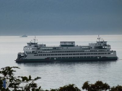
WSF YAKIMA
Passenger

Current Trip
| Trip Time | 1 h, 13 mins |
|---|---|
| Trip Distance | 16.89 nm |
| AVG Speed | 12.7 Knop |
| MAX Speed | 16.3 Knop |
| Djupgående | 5.6 m |
| AVG Wind | 4.5 knots |
| MAX Wind | 6.1 knots |
| MIN Temp | 11°C / 51.8°F |
| MAX Temp | 11.3°C / 52.34°F |
| Position mottagen | 2 m sen |
Current Position
| Longitud | -122.67739° |
|---|---|
| Latitude | 48.50754° |
| Status | Moored |
| Fart | |
| Kurs | 203° |
| Område | The Coastal Waters of Southeast Alaska and British Columbia |
| Station | T-AIS |
| Position mottagen | 2 m sen |
Information
The current position of WSF YAKIMA is in The Coastal Waters of Southeast Alaska and British Columbia with coordinates 48.50754° / -122.67739° as reported on 2025-06-03 07:49 by AIS to our vessel tracker app. The vessel's current speed is 0 Knop and is currently inside the port of ANACORTES.
The vessel WSF YAKIMA (IMO: 8835360, MMSI: 366772750) is a Passenger It's sailing under the flag of [US] USA.
In this page you can find informations about the vessels current position, last detected port calls, and current voyage information. If the vessels is not in coverage by AIS you will find the latest position.
The current position of WSF YAKIMA is detected by our AIS receivers and we are not responsible for the reliability of the data. The last position was recorded while the vessel was in Coverage by the Ais receivers of our vessel tracking app.
The current draught of WSF YAKIMA as reported by AIS is 5.6 meters
Weather
| Temperature | 10.6°C / 51.08°F |
|---|---|
| Wind Speed | 4 knots |
| Direction | 181° S |
| Pressure | 1023.1 hPa |
| Humidity | 86.1 % |
| Cloud Coverage | 6 % |


Featured Company
Last Port Calls
| Port | Arrival | Departure | Time In Port |
|---|---|---|---|
| 2025-06-02 23:14 | |||
| 2025-06-02 21:36 | 2025-06-02 22:01 | 24 m | |
| 2025-06-02 19:43 | 2025-06-02 20:15 | 31 m | |
| 2025-06-02 17:50 | 2025-06-02 18:18 | 27 m | |
| 2025-06-02 13:37 | 2025-06-02 16:22 | 2 h | |
| 2025-06-02 11:41 | 2025-06-02 12:28 | 46 m | |
| 2025-06-02 10:06 | 2025-06-02 10:34 | 27 m | |
| 2025-06-02 08:28 | 2025-06-02 09:00 | 31 m | |
| 2025-06-02 07:08 | 2025-06-02 07:38 | 29 m | |
| 2025-06-02 05:18 | 2025-06-02 05:42 | 24 m |
Most Visited Ports (Last year)
| Port | Arrivals | |
|---|---|---|
| 1659 | ||
| 949 | ||
| 635 | ||
| 121 | ||
| 120 | ||
| 2 |
Last Trips
| Origin | Departure | Destination | Arrival | Distance | |
|---|---|---|---|---|---|
| 2025-06-02 22:01 | 2025-06-02 23:14 | 16.89 nm | |||
| 2025-06-02 20:15 | 2025-06-02 21:36 | 16.74 nm | |||
| 2025-06-02 18:18 | 2025-06-02 19:43 | 17.28 nm | |||
| 2025-06-02 16:22 | 2025-06-02 17:50 | 16.52 nm | |||
| 2025-06-02 12:28 | 2025-06-02 13:37 | 16.67 nm | |||
| 2025-06-02 10:34 | 2025-06-02 11:41 | 16.07 nm | |||
| 2025-06-02 09:00 | 2025-06-02 10:06 | 13.42 nm | |||
| 2025-06-02 07:38 | 2025-06-02 08:28 | 12.62 nm | |||
| 2025-06-02 05:42 | 2025-06-02 07:08 | 17.43 nm | |||
| 2025-06-02 04:10 | 2025-06-02 05:18 | 16.22 nm |
Events
| Tid | Event | Detaljer | Position / Dest | Information |
|---|---|---|---|---|
| 2025-06-03 07:25 | Status ändrad | Moored Default |
48.50754 / -122.67740
[US] ANACORTES
|
Fart: Kurs: 204° |
| 2025-06-03 07:22 | Status ändrad | Default Moored |
48.50751 / -122.67745
[US] ANACORTES
|
Fart: Kurs: 204° |
| 2025-06-03 06:15 | STOPPAR förflyttning |
48.50751 / -122.67744
[US] ANACORTES
|
Fart: 0.1 kn Kurs: 203° |
|
| 2025-06-03 06:14 | ANLÄNDER HAMN |
|
48.50761 / -122.67734
[US] ANACORTES
|
Fart: 0.6 kn Kurs: 202° |
| 2025-06-03 05:01 | AVGÅTT HAMN |
|
48.54018 / -123.01181
WSF TERMINAL
|
Fart: 9 kn Kurs: 11° |
| 2025-06-03 05:00 | STARTAR förflyttning |
48.53849 / -123.01240
[US] FRIDAY HARBOR
|
Fart: 8.7 kn Kurs: 12° |
|
| 2025-06-03 04:38 | STOPPAR förflyttning |
48.53584 / -123.01381
[US] FRIDAY HARBOR
|
Fart: 0.1 kn Kurs: 207° |
|
| 2025-06-03 04:36 | ANLÄNDER HAMN |
|
48.53704 / -123.01284
[US] FRIDAY HARBOR
|
Fart: 5.5 kn Kurs: 203.2° |
| 2025-06-03 04:06 | STARTAR förflyttning | 2.9 nm, South East of ORCAS |
48.57232 / -122.88010
WSF TERMINAL
|
Fart: 7.7 kn Kurs: 71.6° |
| 2025-06-03 03:55 | STOPPAR förflyttning | 2.85 nm, South East of ORCAS |
48.57096 / -122.88288
WSF TERMINAL
|
Fart: 0.3 kn Kurs: 225° |