
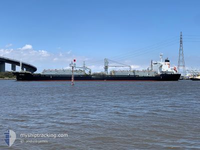
WYUNA
Bulk Carrier
Current Trip
| Time Travelled | 1 day |
|---|---|
| Remaining Time | 17 h, 4 mins |
| Distance Travelled | 296.90 nm |
| Remaining Distance | 224.95 nm |
| AVG Speed | 12.3 Knop |
| MAX Speed | 16.4 Knop |
| AVG Wind | 15.7 knots |
| MAX Wind | 22.2 knots |
| MIN Temp | 15.6°C / 60.08°F |
| MAX Temp | 20.5°C / 68.9°F |
| Djupgående | 6.3 m |
| Position mottagen | 12 h, 7 m sen |
Current Position
| Longitud | 142.73035° |
|---|---|
| Latitude | -38.95972° |
| Status | Under way using engine |
| Fart | 12.2 Knop |
| Kurs | 287° |
| Område | Great Australian Bight |
| Station | T-AIS |
| Position mottagen | 12 h, 7 m sen |
Info
Information
The current position of WYUNA is in Great Australian Bight with coordinates -38.95972° / 142.73035° as reported on 2025-02-04 20:32 by AIS to our vessel tracker app. The vessel's current speed is 12.2 Knop and is heading at the port of ADELAIDE. The estimated time of arrival as calculated by MyShipTracking vessel tracking app is 2025-02-06 01:44 LT
The vessel WYUNA (IMO: 9550448, MMSI: 311000708) is a Bulk Carrier that was built in 2010 ( 15 År gammal ). It's sailing under the flag of [BS] Bahamas.
In this page you can find informations about the vessels current position, last detected port calls, and current voyage information. If the vessels is not in coverage by AIS you will find the latest position.
The current position of WYUNA is detected by our AIS receivers and we are not responsible for the reliability of the data. The last position was recorded while the vessel was in Coverage by the Ais receivers of our vessel tracking app.
The current draught of WYUNA as reported by AIS is 6.3 meters
Weather
| Temperature | 16.8°C / 62.24°F |
|---|---|
| Wind Speed | 24 knots |
| Direction | 140° SE |
| Pressure | 1014.6 hPa |
| Humidity | 70.5 % |
| Cloud Coverage | --- |
Featured Company
Last Port Calls
| Port | Arrival | Departure | Time In Port |
|---|---|---|---|
| 2025-02-02 04:08 | 2025-02-04 07:41 | 2 d | |
| 2025-01-28 09:48 | 2025-01-31 07:58 | 2 d | |
| 2025-01-23 02:30 | 2025-01-25 03:35 | 2 d | |
| 2025-01-16 04:26 | 2025-01-21 01:43 | 4 d | |
| 2025-01-12 22:25 | 2025-01-14 00:16 | 1 d | |
| 2025-01-09 15:46 | 2025-01-11 21:44 | 2 d | |
| 2025-01-03 11:44 | 2025-01-06 02:28 | 2 d | |
| 2024-12-27 23:20 | 2025-01-02 03:12 | 5 d | |
| 2024-12-24 00:27 | 2024-12-26 03:59 | 2 d | |
| 2024-12-15 20:15 | 2024-12-18 01:06 | 2 d |
Last Trips
| Origin | Departure | Destination | Arrival | Distance | |
|---|---|---|---|---|---|
| 2025-01-31 18:28 | 2025-02-02 15:08 | 518.61 nm | |||
| 2025-01-25 14:35 | 2025-01-28 20:18 | 541.26 nm | |||
| 2025-01-21 12:13 | 2025-01-23 13:30 | 518.57 nm | |||
| 2025-01-14 11:16 | 2025-01-16 14:56 | 605.20 nm | |||
| 2025-01-12 08:44 | 2025-01-13 09:25 | 239.50 nm | |||
| 2025-01-06 12:28 | 2025-01-10 02:46 | 1109.55 nm | |||
| 2025-01-02 13:12 | 2025-01-03 21:44 | 333.74 nm | |||
| 2024-12-26 13:59 | 2024-12-28 09:20 | 436.19 nm | |||
| 2024-12-18 12:06 | 2024-12-24 10:27 | 1651.92 nm | |||
| 2024-12-14 06:45 | 2024-12-16 07:15 | 541.02 nm |
Events
| Tid | Event | Detaljer | Position / Dest | Information |
|---|---|---|---|---|
| 2025-02-04 20:38 | Status ändrad | Default Under way using engine |
-38.95350 / 142.70395
AU ADELAIDE
|
Fart: 12.2 kn Kurs: 287° |
| 2025-02-04 20:32 | UTANFÖR täckningsområde |
-38.95972 / 142.73035
Great Australian Bight
AU ADELAIDE
|
Fart: 12.2 kn Kurs: 287° |
|
| 2025-02-04 16:58 | Upptäckt i hav | Australian part of the Great Australian Bight |
-38.99798 / 143.61420
Great Australian Bight
AU ADELAIDE
|
Fart: 11 kn Kurs: 249° |
| 2025-02-04 16:13 | Status ändrad | Under way using engine Default |
-38.95420 / 143.77903
AU ADELAIDE
|
Fart: 10.9 kn Kurs: 250° |
| 2025-02-04 16:13 | I täckningsområde |
-38.95420 / 143.77903
Bass Strait
AU ADELAIDE
|
Fart: 10.7 kn Kurs: 250° |
|
| 2025-02-04 11:48 | Status ändrad | Default Under way using engine |
-38.38708 / 144.45355
AU ADELAIDE
|
Fart: 11.9 kn Kurs: 241° |
| 2025-02-04 11:43 | UTANFÖR täckningsområde |
-38.37957 / 144.47287
Bass Strait
AU ADELAIDE
|
Fart: 11.9 kn Kurs: 241° |
|
| 2025-02-04 10:24 | Status ändrad | Under way using engine Default |
-38.31072 / 144.78012
AU ADELAIDE
|
Fart: 14 kn Kurs: 285° |
| 2025-02-04 10:04 | Status ändrad | Default Under way using engine |
-38.32957 / 144.86879
AU ADELAIDE
|
Fart: 11.7 kn Kurs: 246° |
| 2025-02-04 09:57 | Status ändrad | Under way using engine Default |
-38.33118 / 144.90212
AU ADELAIDE
|
Fart: 12.2 kn Kurs: 183° |