

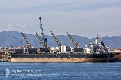
XIN HAI TONG 57
Bulk Carrier

Current Trip
AO LAD
| Time Travelled | 6 days |
|---|---|
| Remaining Time | --- |
| Distance Travelled | 621.59 nm |
| Remaining Distance | --- |
| AVG Speed | 12 Knop |
| MAX Speed | 17 Knop |
| AVG Wind | 6.6 knots |
| MAX Wind | 10.9 knots |
| MIN Temp | 23.7°C / 74.66°F |
| MAX Temp | 30.1°C / 86.18°F |
| Djupgående | 10.4 m |
| Position mottagen | 2025-04-24 03:48 |
Current Position
| Longitud | 17.43958° |
|---|---|
| Latitude | -34.00167° |
| Status | Under way using engine |
| Fart | 11.3 Knop |
| Kurs | 319.3° |
| Område | South Atlantic Ocean |
| Station | T-AIS |
| Position mottagen | 2025-04-24 03:48 |
Information
The current position of XIN HAI TONG 57 is in South Atlantic Ocean with coordinates -34.00167° / 17.43958° as reported on 2025-04-24 03:48 by AIS to our vessel tracker app. The vessel's current speed is 11.3 Knop
The vessel XIN HAI TONG 57 (IMO: 9632296, MMSI: 477767300) is a Bulk Carrier that was built in 2013 ( 12 År gammal ). It's sailing under the flag of [HK] Hong Kong.
In this page you can find informations about the vessels current position, last detected port calls, and current voyage information. If the vessels is not in coverage by AIS you will find the latest position.
The current position of XIN HAI TONG 57 is detected by our AIS receivers and we are not responsible for the reliability of the data. The last position was recorded while the vessel was in Coverage by the Ais receivers of our vessel tracking app.
The current draught of XIN HAI TONG 57 as reported by AIS is 10.4 meters
Weather
| Temperature | 23.7°C / 74.66°F |
|---|---|
| Wind Speed | 7 knots |
| Direction | 180° S |
| Pressure | 1011.2 hPa |
| Humidity | 92.8 % |
| Cloud Coverage | 100 % |


Featured Company
Most Visited Ports (Last year)
| Port | Arrivals | |
|---|---|---|
| 2 | ||
| 2 | ||
| 2 | ||
| 2 | ||
| 1 | ||
| 1 |
Events
| Tid | Event | Detaljer | Position / Dest | Information |
|---|---|---|---|---|
| 2025-06-10 13:03 | STOPPAR förflyttning | 1.08 nm, West of OWENDO |
.27600 / 9.49008
AO LAD
|
Fart: 0.3 kn Kurs: 309° |
| 2025-06-10 11:31 | STARTAR förflyttning | 4.83 nm, South West of LIBREVILLE |
.32563 / 9.39867
AO LAD
|
Fart: 9 kn Kurs: 107° |
| 2025-06-06 13:51 | STOPPAR förflyttning | 4.91 nm, South West of LIBREVILLE |
.33160 / 9.38595
AO LAD
|
Fart: 0.2 kn Kurs: 153° |
| 2025-06-04 12:00 | AVGÅTT HAMN |
|
-5.81727 / 13.45200
AO LAD
|
Fart: 3.3 kn Kurs: 321° |
| 2025-06-04 11:52 | STARTAR förflyttning |
-5.82027 / 13.45420
[CD] MATADI
|
Fart: 6.4 kn Kurs: 54° |