
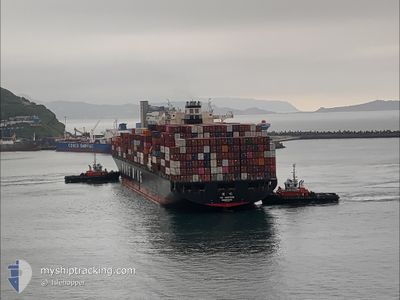
YM UNIFORM
Container Ship
Current Trip
| Time Travelled | 1 day |
|---|---|
| Remaining Time | --- |
| Distance Travelled | 177.45 nm |
| Remaining Distance | 4.83 nm |
| AVG Speed | 14.6 Knop |
| MAX Speed | 19.3 Knop |
| AVG Wind | 6.2 knots |
| MAX Wind | 10.9 knots |
| MIN Temp | -3.4°C / 25.88°F |
| MAX Temp | 2.4°C / 36.32°F |
| Djupgående | 13.2 m |
| Position mottagen | Nu |
Current Position
| Longitud | -123.22855° |
|---|---|
| Latitude | 49.30135° |
| Status | Under way using engine |
| Fart | 0.4 Knop |
| Kurs | 92° |
| Område | The Coastal Waters of Southeast Alaska and British Columbia |
| Station | T-AIS |
| Position mottagen | Nu |
Info
Information
The current position of YM UNIFORM is in The Coastal Waters of Southeast Alaska and British Columbia with coordinates 49.30135° / -123.22855° as reported on 2025-02-07 16:17 by AIS to our vessel tracker app. The vessel's current speed is 0.4 Knop and is heading at the port of VANCOUVER. The estimated time of arrival as calculated by MyShipTracking vessel tracking app is 2025-02-07 11:30 LT
The vessel YM UNIFORM (IMO: 9337482, MMSI: 636013693) is a Container Ship that was built in 2009 ( 16 År gammal ). It's sailing under the flag of [LR] Liberia.
In this page you can find informations about the vessels current position, last detected port calls, and current voyage information. If the vessels is not in coverage by AIS you will find the latest position.
The current position of YM UNIFORM is detected by our AIS receivers and we are not responsible for the reliability of the data. The last position was recorded while the vessel was in Coverage by the Ais receivers of our vessel tracking app.
The current draught of YM UNIFORM as reported by AIS is 13.2 meters
Weather
| Temperature | -3.1°C / 26.42°F |
|---|---|
| Wind Speed | 4 knots |
| Direction | 95° E |
| Pressure | 1017.4 hPa |
| Humidity | 74.6 % |
| Cloud Coverage | 30 % |
Featured Company
Last Port Calls
| Port | Arrival | Departure | Time In Port |
|---|---|---|---|
| 2025-02-02 13:10 | 2025-02-06 14:56 | 4 d | |
| 2025-01-30 13:13 | 2025-01-31 10:00 | 20 h | |
| 2025-01-30 12:36 | 2025-01-30 12:49 | 13 m | |
| 2025-01-16 08:27 | 2025-01-17 14:45 | 1 d | |
| 2025-01-01 05:32 | 2025-01-02 11:13 | 1 d | |
| 2024-12-30 06:35 | 2024-12-30 22:09 | 15 h | |
| 2024-12-28 22:53 | 2024-12-29 22:58 | 1 d | |
| 2024-12-10 11:48 | 2024-12-15 19:43 | 5 d |
Most Visited Ports (Last year)
| Port | Arrivals | |
|---|---|---|
| 10 | ||
| 9 | ||
| 5 | ||
| 5 | ||
| 4 | ||
| 3 |
Last Trips
| Origin | Departure | Destination | Arrival | Distance | |
|---|---|---|---|---|---|
| 2025-01-31 02:00 | 2025-02-02 05:10 | 661.73 nm | |||
| 2025-01-30 04:49 | 2025-01-30 05:13 | 0.67 nm | |||
| 2025-01-17 23:45 | 2025-01-30 04:36 | 4262.73 nm | |||
| 2025-01-02 19:13 | 2025-01-16 17:27 | 1635.75 nm | |||
| 2024-12-31 07:09 | 2025-01-01 13:32 | 453.75 nm | |||
| 2024-12-30 07:58 | 2024-12-30 15:35 | 94.54 nm | |||
| 2024-12-15 11:43 | 2024-12-29 07:53 | 4815.48 nm | |||
| 2024-11-27 05:40 | 2024-12-10 03:48 | 387.00 nm |
Events
| Tid | Event | Detaljer | Position / Dest | Information |
|---|---|---|---|---|
| 2025-02-07 16:17 | STOPPAR förflyttning | 5.25 nm, West of VANCOUVER |
49.30135 / -123.22852
USTIW > CAVAN
|
Fart: 0.3 kn Kurs: 92° |
| 2025-02-07 14:34 | Byter havsområde | Canadian part of the The Coastal Waters of Southeast Alaska and British Columbia United States part of the The Coastal Waters of Southeast Alaska and British Columbia |
49.00371 / -123.25327
The Coastal Waters of Southeast Alaska and British Columbia
USTIW > CAVAN
|
Fart: 17.7 kn Kurs: 313° |
| 2025-02-07 13:49 | Byter havsområde | United States part of the The Coastal Waters of Southeast Alaska and British Columbia Canadian part of the The Coastal Waters of Southeast Alaska and British Columbia |
48.84347 / -123.02823
The Coastal Waters of Southeast Alaska and British Columbia
USTIW > CAVAN
|
Fart: 17 kn Kurs: 329.8° |
| 2025-02-07 13:10 | Byter havsområde | Canadian part of the The Coastal Waters of Southeast Alaska and British Columbia United States part of the The Coastal Waters of Southeast Alaska and British Columbia |
48.71825 / -123.18009
The Coastal Waters of Southeast Alaska and British Columbia
USTIW > CAVAN
|
Fart: 17.8 kn Kurs: 64.1° |
| 2025-02-07 12:16 | Byter havsområde | United States part of the The Coastal Waters of Southeast Alaska and British Columbia Canadian part of the The Coastal Waters of Southeast Alaska and British Columbia |
48.48272 / -123.17520
The Coastal Waters of Southeast Alaska and British Columbia
USTIW > CAVAN
|
Fart: 17 kn Kurs: 343.6° |
| 2025-02-07 11:13 | Status ändrad | Under way using engine At anchor |
48.33407 / -123.36461
USTIW > CAVAN
|
Fart: 0.4 kn Kurs: 232° |
| 2025-02-07 11:13 | STARTAR förflyttning | 5.41 nm, South of VICTORIA |
48.33407 / -123.36461
USTIW > CAVAN
|
Fart: 3.3 kn Kurs: 261° |
| 2025-02-07 11:11 | Status ändrad | At anchor Default |
48.33461 / -123.36329
USTIW > CAVAN
|
Fart: 0.3 kn Kurs: 208° |
| 2025-02-07 10:53 | Status ändrad | Default At anchor |
48.33545 / -123.36311
USTIW > CAVAN
|
Fart: 0.2 kn Kurs: 228° |
| 2025-02-07 10:50 | Status ändrad | At anchor Default |
48.33569 / -123.36279
USTIW > CAVAN
|
Fart: Kurs: 233° |