
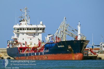
YM VENUS
Oil/Chemical Tanker
Current Trip
TR GEM > EG EDK
| Time Travelled | 14 h, 42 mins |
|---|---|
| Remaining Time | --- |
| Distance Travelled | 3.81 nm |
| Remaining Distance | --- |
| AVG Speed | 12.8 Knop |
| MAX Speed | 13.2 Knop |
| AVG Wind | 13 knots |
| MAX Wind | 13 knots |
| MIN Temp | 20.8°C / 69.44°F |
| MAX Temp | 20.9°C / 69.62°F |
| Djupgående | 4.9 m |
| Position mottagen | 2 d sen |
Current Position
| Longitud | 28.96292° |
|---|---|
| Latitude | 32.85198° |
| Status | Under way using engine |
| Fart | 11.9 Knop |
| Kurs | 160° |
| Område | Mediterranean Sea - Eastern Basin |
| Station | T-AIS |
| Position mottagen | 2 d sen |
Information
The current position of YM VENUS is in Mediterranean Sea - Eastern Basin with coordinates 32.85198° / 28.96292° as reported on 2025-05-29 02:18 by AIS to our vessel tracker app. The vessel's current speed is 11.9 Knop
The vessel YM VENUS (IMO: 9291585, MMSI: 215826000) is a Oil/Chemical Tanker that was built in 2005 ( 20 År gammal ). It's sailing under the flag of [MT] Malta.
In this page you can find informations about the vessels current position, last detected port calls, and current voyage information. If the vessels is not in coverage by AIS you will find the latest position.
The current position of YM VENUS is detected by our AIS receivers and we are not responsible for the reliability of the data. The last position was recorded while the vessel was in Coverage by the Ais receivers of our vessel tracking app.
The current draught of YM VENUS as reported by AIS is 4.9 meters
Weather
| Temperature | 21.5°C / 70.7°F |
|---|---|
| Wind Speed | 10 knots |
| Direction | 36° NE |
| Pressure | 1010.9 hPa |
| Humidity | 68.3 % |
| Cloud Coverage | 1 % |
Featured Company
Last Port Calls
| Port | Arrival | Departure | Time In Port |
|---|---|---|---|
| 2025-05-29 15:06 | 2025-05-31 09:30 | 1 d | |
| 2025-05-24 05:10 | 2025-05-26 02:09 | 1 d | |
| 2025-05-16 11:26 | 2025-05-17 16:59 | 1 d | |
| 2025-05-07 16:02 | 2025-05-10 13:00 | 2 d | |
| 2025-04-12 19:14 | 2025-05-06 10:53 | 23 d | |
| 2025-04-04 15:58 | 2025-04-06 09:06 | 1 d | |
| 2025-04-01 14:38 |
Last Trips
| Origin | Departure | Destination | Arrival | Distance | |
|---|---|---|---|---|---|
| 2025-05-26 05:09 | 2025-05-29 17:06 | 785.84 nm | |||
| 2025-05-17 18:59 | 2025-05-24 08:10 | 1604.72 nm | |||
| 2025-05-10 14:00 | 2025-05-16 13:26 | 575.35 nm | |||
| 2025-05-06 12:53 | 2025-05-07 17:02 | 317.54 nm | |||
| 2025-04-06 11:06 | 2025-04-12 21:14 | 1155.98 nm | |||
| 2025-04-01 16:38 | 2025-04-04 17:58 | 814.13 nm |
Events
| Tid | Event | Detaljer | Position / Dest | Information |
|---|---|---|---|---|
| 2025-05-31 09:30 | AVGÅTT HAMN |
|
31.16415 / 29.80702
TR GEM > EG EDK
|
Fart: 7 kn Kurs: 356° |
| 2025-05-31 09:19 | STARTAR förflyttning |
31.14459 / 29.80084
[EG] EL DEKHEILA
|
Fart: 7.2 kn Kurs: 53° |
|
| 2025-05-29 15:27 | STOPPAR förflyttning |
31.13724 / 29.79567
[EG] EL DEKHEILA
|
Fart: 0.2 kn Kurs: 208° |
|
| 2025-05-29 15:06 | ANLÄNDER HAMN |
|
31.14954 / 29.80697
[EG] EL DEKHEILA
|
Fart: 9.6 kn Kurs: 170° |
| 2025-05-29 14:42 | STARTAR förflyttning | 3.09 nm, North West of EL DEKHEILA |
31.19373 / 29.78232
TR GEM > EG EDK
|
Fart: 3.9 kn Kurs: 181° |
| 2025-05-29 11:59 | STOPPAR förflyttning | 3.6 nm, North of EL DEKHEILA |
31.20317 / 29.78291
TR GEM > EG EDK
|
Fart: 0.2 kn Kurs: 307° |
| 2025-05-29 02:19 | Status ändrad | Default Under way using engine |
32.84807 / 28.96441
TR GEM > EG EDK
|
Fart: 11.9 kn Kurs: 160° |
| 2025-05-29 02:18 | UTANFÖR täckningsområde |
32.85198 / 28.96292
Mediterranean Sea - Eastern Basin
TR GEM > EG EDK
|
Fart: 11.9 kn Kurs: 160° |
|
| 2025-05-29 01:53 | Status ändrad | Under way using engine Default |
32.92997 / 28.93172
TR GEM > EG EDK
|
Fart: 12 kn Kurs: 162° |
| 2025-05-29 01:39 | Status ändrad | Default Under way using engine |
32.97445 / 28.91302
TR GEM > EG EDK
|
Fart: 11.9 kn Kurs: 159.7° |