

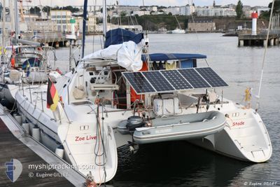
ZOE LIVE
Sailing

Current Trip
Unknown
Destination Port
ETA*
---
| Time Travelled | --- |
|---|---|
| Remaining Time | --- |
| Distance Travelled | 298.48 nm |
| Remaining Distance | --- |
| AVG Speed | 4.1 Knop |
| MAX Speed | 9.1 Knop |
| AVG Wind | 12.7 knots |
| MAX Wind | 21 knots |
| MIN Temp | 22.3°C / 72.14°F |
| MAX Temp | 28°C / 82.4°F |
| Djupgående | 0 m |
| Position mottagen | 1 m sen |
Current Position
| Longitud | -76.44576° |
|---|---|
| Latitude | 24.17715° |
| Status | Default |
| Fart | |
| Kurs | --- |
| Område | North Atlantic Ocean |
| Station | T-AIS |
| Position mottagen | 1 m sen |
Information
The current position of ZOE LIVE is in North Atlantic Ocean with coordinates 24.17715° / -76.44576° as reported on 2025-03-31 23:25 by AIS to our vessel tracker app. The vessel's current speed is 0 Knop
The vessel ZOE LIVE (MMSI: 211851840) is a Sailing It's sailing under the flag of [DE] Germany.
In this page you can find informations about the vessels current position, last detected port calls, and current voyage information. If the vessels is not in coverage by AIS you will find the latest position.
The current position of ZOE LIVE is detected by our AIS receivers and we are not responsible for the reliability of the data. The last position was recorded while the vessel was in Coverage by the Ais receivers of our vessel tracking app.
Weather
| Temperature | 25.1°C / 77.18°F |
|---|---|
| Wind Speed | 13 knots |
| Direction | 131° SE |
| Pressure | 1015.3 hPa |
| Humidity | 87.3 % |
| Cloud Coverage | --- |


Featured Company
Limited time offer - Install a base station receiver to your area and list your company on MyShipTracking Free forever!
Last Port Calls
| Port | Arrival | Departure | Time In Port |
|---|---|---|---|
| 2025-01-14 15:49 | 2025-01-16 09:07 | 1 d |
Most Visited Ports (Last year)
| Port | Arrivals | |
|---|---|---|
| 5 | ||
| 1 | ||
| 1 | ||
| 1 |
Last Trips
| Origin | Departure | Destination | Arrival | Distance | |
|---|---|---|---|---|---|
| 2024-12-19 14:10 | 2025-01-14 15:49 | 130.36 nm |
Events
| Tid | Event | Detaljer | Position / Dest | Information |
|---|---|---|---|---|
| 2025-03-31 14:02 | STOPPAR förflyttning |
24.17712 / -76.44552
|
Fart: 0.1 kn Kurs: 511° |
|
| 2025-03-31 13:43 | STARTAR förflyttning |
24.18758 / -76.44825
|
Fart: 3.1 kn Kurs: 103.4° |
|
| 2025-03-30 20:59 | STOPPAR förflyttning |
24.19192 / -76.45232
|
Fart: Kurs: 0° |
|
| 2025-03-30 20:50 | STARTAR förflyttning |
24.18468 / -76.44876
|
Fart: 3.6 kn Kurs: 317° |
|
| 2025-03-30 20:41 | STOPPAR förflyttning |
24.18301 / -76.44721
|
Fart: 0.3 kn Kurs: 81° |
|
| 2025-03-30 15:59 | I täckningsområde |
23.95533 / -76.20443
North Atlantic Ocean
|
Fart: 5 kn Kurs: 324.7° |
|
| 2025-03-30 12:24 | UTANFÖR täckningsområde |
23.76645 / -76.04000
North Atlantic Ocean
|
Fart: 3.4 kn Kurs: 321.2° |
|
| 2025-03-30 11:01 | STARTAR förflyttning |
23.69817 / -75.98884
|
Fart: 4 kn Kurs: 334.2° |
|
| 2025-03-29 19:56 | I täckningsområde |
23.69593 / -75.98669
North Atlantic Ocean
|
Fart: 0.1 kn Kurs: 511° |
|
| 2025-03-27 16:41 | UTANFÖR täckningsområde |
23.69580 / -75.98658
North Atlantic Ocean
|
Fart: 0.1 kn Kurs: 511° |