
Unkown Name
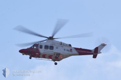
Search and Rescue Aircraft
Current Trip
Unknown
| Time Travelled | 1 day |
|---|---|
| Remaining Time | --- |
| Distance Travelled | 134.40 nm |
| Remaining Distance | --- |
| AVG Speed | 68.9 Knots |
| MAX Speed | 68.9 Knots |
| AVG Wind | 12.1 knots |
| MAX Wind | 16 knots |
| MIN Temp | 11.7°C / 53.06°F |
| MAX Temp | 15.1°C / 59.18°F |
| Draught | 0 m |
| Position Received | 1 d ago |
Current Position
| Longitude | 0.93314° |
|---|---|
| Latitude | 50.95013° |
| Status | Default |
| Speed | 63 Knots |
| Course | 33.8° |
| Area | English Channel |
| Station | T-AIS |
| Position Received | 1 d ago |
Information
The current position of Unkown Name is in English Channel with coordinates 50.95013° / 0.93314° as reported on 2025-05-15 12:20 by AIS to our vessel tracker app. The vessel's current speed is 63 Knots
The vessel Unkown Name (MMSI: 111232014) is a Search and Rescue Aircraft It's sailing under the flag of [GB] United Kingdom.
In this page you can find informations about the vessels current position, last detected port calls, and current voyage information. If the vessels is not in coverage by AIS you will find the latest position.
The current position of Unkown Name is detected by our AIS receivers and we are not responsible for the reliability of the data. The last position was recorded while the vessel was in Coverage by the Ais receivers of our vessel tracking app.
Weather
| Temperature | 12.3°C / 54.14°F |
|---|---|
| Wind Speed | 15 knots |
| Direction | 16° NNE |
| Pressure | 1023.5 hPa |
| Humidity | 70.5 % |
| Cloud Coverage | 96 % |
Featured Company
Last Port Calls
| Port | Arrival | Departure | Time In Port |
|---|---|---|---|
| 2025-05-14 16:08 | 2025-05-14 16:13 | 5 m | |
| 2025-05-13 16:06 | 2025-05-13 16:06 | 0 m | |
| 2025-05-11 15:31 | 2025-05-11 15:31 | 0 m | |
| 2025-05-10 15:12 | 2025-05-10 15:13 | 0 m | |
| 2025-05-10 15:11 | 2025-05-10 15:11 | 0 m | |
| 2025-05-10 07:28 | 2025-05-10 07:29 | 0 m | |
| 2025-05-10 05:37 | 2025-05-10 07:13 | 1 h | |
| 2025-05-05 22:41 | 2025-05-05 22:42 | 0 m | |
| 2025-05-05 22:34 | 2025-05-05 22:41 | 6 m | |
| 2025-05-04 14:54 | 2025-05-04 14:54 | 0 m |
Most Visited Ports (Last year)
| Port | Arrivals | |
|---|---|---|
| 17 | ||
| 9 | ||
| 5 | ||
| 3 | ||
| 3 | ||
| 3 |
Last Trips
| Origin | Departure | Destination | Arrival | Distance | |
|---|---|---|---|---|---|
| 2025-05-13 17:06 | 2025-05-14 17:08 | 146.75 nm | |||
| 2025-05-10 16:13 | 2025-05-11 16:31 | 151.31 nm | |||
| 2025-05-10 16:11 | 2025-05-10 16:12 | 2.65 nm | |||
| 2025-05-10 16:11 | 2025-05-10 16:11 | 2.65 nm | |||
| 2025-05-10 08:13 | 2025-05-10 08:28 | 36.40 nm | |||
| 2025-05-05 23:42 | 2025-05-10 06:37 | 567.67 nm | |||
| 2025-05-05 23:41 | 2025-05-05 23:41 | 3.88 nm | |||
| 2025-05-04 15:54 | 2025-05-05 23:34 | 125.07 nm | |||
| 2025-05-03 21:38 | 2025-05-03 22:21 | 43.07 nm | |||
| 2025-05-03 20:31 | 2025-05-03 21:24 | 37.56 nm |
Events
| Time | Event | Details | Position / Dest | Info |
|---|---|---|---|---|
| 2025-05-15 12:20 | OUT of Coverage |
50.95013 / .93314
English Channel
|
Speed: 63 kn Course: 33.8° |
|
| 2025-05-15 12:02 | START Moving | 5.7 nm, South West of EASTBOURNE |
50.74363 / .19960
|
Speed: 60 kn Course: 261.9° |
| 2025-05-15 12:02 | STOP Moving | 5.6 nm, South West of EASTBOURNE |
50.74317 / .20291
|
Speed: Course: 285.1° |
| 2025-05-15 10:53 | Change Sea Area | United Kingdom part of the English Channel United Kingdom part of the North Sea |
50.89311 / .73983
English Channel
|
Speed: 154 kn Course: 232.3° |
| 2025-05-15 10:49 | IN Coverage |
50.96236 / .90420
North Sea
|
Speed: 135 kn Course: 254.5° |
|
| 2025-05-14 16:28 | OUT of Coverage |
50.95189 / .93480
North Sea
|
Speed: 49 kn Course: 32.7° |
|
| 2025-05-14 16:13 | START Moving | 1.41 nm, North East of DOVER |
51.14064 / 1.34748
|
Speed: 80 kn Course: 350.6° |
| 2025-05-14 16:13 | PORT DEPARTURE |
|
51.14064 / 1.34748
|
Speed: 1 kn Course: 198.3° |
| 2025-05-14 16:09 | STOP Moving |
51.13323 / 1.33987
[GB] DOVER
|
Speed: Course: 75.7° |
|
| 2025-05-14 16:08 | PORT ARRIVAL |
|
51.12922 / 1.33938
[GB] DOVER
|
Speed: 66 kn Course: 252° |