

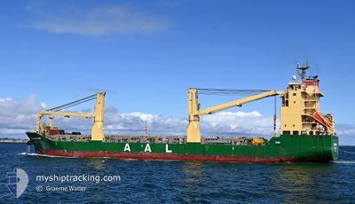
AAL BANGKOK
General Cargo

Current Trip
| Time Travelled | 7 days |
|---|---|
| Remaining Time | --- |
| Distance Travelled | 956.68 nm |
| Remaining Distance | --- |
| AVG Speed | 13.1 Knots |
| MAX Speed | 15.4 Knots |
| AVG Wind | 12.5 knots |
| MAX Wind | 25.6 knots |
| MIN Temp | 15.6°C / 60.08°F |
| MAX Temp | 26.4°C / 79.52°F |
| Draught | 6.5 m |
| Position Received | 2 h, 54 m ago |
Current Position
| Longitude | 116.76837° |
|---|---|
| Latitude | -20.08161° |
| Status | Under way using engine |
| Speed | 14.1 Knots |
| Course | 56.5° |
| Area | Indian Ocean |
| Station | T-AIS |
| Position Received | 2 h, 54 m ago |
Information
The current position of AAL BANGKOK is in Indian Ocean with coordinates -20.08161° / 116.76837° as reported on 2025-06-02 12:50 by AIS to our vessel tracker app. The vessel's current speed is 14.1 Knots and is heading at the port of BATU AMPAR. The estimated time of arrival as calculated by MyShipTracking vessel tracking app is 2025-06-07 14:00 LT
The vessel AAL BANGKOK (IMO: 9521564, MMSI: 210493000) is a General Cargo that was built in 2012 ( 13 years old ). It's sailing under the flag of [CY] Cyprus.
In this page you can find informations about the vessels current position, last detected port calls, and current voyage information. If the vessels is not in coverage by AIS you will find the latest position.
The current position of AAL BANGKOK is detected by our AIS receivers and we are not responsible for the reliability of the data. The last position was recorded while the vessel was in Coverage by the Ais receivers of our vessel tracking app.
The current draught of AAL BANGKOK as reported by AIS is 6.5 meters
Weather
| Temperature | 25.5°C / 77.9°F |
|---|---|
| Wind Speed | 9 knots |
| Direction | 30° NNE |
| Pressure | 1013.9 hPa |
| Humidity | 66.3 % |
| Cloud Coverage | 4 % |


Featured Company
Last Port Calls
| Port | Arrival | Departure | Time In Port |
|---|---|---|---|
| 2025-05-24 13:31 | 2025-05-26 17:35 | 2 d | |
| 2025-05-21 21:34 | 2025-05-21 23:01 | 1 h | |
| 2025-05-17 21:13 | 2025-05-21 10:17 | 3 d | |
| 2025-05-11 04:38 | 2025-05-12 02:40 | 22 h | |
| 2025-04-21 21:58 | 2025-04-23 07:10 | 1 d | |
| 2025-04-16 17:23 | 2025-04-18 04:46 | 1 d | |
| 2025-04-11 05:16 | 2025-04-13 19:20 | 2 d |
Last Trips
| Origin | Departure | Destination | Arrival | Distance | |
|---|---|---|---|---|---|
| 2025-05-21 23:01 | 2025-05-24 13:31 | 22.43 nm | |||
| 2025-05-21 10:17 | 2025-05-21 21:34 | 13.32 nm | |||
| 2025-05-12 02:40 | 2025-05-17 21:13 | 1730.15 nm | |||
| 2025-04-23 07:10 | 2025-05-11 04:38 | 5164.47 nm | |||
| 2025-04-18 04:46 | 2025-04-21 21:58 | 777.55 nm | |||
| 2025-04-13 19:20 | 2025-04-16 17:23 | 738.59 nm | |||
| 2025-03-28 16:48 | 2025-04-11 05:16 | 4273.05 nm |
Events
| Time | Event | Details | Position / Dest | Info |
|---|---|---|---|---|
| 2025-06-02 12:59 | Status Changed | Default Under way using engine |
-20.06050 / 116.79798
BATAM
|
Speed: 14.1 kn Course: 56.5° |
| 2025-06-02 12:50 | OUT of Coverage |
-20.08161 / 116.76837
Indian Ocean
BATAM
|
Speed: 14.1 kn Course: 56.5° |
|
| 2025-06-02 12:50 | Status Changed | Under way using engine Default |
-20.08247 / 116.76698
BATAM
|
Speed: 14.2 kn Course: 56° |
| 2025-06-02 12:32 | IN Coverage |
-20.08247 / 116.76698
Indian Ocean
BATAM
|
Speed: 14.1 kn Course: 56.3° |
|
| 2025-06-02 11:52 | Status Changed | Default Under way using engine |
-20.20788 / 116.56158
BATAM
|
Speed: 14.2 kn Course: 54.6° |
| 2025-06-02 11:45 | Status Changed | Under way using engine Default |
-20.22207 / 116.54025
BATAM
|
Speed: 14.3 kn Course: 56° |
| 2025-06-02 11:45 | OUT of Coverage |
-20.22207 / 116.54025
Indian Ocean
BATAM
|
Speed: 14.2 kn Course: 54.6° |
|
| 2025-06-02 11:26 | IN Coverage |
-20.22207 / 116.54025
Indian Ocean
BATAM
|
Speed: 14.2 kn Course: 54.6° |
|
| 2025-06-02 09:45 | START Moving | 9.47 nm, North West of DAMPIER |
-20.55909 / 116.59075
BATAM
|
Speed: 5.2 kn Course: 283° |
| 2025-06-02 03:44 | OUT of Coverage |
-20.56330 / 116.59014
Indian Ocean
BATAM
|
Speed: Course: 8.5° |