
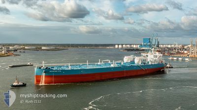
ADVANTAGE VITAL
Tanker
Current Trip
| Time Travelled | --- |
|---|---|
| Remaining Time | --- |
| Distance Travelled | 10699.56 nm |
| Remaining Distance | --- |
| AVG Speed | 11.3 Knots |
| MAX Speed | 11.3 Knots |
| AVG Wind | 8.1 knots |
| MAX Wind | 23.8 knots |
| MIN Temp | 18.2°C / 64.76°F |
| MAX Temp | 29.7°C / 85.46°F |
| Draught | 21.7 m |
| Position Received | 17 d ago |
Current Position
| Longitude | 104.10503° |
|---|---|
| Latitude | 1.24300° |
| Status | Constrained by her draught |
| Speed | 2.2 Knots |
| Course | 88° |
| Area | Singapore Strait |
| Station | T-AIS |
| Position Received | 17 d ago |
Info
Information
The current position of ADVANTAGE VITAL is in Singapore Strait with coordinates 1.24300° / 104.10503° as reported on 2025-11-27 13:04 by AIS to our vessel tracker app. The vessel's current speed is 2.2 Knots and is heading at the port of DAESAN. The estimated time of arrival as calculated by MyShipTracking vessel tracking app is 2025-12-06 23:00 LT
The vessel ADVANTAGE VITAL (IMO: 9933561, MMSI: 538010020) is a Tanker It's sailing under the flag of [MH] Marshall Is.
In this page you can find informations about the vessels current position, last detected port calls, and current voyage information. If the vessels is not in coverage by AIS you will find the latest position.
The current position of ADVANTAGE VITAL is detected by our AIS receivers and we are not responsible for the reliability of the data. The last position was recorded while the vessel was in Coverage by the Ais receivers of our vessel tracking app.
The current draught of ADVANTAGE VITAL as reported by AIS is 21.7 meters
Weather
| Temperature | 12.5°C / 54.5°F |
|---|---|
| Wind Speed | 16 knots |
| Direction | 354° N |
| Pressure | 1024.8 hPa |
| Humidity | 58.9 % |
| Cloud Coverage | 5 % |
Featured Company
Last Port Calls
Most Visited Ports (Last year)
| Port | Arrivals | |
|---|---|---|
| 2 | ||
| 1 | ||
| 1 |
Last Trips
| Origin | Departure | Destination | Arrival | Distance |
|---|
Events
| Time | Event | Details | Position / Dest | Info |
|---|---|---|---|---|
| 2025-12-13 07:49 | START Moving | 1.95 nm, West of DAESAN |
37.02360 / 126.33871
SA RTA > KR TSN
|
Speed: 3.8 kn Course: 240° |
| 2025-12-12 00:54 | START Moving | 4.07 nm, North of TAEAN-GUN |
36.98000 / 126.25833
SA RTA > KR TSN
|
Speed: 5 kn Course: 61° |
| 2025-12-10 21:58 | STOP Moving | 4.39 nm, North of TAEAN-GUN |
36.98613 / 126.25478
SA RTA > KR TSN
|
Speed: 0.2 kn Course: 233° |
| 2025-12-10 20:53 | START Moving | 2.01 nm, West of DAESAN |
37.03100 / 126.33756
SA RTA > KR TSN
|
Speed: 5.6 kn Course: 222° |
| 2025-12-10 00:46 | STOP Moving | 1.83 nm, West of DAESAN |
37.03089 / 126.34132
SA RTA > KR TSN
|
Speed: 0.3 kn Course: 68° |
| 2025-12-09 09:15 | START Moving |
36.16167 / 124.62167
SA RTA > KR TSN
|
Speed: 4 kn Course: -1° |
|
| 2025-12-08 11:15 | STOP Moving |
36.27334 / 124.57833
SA RTA > KR TSN
|
Speed: Course: -1° |
|
| 2025-12-08 08:36 | START Moving |
36.30208 / 124.59547
SA RTA > KR TSN
|
Speed: 6.3 kn Course: 78° |
|
| 2025-12-07 19:03 | STOP Moving |
36.37667 / 124.51667
SA RTA > KR TSN
|
Speed: Course: -1° |
|
| 2025-12-07 15:48 | START Moving |
36.30833 / 124.99167
SA RTA > KR TSN
|
Speed: 5 kn Course: 269° |