

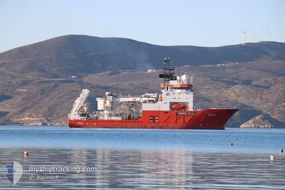
AETHRA
Offshore Supply Ship

Current Position
| Longitude | -4.66453° |
|---|---|
| Latitude | 49.44470° |
| Status | Under way using engine |
| Speed | 10.1 Knots |
| Course | 74.4° |
| Area | English Channel |
| Station | T-AIS |
| Position Received | 1 m ago |
Information
The current position of AETHRA is in English Channel with coordinates 49.44470° / -4.66453° as reported on 2025-05-23 12:19 by AIS to our vessel tracker app. The vessel's current speed is 10.1 Knots
The vessel AETHRA (IMO: 9181481, MMSI: 241831000) is a Offshore Supply Ship that was built in 1999 ( 26 years old ). It's sailing under the flag of [GR] Greece.
In this page you can find informations about the vessels current position, last detected port calls, and current voyage information. If the vessels is not in coverage by AIS you will find the latest position.
The current position of AETHRA is detected by our AIS receivers and we are not responsible for the reliability of the data. The last position was recorded while the vessel was in Coverage by the Ais receivers of our vessel tracking app.
The current draught of AETHRA as reported by AIS is 6.4 meters
Weather
| Temperature | 14.6°C / 58.28°F |
|---|---|
| Wind Speed | 5 knots |
| Direction | 282° WNW |
| Pressure | 1021.6 hPa |
| Humidity | 71.5 % |
| Cloud Coverage | 86 % |


Featured Company
Last Port Calls
| Port | Arrival | Departure | Time In Port |
|---|---|---|---|
| 2025-04-28 19:52 | |||
| 2025-04-23 19:23 | 2025-04-24 02:55 | 7 h | |
| 2025-04-16 16:15 | 2025-04-17 18:55 | 1 d | |
| 2025-03-18 18:21 | 2025-04-16 14:18 | 28 d | |
| 2025-03-12 09:46 | 2025-03-14 18:27 | 2 d | |
| 2025-03-06 22:56 | 2025-03-06 23:10 | 14 m |
Last Trips
| Origin | Departure | Destination | Arrival | Distance | |
|---|---|---|---|---|---|
| 2025-04-24 02:55 | 2025-04-28 19:52 | 1130.30 nm | |||
| 2025-04-17 18:55 | 2025-04-23 19:23 | 1497.84 nm | |||
| 2025-04-16 14:18 | 2025-04-16 16:15 | 0.63 nm | |||
| 2025-03-14 18:27 | 2025-03-18 18:21 | 67.92 nm | |||
| 2025-03-06 23:10 | 2025-03-12 09:46 | 207.25 nm | |||
| 2025-02-24 17:35 | 2025-03-06 22:56 | 250.41 nm |
Events
| Time | Event | Details | Position / Dest | Info |
|---|---|---|---|---|
| 2025-05-23 10:25 | Change Sea Area | United Kingdom part of the English Channel United Kingdom part of the Celtic Sea |
49.35310 / -5.14023
English Channel
FRCER
|
Speed: 10 kn Course: 72.1° |
| 2025-05-23 10:16 | Draught Changed | 6.4 6.5 |
49.34540 / -5.17858
FRCER
|
Speed: 10.4 kn Course: 73.4° |
| 2025-05-23 10:16 | Destination Changed | FRCER CELTIC WORKSITE |
49.34540 / -5.17858
FRCER
|
Speed: 10.4 kn Course: 73.4° |
| 2025-05-23 10:16 | ETA Changed | 2025/05/24 07:30 2025/05/07 19:00 |
49.34540 / -5.17858
FRCER
|
Speed: 10.4 kn Course: 73.4° |
| 2025-05-23 08:30 | Status Changed | Under way using engine Restricted manoeuverability |
49.25035 / -5.64057
CELTIC WORKSITE
|
Speed: 0.1 kn Course: 45° |
| 2025-05-23 08:30 | START Moving |
49.25035 / -5.64057
CELTIC WORKSITE
|
Speed: 10.3 kn Course: 72.7° |
|
| 2025-05-23 07:34 | STOP Moving |
49.21738 / -5.79103
CELTIC WORKSITE
|
Speed: Course: 255° |
|
| 2025-05-23 07:10 | IN Coverage |
49.22037 / -5.77982
Celtic Sea
|
Speed: 0.7 kn Course: 257.4° |
|
| 2025-05-23 05:59 | OUT of Coverage |
49.22045 / -5.78000
Celtic Sea
|
Speed: 0.2 kn Course: 120.5° |
|
| 2025-05-22 01:24 | STOP Moving |
49.23947 / -5.82368
CELTIC WORKSITE
|
Speed: 0.1 kn Course: 330° |