
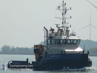
AL MIRFA
Tug
Current Trip
MINA ZAYED
| Time Travelled | 2 days |
|---|---|
| Remaining Time | --- |
| Distance Travelled | 80.92 nm |
| Remaining Distance | --- |
| AVG Speed | 6.4 Knots |
| MAX Speed | 8.8 Knots |
| AVG Wind | 5.5 knots |
| MAX Wind | 13 knots |
| MIN Temp | 23.8°C / 74.84°F |
| MAX Temp | 26°C / 78.8°F |
| Draught | 3.3 m |
| Position Received | 2 d ago |
Current Position
| Longitude | 53.68762° |
|---|---|
| Latitude | 24.89811° |
| Status | Under way sailing |
| Speed | |
| Course | 247° |
| Area | Persian Gulf |
| Station | T-AIS |
| Position Received | 2 d ago |
Info
Information
The current position of AL MIRFA is in Persian Gulf with coordinates 24.89811° / 53.68762° as reported on 2025-12-12 20:40 by AIS to our vessel tracker app. The vessel's current speed is 0 Knots
The vessel AL MIRFA (IMO: 9901441, MMSI: 470779000) is a Tug It's sailing under the flag of [AE] UAE.
In this page you can find informations about the vessels current position, last detected port calls, and current voyage information. If the vessels is not in coverage by AIS you will find the latest position.
The current position of AL MIRFA is detected by our AIS receivers and we are not responsible for the reliability of the data. The last position was recorded while the vessel was in Coverage by the Ais receivers of our vessel tracking app.
The current draught of AL MIRFA as reported by AIS is 3.3 meters
Weather
| Temperature | 23.8°C / 74.84°F |
|---|---|
| Wind Speed | 11 knots |
| Direction | 337° NNW |
| Pressure | 1015.7 hPa |
| Humidity | 51.1 % |
| Cloud Coverage | --- |
Featured Company
Events
| Time | Event | Details | Position / Dest | Info |
|---|---|---|---|---|
| 2025-12-14 21:50 | STOP Moving |
24.88628 / 53.69894
MINA ZAYED
|
Speed: Course: 17° |
|
| 2025-12-13 19:29 | START Moving |
24.89027 / 53.69781
MINA ZAYED
|
Speed: 3.8 kn Course: 58° |
|
| 2025-12-13 19:25 | STOP Moving |
24.88790 / 53.69436
MINA ZAYED
|
Speed: Course: 75° |
|
| 2025-12-13 18:57 | START Moving |
24.86903 / 53.68362
MINA ZAYED
|
Speed: 5.5 kn Course: 102° |
|
| 2025-12-13 18:49 | STOP Moving |
24.86645 / 53.67986
MINA ZAYED
|
Speed: 0.2 kn Course: 108° |
|
| 2025-12-13 14:37 | START Moving |
24.89105 / 53.67601
MINA ZAYED
|
Speed: 5.3 kn Course: 317° |
|
| 2025-12-13 14:33 | STOP Moving |
24.88734 / 53.67876
MINA ZAYED
|
Speed: 0.1 kn Course: 257° |
|
| 2025-12-12 20:40 | OUT of Coverage |
24.89811 / 53.68762
Persian Gulf
|
Speed: Course: 133.9° |
|
| 2025-12-12 20:40 | IN Coverage |
24.89811 / 53.68762
Persian Gulf
|
Speed: Course: 133.9° |
|
| 2025-12-12 16:36 | OUT of Coverage |
24.98546 / 53.79232
Persian Gulf
|
Speed: 7.3 kn Course: 289.5° |