
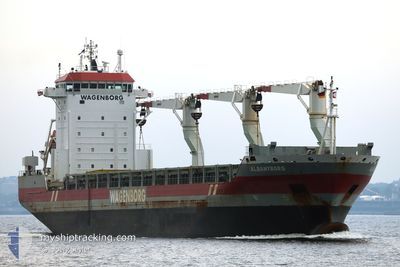
ALBANYBORG
General Cargo
Current Trip
| Time Travelled | 8 days |
|---|---|
| Remaining Time | --- |
| Distance Travelled | 1912.68 nm |
| Remaining Distance | --- |
| AVG Speed | 10.8 Knots |
| MAX Speed | 14 Knots |
| AVG Wind | 16.4 knots |
| MAX Wind | 35.3 knots |
| MIN Temp | 11.3°C / 52.34°F |
| MAX Temp | 18.9°C / 66.02°F |
| Draught | 7.9 m |
| Position Received | 10 h, 27 m ago |
Current Position
| Longitude | -9.84252° |
|---|---|
| Latitude | 39.83942° |
| Status | Under way using engine |
| Speed | 13.4 Knots |
| Course | 5° |
| Area | North Atlantic Ocean |
| Station | T-AIS |
| Position Received | 10 h, 27 m ago |
Info
Information
The current position of ALBANYBORG is in North Atlantic Ocean with coordinates 39.83942° / -9.84252° as reported on 2025-01-31 16:25 by AIS to our vessel tracker app. The vessel's current speed is 13.4 Knots and is heading at the port of RONNSKAR. The estimated time of arrival as calculated by MyShipTracking vessel tracking app is 2025-02-08 07:00 LT
The vessel ALBANYBORG (IMO: 9466300, MMSI: 246519000) is a General Cargo that was built in 2010 ( 15 years old ). It's sailing under the flag of [NL] Netherlands.
In this page you can find informations about the vessels current position, last detected port calls, and current voyage information. If the vessels is not in coverage by AIS you will find the latest position.
The current position of ALBANYBORG is detected by our AIS receivers and we are not responsible for the reliability of the data. The last position was recorded while the vessel was in Coverage by the Ais receivers of our vessel tracking app.
The current draught of ALBANYBORG as reported by AIS is 7.9 meters
Weather
| Temperature | 14.4°C / 57.92°F |
|---|---|
| Wind Speed | 4 knots |
| Direction | 300° WNW |
| Pressure | 1028.4 hPa |
| Humidity | 88.7 % |
| Cloud Coverage | 100 % |
Featured Company
Most Visited Ports (Last year)
| Port | Arrivals | |
|---|---|---|
| 2 | ||
| 2 | ||
| 2 | ||
| 1 | ||
| 1 | ||
| 1 |
Last Trips
| Origin | Departure | Destination | Arrival | Distance | |
|---|---|---|---|---|---|
| 2025-01-17 16:29 | 2025-01-19 07:23 | 364.80 nm | |||
| 2024-12-23 21:33 | 2024-12-25 14:18 | 377.00 nm | |||
| 2024-12-04 08:22 | 2024-12-19 20:20 | 3015.85 nm | |||
| 2024-11-21 16:29 | 2024-12-02 23:11 | 1418.58 nm |
Events
| Time | Event | Details | Position / Dest | Info |
|---|---|---|---|---|
| 2025-01-31 16:27 | Status Changed | Default Under way using engine |
39.84627 / -9.84200
SEROR
|
Speed: 13.4 kn Course: 5° |
| 2025-01-31 16:25 | Status Changed | Under way using engine Default |
39.83942 / -9.84252
SEROR
|
Speed: 13.6 kn Course: 1° |
| 2025-01-31 16:25 | OUT of Coverage |
39.83942 / -9.84252
North Atlantic Ocean
SEROR
|
Speed: 13.4 kn Course: 5° |
|
| 2025-01-31 16:11 | Status Changed | Default Under way using engine |
39.78636 / -9.84328
SEROR
|
Speed: 13.2 kn Course: 358.7° |
| 2025-01-31 05:29 | Status Changed | Under way using engine Default |
37.53406 / -9.49834
SEROR
|
Speed: 12.4 kn Course: 344° |
| 2025-01-31 05:27 | Status Changed | Default Under way using engine |
37.52914 / -9.49673
SEROR
|
Speed: 12.4 kn Course: 345.6° |
| 2025-01-31 05:16 | Status Changed | Under way using engine Default |
37.48993 / -9.48517
SEROR
|
Speed: 12.4 kn Course: 344° |
| 2025-01-31 05:03 | IN Coverage |
37.49440 / -9.48633
North Atlantic Ocean
SEROR
|
Speed: 12.3 kn Course: 346.4° |
|
| 2025-01-30 21:35 | Status Changed | Default Under way using engine |
36.70303 / -8.89481
SEROR
|
Speed: 7.8 kn Course: 271.8° |
| 2025-01-30 21:28 | OUT of Coverage |
36.70277 / -8.87462
North Atlantic Ocean
SEROR
|
Speed: 7.8 kn Course: 271.8° |