

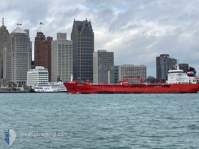
ALGOLUNA
Oil/Chemical Tanker

Current Trip
NANTICOKE
| Time Travelled | 1 day |
|---|---|
| Remaining Time | --- |
| Distance Travelled | 62.94 nm |
| Remaining Distance | --- |
| AVG Speed | 5.1 Knots |
| MAX Speed | 8.2 Knots |
| AVG Wind | 14.6 knots |
| MAX Wind | 21.1 knots |
| MIN Temp | 6.4°C / 43.52°F |
| MAX Temp | 12.5°C / 54.5°F |
| Draught | 7.2 m |
| Position Received | 2 m ago |
Current Position
| Longitude | -80.12522° |
|---|---|
| Latitude | 42.73460° |
| Status | At anchor |
| Speed | 0.1 Knots |
| Course | 318° |
| Area | Gulf of St-Lawrence |
| Station | T-AIS |
| Position Received | 2 m ago |
Information
The current position of ALGOLUNA is in Gulf of St-Lawrence with coordinates 42.73460° / -80.12522° as reported on 2025-05-25 13:04 by AIS to our vessel tracker app. The vessel's current speed is 0.1 Knots
The vessel ALGOLUNA (IMO: 9483516, MMSI: 316053441) is a Oil/Chemical Tanker that was built in 2010 ( 15 years old ). It's sailing under the flag of [CA] Canada.
In this page you can find informations about the vessels current position, last detected port calls, and current voyage information. If the vessels is not in coverage by AIS you will find the latest position.
The current position of ALGOLUNA is detected by our AIS receivers and we are not responsible for the reliability of the data. The last position was recorded while the vessel was in Coverage by the Ais receivers of our vessel tracking app.
The current draught of ALGOLUNA as reported by AIS is 7.2 meters
Weather
| Temperature | 10.5°C / 50.9°F |
|---|---|
| Wind Speed | 9 knots |
| Direction | 305° NW |
| Pressure | 1024.1 hPa |
| Humidity | 71.1 % |
| Cloud Coverage | 100 % |


Featured Company
Last Port Calls
| Port | Arrival | Departure | Time In Port |
|---|---|---|---|
| 2025-05-23 07:56 | 2025-05-23 16:34 | 8 h | |
| 2025-05-21 00:35 | 2025-05-21 01:25 | 50 m | |
| 2025-05-18 20:44 | 2025-05-18 22:45 | 2 h | |
| 2025-05-17 03:32 | 2025-05-17 04:16 | 44 m | |
| 2025-05-14 10:38 | 2025-05-15 19:11 | 1 d | |
| 2025-05-13 04:40 | 2025-05-14 10:17 | 1 d | |
| 2025-05-12 09:18 | 2025-05-13 04:21 | 19 h | |
| 2025-05-10 06:44 | 2025-05-11 12:00 | 1 d | |
| 2025-05-09 14:17 | 2025-05-10 02:58 | 12 h | |
| 2025-05-09 06:19 | 2025-05-09 06:52 | 33 m |
Last Trips
| Origin | Departure | Destination | Arrival | Distance | |
|---|---|---|---|---|---|
| 2025-05-21 01:25 | 2025-05-23 07:56 | 293.20 nm | |||
| 2025-05-18 22:45 | 2025-05-21 00:35 | 260.90 nm | |||
| 2025-05-17 04:16 | 2025-05-18 20:44 | 296.78 nm | |||
| 2025-05-15 19:11 | 2025-05-17 03:32 | 287.34 nm | |||
| 2025-05-14 10:17 | 2025-05-14 10:38 | 1.13 nm | |||
| 2025-05-13 04:21 | 2025-05-13 04:40 | 0.85 nm | |||
| 2025-05-11 12:00 | 2025-05-12 09:18 | 242.98 nm | |||
| 2025-05-10 02:58 | 2025-05-10 06:44 | 44.89 nm | |||
| 2025-05-09 06:52 | 2025-05-09 14:17 | 19.01 nm | |||
| 2025-05-07 21:13 | 2025-05-09 06:19 | 294.89 nm |
Events
| Time | Event | Details | Position / Dest | Info |
|---|---|---|---|---|
| 2025-05-24 23:36 | Status Changed | At anchor Default |
42.73495 / -80.12480
NANTICOKE
|
Speed: 0.1 kn Course: 291° |
| 2025-05-24 23:30 | Status Changed | Default At anchor |
42.73497 / -80.12480
NANTICOKE
|
Speed: 0.1 kn Course: 285° |
| 2025-05-24 13:31 | Status Changed | At anchor Under way using engine |
42.73497 / -80.12475
NANTICOKE
|
Speed: 0.1 kn Course: 289° |
| 2025-05-24 13:26 | STOP Moving | 4.28 nm, South East of PORT DOVER |
42.73483 / -80.12486
NANTICOKE
|
Speed: 0.2 kn Course: 294° |
| 2025-05-24 03:48 | START Moving | 0.77 nm, North of PORT COLBORNE |
42.89427 / -79.24725
NANTICOKE
|
Speed: 3.8 kn Course: 193° |
| 2025-05-24 03:29 | STOP Moving | 1.11 nm, North of PORT COLBORNE |
42.89976 / -79.24584
NANTICOKE
|
Speed: Course: 190° |
| 2025-05-24 00:57 | START Moving | 5.68 nm, South East of DALHOUSIE |
43.11987 / -79.19466
NANTICOKE
|
Speed: 3.1 kn Course: 191° |
| 2025-05-23 23:49 | Status Changed | Under way using engine Default |
43.13437 / -79.19271
NANTICOKE
|
Speed: Course: 183° |
| 2025-05-23 23:32 | IN Coverage |
43.13437 / -79.19271
Gulf of St-Lawrence
|
Speed: 0.6 kn Course: 183.1° |
|
| 2025-05-23 22:37 | OUT of Coverage |
43.15091 / -79.19296
Gulf of St-Lawrence
|
Speed: 3.5 kn Course: 174.9° |