
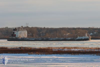
ALGOMA DISCOVERY
Bulk Carrier
Current Trip
| Time Travelled | 1 day |
|---|---|
| Remaining Time | --- |
| Distance Travelled | 520.07 nm |
| Remaining Distance | --- |
| AVG Speed | 10.3 Knots |
| MAX Speed | 13.9 Knots |
| AVG Wind | 8.6 knots |
| MAX Wind | 16.8 knots |
| MIN Temp | 8.3°C / 46.94°F |
| MAX Temp | 27.5°C / 81.5°F |
| Draught | 8.1 m |
| Position Received | 1 m ago |
Current Position
| Longitude | -79.19397° |
|---|---|
| Latitude | 43.12223° |
| Status | Under way using engine |
| Speed | |
| Course | 10° |
| Area | Gulf of St-Lawrence |
| Station | T-AIS |
| Position Received | 1 m ago |
Information
The current position of ALGOMA DISCOVERY is in Gulf of St-Lawrence with coordinates 43.12223° / -79.19397° as reported on 2025-06-12 15:12 by AIS to our vessel tracker app. The vessel's current speed is 0 Knots and is heading at the port of QUEBEC. The estimated time of arrival as calculated by MyShipTracking vessel tracking app is 2025-06-14 22:00 LT
The vessel ALGOMA DISCOVERY (IMO: 8505848, MMSI: 316018477) is a Bulk Carrier that was built in 1987 ( 38 years old ). It's sailing under the flag of [CA] Canada.
In this page you can find informations about the vessels current position, last detected port calls, and current voyage information. If the vessels is not in coverage by AIS you will find the latest position.
The current position of ALGOMA DISCOVERY is detected by our AIS receivers and we are not responsible for the reliability of the data. The last position was recorded while the vessel was in Coverage by the Ais receivers of our vessel tracking app.
The current draught of ALGOMA DISCOVERY as reported by AIS is 8.1 meters
Weather
| Temperature | 18.7°C / 65.66°F |
|---|---|
| Wind Speed | 3 knots |
| Direction | 283° WNW |
| Pressure | 1019.9 hPa |
| Humidity | 52.1 % |
| Cloud Coverage | 92 % |
Featured Company
Last Port Calls
| Port | Arrival | Departure | Time In Port |
|---|---|---|---|
| 2025-06-10 12:04 | 2025-06-10 13:08 | 1 h | |
| 2025-06-08 11:01 | 2025-06-09 18:04 | 1 d | |
| 2025-06-07 17:31 | 2025-06-07 18:20 | 48 m | |
| 2025-06-05 09:32 | 2025-06-05 10:56 | 1 h | |
| 2025-06-04 11:40 | 2025-06-05 06:48 | 19 h | |
| 2025-06-04 08:34 | 2025-06-04 09:22 | 47 m | |
| 2025-06-02 02:08 | 2025-06-02 03:28 | 1 h | |
| 2025-05-31 06:24 | 2025-05-31 22:48 | 16 h | |
| 2025-05-29 22:50 | 2025-05-29 23:39 | 48 m | |
| 2025-05-27 20:31 | 2025-05-27 21:40 | 1 h |
Most Visited Ports (Last year)
| Port | Arrivals | |
|---|---|---|
| 40 | ||
| 32 | ||
| 20 | ||
| 17 | ||
| 13 | ||
| 7 |
Last Trips
| Origin | Departure | Destination | Arrival | Distance | |
|---|---|---|---|---|---|
| 2025-06-09 18:04 | 2025-06-10 12:04 | 232.03 nm | |||
| 2025-06-07 18:20 | 2025-06-08 11:01 | 232.35 nm | |||
| 2025-06-05 10:56 | 2025-06-07 17:31 | 524.55 nm | |||
| 2025-06-05 06:48 | 2025-06-05 09:32 | 26.94 nm | |||
| 2025-06-04 09:22 | 2025-06-04 11:40 | 26.86 nm | |||
| 2025-06-02 03:28 | 2025-06-04 08:34 | 526.94 nm | |||
| 2025-05-31 22:48 | 2025-06-02 02:08 | 346.38 nm | |||
| 2025-05-29 23:39 | 2025-05-31 06:24 | 339.81 nm | |||
| 2025-05-27 21:40 | 2025-05-29 22:50 | 522.95 nm | |||
| 2025-05-27 15:37 | 2025-05-27 20:31 | 30.50 nm |
Events
| Time | Event | Details | Position / Dest | Info |
|---|---|---|---|---|
| 2025-06-12 14:59 | STOP Moving | 5.6 nm, South East of DALHOUSIE |
43.12195 / -79.19403
QUEBEC CITY
|
Speed: 0.3 kn Course: 10° |
| 2025-06-12 12:21 | START Moving | 1.39 nm, North of PORT COLBORNE |
42.90436 / -79.24476
QUEBEC CITY
|
Speed: 3.3 kn Course: 7° |
| 2025-06-12 11:57 | STOP Moving | 0.99 nm, North of PORT COLBORNE |
42.89779 / -79.24620
QUEBEC CITY
|
Speed: 0.3 kn Course: 10° |
| 2025-06-12 10:51 | START Moving | 2.17 nm, South of PORT COLBORNE |
42.84616 / -79.26030
QUEBEC CITY
|
Speed: 3.2 kn Course: 14° |
| 2025-06-12 10:13 | STOP Moving | 3.33 nm, South of PORT COLBORNE |
42.82810 / -79.26967
QUEBEC CITY
|
Speed: 0.3 kn Course: 23° |
| 2025-06-12 03:08 | Status Changed | Under way using engine Default |
42.15228 / -81.09547
QUEBEC CITY
|
Speed: 13.7 kn Course: 70° |
| 2025-06-12 03:00 | IN Coverage |
42.15572 / -81.08252
Gulf of St-Lawrence
QUEBEC CITY
|
Speed: 13.6 kn Course: 70.5° |
|
| 2025-06-12 01:41 | Status Changed | Default Under way using engine |
42.04440 / -81.51568
QUEBEC CITY
|
Speed: 13.6 kn Course: 70.8° |
| 2025-06-12 01:25 | OUT of Coverage |
42.02463 / -81.59246
Gulf of St-Lawrence
QUEBEC CITY
|
Speed: 13.6 kn Course: 70.8° |
|
| 2025-06-11 21:52 | Status Changed | Under way using engine Default |
41.86587 / -82.60480
QUEBEC CITY
|
Speed: 13 kn Course: 97° |