

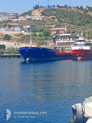
ALI TAHA C
Passenger

Current Trip
| Time Travelled | 2 h, 55 mins |
|---|---|
| Remaining Time | 1 h, 54 mins |
| Distance Travelled | 0.51 nm |
| Remaining Distance | --- |
| AVG Speed | 10.1 Knots |
| MAX Speed | 10.1 Knots |
| AVG Wind | 4 knots |
| MAX Wind | 4 knots |
| MIN Temp | 14°C / 57.2°F |
| MAX Temp | 14°C / 57.2°F |
| Draught | --- |
| Position Received | 2 h, 15 m ago |
Current Position
| Longitude | 27.68577° |
|---|---|
| Latitude | 40.46969° |
| Status | Default |
| Speed | 10 Knots |
| Course | 333.4° |
| Area | Sea of Marmara |
| Station | T-AIS |
| Position Received | 2 h, 15 m ago |
Information
The current position of ALI TAHA C is in Sea of Marmara with coordinates 40.46969° / 27.68577° as reported on 2025-05-18 02:42 by AIS to our vessel tracker app. The vessel's current speed is 10 Knots and is heading at the port of TEKIRDAG. The estimated time of arrival as calculated by MyShipTracking vessel tracking app is 2025-05-18 09:52 LT
The vessel ALI TAHA C (MMSI: 271002573) is a Passenger It's sailing under the flag of [TR] Turkey.
In this page you can find informations about the vessels current position, last detected port calls, and current voyage information. If the vessels is not in coverage by AIS you will find the latest position.
The current position of ALI TAHA C is detected by our AIS receivers and we are not responsible for the reliability of the data. The last position was recorded while the vessel was in Coverage by the Ais receivers of our vessel tracking app.
Weather
| Temperature | 14.2°C / 57.56°F |
|---|---|
| Wind Speed | 4 knots |
| Direction | 249° WSW |
| Pressure | 1015.1 hPa |
| Humidity | 84.9 % |
| Cloud Coverage | 29 % |


Featured Company
Last Port Calls
| Port | Arrival | Departure | Time In Port |
|---|---|---|---|
| 2025-05-17 21:21 | 2025-05-18 05:03 | 7 h | |
| 2025-05-17 17:53 | 2025-05-17 19:28 | 1 h | |
| 2025-05-17 10:00 | 2025-05-17 16:05 | 6 h | |
| 2025-05-17 07:16 | 2025-05-17 08:06 | 49 m | |
| 2025-05-16 21:03 | 2025-05-17 05:09 | 8 h | |
| 2025-05-16 18:12 | 2025-05-16 19:02 | 50 m | |
| 2025-05-16 06:23 | 2025-05-16 16:24 | 10 h | |
| 2025-05-15 21:27 | 2025-05-16 02:33 | 5 h | |
| 2025-05-15 18:00 | 2025-05-15 19:18 | 1 h | |
| 2025-05-15 09:55 | 2025-05-15 16:08 | 6 h |
Last Trips
| Origin | Departure | Destination | Arrival | Distance | |
|---|---|---|---|---|---|
| 2025-05-17 19:28 | 2025-05-17 21:21 | 14.80 nm | |||
| 2025-05-17 16:05 | 2025-05-17 17:53 | 18.26 nm | |||
| 2025-05-17 08:06 | 2025-05-17 10:00 | 17.82 nm | |||
| 2025-05-17 05:09 | 2025-05-17 07:16 | 14.05 nm | |||
| 2025-05-16 19:02 | 2025-05-16 21:03 | 20.13 nm | |||
| 2025-05-16 16:24 | 2025-05-16 18:12 | 18.48 nm | |||
| 2025-05-16 02:33 | 2025-05-16 06:23 | 38.79 nm | |||
| 2025-05-15 19:18 | 2025-05-15 21:27 | 20.84 nm | |||
| 2025-05-15 16:08 | 2025-05-15 18:00 | 19.04 nm | |||
| 2025-05-15 08:09 | 2025-05-15 09:55 | 19.08 nm |
Events
| Time | Event | Details | Position / Dest | Info |
|---|---|---|---|---|
| 2025-05-18 02:42 | OUT of Coverage |
40.46969 / 27.68577
Sea of Marmara
|
Speed: 10 kn Course: 333.4° |
|
| 2025-05-18 02:39 | IN Coverage |
40.46505 / 27.68992
Sea of Marmara
|
Speed: 10.1 kn Course: 319.9° |
|
| 2025-05-18 02:03 | PORT DEPARTURE |
|
40.46296 / 27.69237
|
Speed: Course: -1° |
| 2025-05-17 18:21 | PORT ARRIVAL |
|
40.39422 / 27.79120
[TR] ERDEK
|
Speed: 10.8 kn Course: 147.2° |
| 2025-05-17 17:44 | IN Coverage |
40.46968 / 27.68481
Sea of Marmara
|
Speed: 10.8 kn Course: 147.2° |
|
| 2025-05-17 17:44 | OUT of Coverage |
40.46968 / 27.68481
Sea of Marmara
|
Speed: 10.8 kn Course: 147.2° |
|
| 2025-05-17 16:28 | PORT DEPARTURE |
|
40.60131 / 27.72919
|
Speed: Course: -1° |
| 2025-05-17 15:10 | STOP Moving |
40.65611 / 27.65915
[TR] SARAYLAR
|
Speed: Course: -1° |
|
| 2025-05-17 14:53 | PORT ARRIVAL |
|
40.65554 / 27.66238
[TR] SARAYLAR
|
Speed: 10.7 kn Course: 159° |
| 2025-05-17 13:18 | OUT of Coverage |
40.92383 / 27.53180
Sea of Marmara
|
Speed: 10.7 kn Course: 160.8° |