

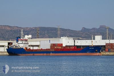
ALIYE HANIM
General Cargo

Current Trip
ORDER
| Time Travelled | 5 days |
|---|---|
| Remaining Time | --- |
| Distance Travelled | 8.38 nm |
| Remaining Distance | --- |
| AVG Speed | 6.6 Knots |
| MAX Speed | 8.5 Knots |
| AVG Wind | 11.2 knots |
| MAX Wind | 17.9 knots |
| MIN Temp | 14.4°C / 57.92°F |
| MAX Temp | 19.4°C / 66.92°F |
| Draught | 3.5 m |
| Position Received | 1 m ago |
Current Position
| Longitude | 28.75551° |
|---|---|
| Latitude | 44.12301° |
| Status | At anchor |
| Speed | |
| Course | 325° |
| Area | Black Sea |
| Station | T-AIS |
| Position Received | 1 m ago |
Information
The current position of ALIYE HANIM is in Black Sea with coordinates 44.12301° / 28.75551° as reported on 2025-06-02 04:44 by AIS to our vessel tracker app. The vessel's current speed is 0 Knots
The vessel ALIYE HANIM (IMO: 9414723, MMSI: 271000930) is a General Cargo that was built in 2007 ( 18 years old ). It's sailing under the flag of [TR] Turkey.
In this page you can find informations about the vessels current position, last detected port calls, and current voyage information. If the vessels is not in coverage by AIS you will find the latest position.
The current position of ALIYE HANIM is detected by our AIS receivers and we are not responsible for the reliability of the data. The last position was recorded while the vessel was in Coverage by the Ais receivers of our vessel tracking app.
The current draught of ALIYE HANIM as reported by AIS is 3.5 meters
Weather
| Temperature | 18°C / 64.4°F |
|---|---|
| Wind Speed | 3 knots |
| Direction | 252° WSW |
| Pressure | 1018.5 hPa |
| Humidity | 68.7 % |
| Cloud Coverage | 3 % |


Featured Company
Last Port Calls
| Port | Arrival | Departure | Time In Port |
|---|---|---|---|
| 2025-05-26 19:48 | 2025-05-28 01:12 | 1 d | |
| 2025-05-22 19:52 | 2025-05-24 16:13 | 1 d | |
| 2025-05-16 14:22 | 2025-05-17 11:58 | 21 h | |
| 2025-05-11 04:41 | 2025-05-12 11:25 | 1 d | |
| 2025-05-05 07:01 | 2025-05-06 14:50 | 1 d | |
| 2025-04-25 10:55 | 2025-04-28 01:38 | 2 d | |
| 2025-04-24 18:46 | 2025-04-25 10:28 | 15 h | |
| 2025-04-20 14:24 | 2025-04-23 08:18 | 2 d | |
| 2025-04-16 07:21 | 2025-04-17 17:37 | 1 d | |
| 2025-04-10 01:47 | 2025-04-12 12:22 | 2 d |
Most Visited Ports (Last year)
| Port | Arrivals | |
|---|---|---|
| 19 | ||
| 7 | ||
| 5 | ||
| 4 | ||
| 3 | ||
| 2 |
Last Trips
| Origin | Departure | Destination | Arrival | Distance | |
|---|---|---|---|---|---|
| 2025-05-24 16:13 | 2025-05-26 19:48 | 212.92 nm | |||
| 2025-05-17 11:58 | 2025-05-22 19:52 | 5.40 nm | |||
| 2025-05-12 11:25 | 2025-05-16 14:22 | 395.04 nm | |||
| 2025-05-06 14:50 | 2025-05-11 04:41 | 630.45 nm | |||
| 2025-04-28 01:38 | 2025-05-05 07:01 | 844.35 nm | |||
| 2025-04-25 10:28 | 2025-04-25 10:55 | 3.13 nm | |||
| 2025-04-23 08:18 | 2025-04-24 18:46 | 273.56 nm | |||
| 2025-04-17 17:37 | 2025-04-20 14:24 | 220.50 nm | |||
| 2025-04-12 12:22 | 2025-04-16 07:21 | 590.67 nm | |||
| 2025-04-09 00:41 | 2025-04-10 01:47 | 207.29 nm |
Events
| Time | Event | Details | Position / Dest | Info |
|---|---|---|---|---|
| 2025-06-01 10:59 | Status Changed | At anchor Default |
44.12313 / 28.75367
ORDER
|
Speed: Course: 60° |
| 2025-06-01 10:58 | Status Changed | Default At anchor |
44.12314 / 28.75369
ORDER
|
Speed: Course: 60° |
| 2025-06-01 09:28 | Status Changed | At anchor Default |
44.12305 / 28.75384
ORDER
|
Speed: 0.1 kn Course: 57° |
| 2025-06-01 09:27 | Status Changed | Default At anchor |
44.12306 / 28.75379
ORDER
|
Speed: 0.1 kn Course: 57° |
| 2025-06-01 00:02 | Status Changed | At anchor Default |
44.12283 / 28.75523
ORDER
|
Speed: 0.1 kn Course: 336° |
| 2025-05-31 23:56 | Status Changed | Default At anchor |
44.12281 / 28.75530
ORDER
|
Speed: 0.1 kn Course: 339° |
| 2025-05-30 11:39 | Status Changed | At anchor Default |
44.12282 / 28.75414
ORDER
|
Speed: 0.1 kn Course: 14° |
| 2025-05-30 11:38 | Status Changed | Default At anchor |
44.12280 / 28.75419
ORDER
|
Speed: 0.1 kn Course: 14° |
| 2025-05-27 22:59 | STOP Moving | 3.63 nm, East of CONSTANTA |
44.12475 / 28.75545
ORDER
|
Speed: 0.3 kn Course: 215° |
| 2025-05-27 22:52 | Status Changed | At anchor Moored |
44.12343 / 28.75562
ORDER
|
Speed: 0.8 kn Course: 345° |