
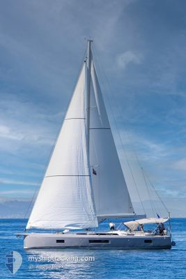
AMELIE
Sailing
Current Trip
| Trip Time | 6 days |
|---|---|
| Trip Distance | 157.97 nm |
| AVG Speed | 5.5 Knots |
| MAX Speed | 8.2 Knots |
| Draught | --- |
| AVG Wind | 14.2 knots |
| MAX Wind | 18.1 knots |
| MIN Temp | 17.2°C / 62.96°F |
| MAX Temp | 21.2°C / 70.16°F |
| Position Received | 1 d ago |
Current Position
| Longitude | 27.30138° |
|---|---|
| Latitude | 36.89193° |
| Status | Default |
| Speed | |
| Course | --- |
| Area | Aegean Sea |
| Station | T-AIS |
| Position Received | 1 d ago |
Information
The current position of AMELIE is in Aegean Sea with coordinates 36.89193° / 27.30138° as reported on 2025-05-16 02:42 by AIS to our vessel tracker app. The vessel's current speed is 0 Knots and is currently inside the port of KOS.
The vessel AMELIE (MMSI: 240582100) is a Sailing It's sailing under the flag of [GR] Greece.
In this page you can find informations about the vessels current position, last detected port calls, and current voyage information. If the vessels is not in coverage by AIS you will find the latest position.
The current position of AMELIE is detected by our AIS receivers and we are not responsible for the reliability of the data. The last position was recorded while the vessel was in Coverage by the Ais receivers of our vessel tracking app.
Weather
| Temperature | 17.6°C / 63.68°F |
|---|---|
| Wind Speed | 14 knots |
| Direction | 117° ESE |
| Pressure | 1011.5 hPa |
| Humidity | 65.2 % |
| Cloud Coverage | 40 % |
Featured Company
Last Port Calls
| Port | Arrival | Departure | Time In Port |
|---|---|---|---|
| 2025-05-15 15:36 | |||
| 2025-05-09 13:26 | 2025-05-09 13:32 | 5 m | |
| 2025-05-04 06:56 | |||
| 2025-04-23 07:38 | |||
| 2025-04-18 13:58 | 2025-04-20 06:07 | 1 d | |
| 2025-04-17 14:12 | 2025-04-17 14:19 | 7 m | |
| 2025-04-17 14:03 | 2025-04-17 14:08 | 4 m | |
| 2025-04-12 04:26 |
Last Trips
| Origin | Departure | Destination | Arrival | Distance | |
|---|---|---|---|---|---|
| 2025-05-09 16:32 | 2025-05-15 18:36 | 157.97 nm | |||
| 2025-05-04 09:56 | 2025-05-09 16:26 | 159.31 nm | |||
| 2025-04-17 17:19 | 2025-04-18 16:58 | 18.74 nm | |||
| 2025-04-17 17:08 | 2025-04-17 17:12 | 0.54 nm | |||
| 2025-04-12 07:26 | 2025-04-17 17:03 | 81.49 nm |
Events
| Time | Event | Details | Position / Dest | Info |
|---|---|---|---|---|
| 2025-05-16 02:42 | OUT of Coverage |
36.89193 / 27.30138
Aegean Sea
[GR] KOS
|
Speed: Course: 511° |
|
| 2025-05-16 02:21 | IN Coverage |
36.89195 / 27.30136
Aegean Sea
[GR] KOS
|
Speed: Course: 511° |
|
| 2025-05-15 19:51 | OUT of Coverage |
36.89196 / 27.30139
Aegean Sea
[GR] KOS
|
Speed: Course: 511° |
|
| 2025-05-15 16:33 | STOP Moving |
36.89195 / 27.30143
[GR] KOS
|
Speed: Course: 511° |
|
| 2025-05-15 15:36 | PORT ARRIVAL |
|
36.90304 / 27.29870
[GR] KOS
|
Speed: 5.8 kn Course: 79.6° |
| 2025-05-15 14:06 | IN Coverage |
36.89997 / 27.12330
Aegean Sea
|
Speed: 5.3 kn Course: 85.9° |
|
| 2025-05-15 08:21 | OUT of Coverage |
36.93843 / 26.84289
Aegean Sea
|
Speed: 5.7 kn Course: 46.8° |
|
| 2025-05-15 06:38 | IN Coverage |
36.90081 / 26.92675
Aegean Sea
|
Speed: 5.9 kn Course: 250.7° |
|
| 2025-05-13 06:04 | OUT of Coverage |
36.55819 / 27.26257
Aegean Sea
|
Speed: 5.6 kn Course: 269.4° |
|
| 2025-05-13 04:54 | Change Sea Area | Greek part of the Aegean Sea Turkish part of the Aegean Sea |
36.57072 / 27.39050
Aegean Sea
|
Speed: 4.3 kn Course: 266.1° |