
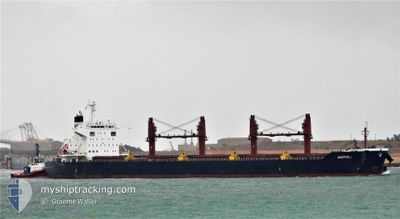
ANATOLI
Cargo
Current Trip
BD CGP
| Time Travelled | 5 days |
|---|---|
| Remaining Time | --- |
| Distance Travelled | 1440.28 nm |
| Remaining Distance | --- |
| AVG Speed | 11.3 Knots |
| MAX Speed | 13.3 Knots |
| AVG Wind | 9.7 knots |
| MAX Wind | 18.8 knots |
| MIN Temp | 22.1°C / 71.78°F |
| MAX Temp | 28.6°C / 83.48°F |
| Draught | 13.4 m |
| Position Received | 13 m ago |
Current Position
| Longitude | 102.31154° |
|---|---|
| Latitude | 1.85380° |
| Status | Under way using engine |
| Speed | 12.4 Knots |
| Course | 117° |
| Area | Malacca Strait |
| Station | T-AIS |
| Position Received | 13 m ago |
Info
Information
The current position of ANATOLI is in Malacca Strait with coordinates 1.85380° / 102.31154° as reported on 2026-01-07 17:43 by AIS to our vessel tracker app. The vessel's current speed is 12.4 Knots
The vessel ANATOLI (IMO: 9791987, MMSI: 248546000) is a Cargo It's sailing under the flag of [MT] Malta.
In this page you can find informations about the vessels current position, last detected port calls, and current voyage information. If the vessels is not in coverage by AIS you will find the latest position.
The current position of ANATOLI is detected by our AIS receivers and we are not responsible for the reliability of the data. The last position was recorded while the vessel was in Coverage by the Ais receivers of our vessel tracking app.
The current draught of ANATOLI as reported by AIS is 13.4 meters
Weather
| Temperature | 26.1°C / 78.98°F |
|---|---|
| Wind Speed | 15 knots |
| Direction | 38° NE |
| Pressure | 1012.4 hPa |
| Humidity | 81.3 % |
| Cloud Coverage | 100 % |
Featured Company
Last Port Calls
| Port | Arrival | Departure | Time In Port |
|---|---|---|---|
| 2025-12-30 15:19 | 2026-01-02 19:04 | 3 d | |
| 2025-11-10 02:03 | 2025-11-11 11:09 | 1 d | |
| 2025-11-06 19:10 | 2025-11-09 20:18 | 3 d |
Most Visited Ports (Last year)
| Port | Arrivals | |
|---|---|---|
| 2 | ||
| 1 | ||
| 1 | ||
| 1 | ||
| 1 | ||
| 1 |
Last Trips
| Origin | Departure | Destination | Arrival | Distance | |
|---|---|---|---|---|---|
| 2025-11-11 11:09 | 2025-12-30 15:19 | 9180.90 nm | |||
| 2025-11-09 20:18 | 2025-11-10 02:03 | 40.53 nm | |||
| 2025-09-22 06:42 | 2025-11-06 19:10 | 7756.91 nm |
Events
| Time | Event | Details | Position / Dest | Info |
|---|---|---|---|---|
| 2026-01-07 17:48 | Status Changed | Default Under way using engine |
1.84472 / 102.32877
BD CGP
|
Speed: 12.4 kn Course: 117° |
| 2026-01-07 17:08 | Status Changed | Under way using engine Default |
1.91556 / 102.20918
BD CGP
|
Speed: 12.5 kn Course: 128° |
| 2026-01-07 17:01 | Status Changed | Default Under way using engine |
1.92987 / 102.18917
BD CGP
|
Speed: 12.7 kn Course: 132.5° |
| 2026-01-07 16:47 | Status Changed | Under way using engine Default |
1.96266 / 102.15224
BD CGP
|
Speed: 13 kn Course: 133° |
| 2026-01-07 16:38 | Status Changed | Default Under way using engine |
1.98585 / 102.12804
BD CGP
|
Speed: 12.9 kn Course: 134° |
| 2026-01-07 16:30 | Change Sea Area | Indonesian part of the Malacca Strait Malaysian part of the Malacca Strait |
2.00576 / 102.10727
Malacca Strait
|
Speed: 12.9 kn Course: 134.2° |
| 2026-01-07 16:11 | Status Changed | Under way using engine Default |
2.05228 / 102.05901
BD CGP
|
Speed: 13 kn Course: 133° |
| 2026-01-07 16:08 | Status Changed | Default Under way using engine |
2.05850 / 102.05244
BD CGP
|
Speed: 13 kn Course: 133.5° |
| 2026-01-07 16:01 | Status Changed | Under way using engine Default |
2.07694 / 102.03237
BD CGP
|
Speed: 13 kn Course: 132° |
| 2026-01-07 15:49 | IN Coverage |
2.07694 / 102.03237
Malacca Strait
|
Speed: 13 kn Course: 131.2° |