
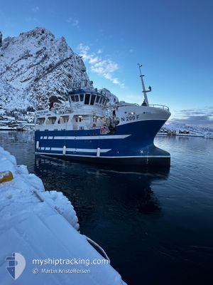
ANGELSEN SENIOR
Fishing
Current Trip
CH 16 FOR INFO
| Time Travelled | 4 days |
|---|---|
| Remaining Time | --- |
| Distance Travelled | 271.63 nm |
| Remaining Distance | --- |
| AVG Speed | 5.8 Knots |
| MAX Speed | 7.9 Knots |
| AVG Wind | 12.6 knots |
| MAX Wind | 24 knots |
| MIN Temp | 2°C / 35.6°F |
| MAX Temp | 5.1°C / 41.18°F |
| Draught | 0 m |
| Position Received | 2 m ago |
Current Position
| Longitude | 6.12897° |
|---|---|
| Latitude | 62.58209° |
| Status | Engaged in Fishing |
| Speed | |
| Course | 252° |
| Area | Norwegian Sea |
| Station | T-AIS |
| Position Received | 2 m ago |
Info
Information
The current position of ANGELSEN SENIOR is in Norwegian Sea with coordinates 62.58209° / 6.12897° as reported on 2025-03-14 18:45 by AIS to our vessel tracker app. The vessel's current speed is 0 Knots
The vessel ANGELSEN SENIOR (MMSI: 257046470) is a Fishing It's sailing under the flag of [NO] Norway.
In this page you can find informations about the vessels current position, last detected port calls, and current voyage information. If the vessels is not in coverage by AIS you will find the latest position.
The current position of ANGELSEN SENIOR is detected by our AIS receivers and we are not responsible for the reliability of the data. The last position was recorded while the vessel was in Coverage by the Ais receivers of our vessel tracking app.
Weather
| Temperature | 3.2°C / 37.76°F |
|---|---|
| Wind Speed | 12 knots |
| Direction | 226° SW |
| Pressure | 1014.3 hPa |
| Humidity | 63.6 % |
| Cloud Coverage | 100 % |
Featured Company
Last Port Calls
| Port | Arrival | Departure | Time In Port |
|---|---|---|---|
| 2025-03-10 09:50 | 2025-03-10 13:51 | 4 h | |
| 2025-03-09 13:00 | 2025-03-10 08:06 | 19 h | |
| 2025-02-15 11:13 | |||
| 2025-02-05 14:10 | 2025-02-05 16:21 | 2 h | |
| 2025-02-04 17:07 | 2025-02-05 00:39 | 7 h | |
| 2025-02-03 18:27 | 2025-02-04 02:39 | 8 h | |
| 2025-02-01 20:31 | 2025-02-02 04:30 | 7 h | |
| 2025-01-29 15:30 | 2025-01-30 00:41 | 9 h | |
| 2025-01-28 16:23 | 2025-01-29 02:00 | 9 h | |
| 2025-01-27 16:10 | 2025-01-28 02:21 | 10 h |
Last Trips
| Origin | Departure | Destination | Arrival | Distance | |
|---|---|---|---|---|---|
| 2025-03-10 08:06 | 2025-03-10 09:50 | 11.36 nm | |||
| 2025-02-15 11:13 | 2025-03-09 13:00 | 1417.85 nm | |||
| 2025-02-05 00:39 | 2025-02-05 14:10 | 37.70 nm | |||
| 2025-02-04 02:39 | 2025-02-04 17:07 | 46.79 nm | |||
| 2025-02-02 04:30 | 2025-02-03 18:27 | 97.38 nm | |||
| 2025-01-30 00:41 | 2025-02-01 20:31 | 175.38 nm | |||
| 2025-01-29 02:00 | 2025-01-29 15:30 | 40.52 nm | |||
| 2025-01-28 02:21 | 2025-01-28 16:23 | 43.03 nm | |||
| 2025-01-27 02:03 | 2025-01-27 16:10 | 46.73 nm | |||
| 2025-01-26 01:56 | 2025-01-26 14:33 | 44.70 nm |
Events
| Time | Event | Details | Position / Dest | Info |
|---|---|---|---|---|
| 2025-03-14 14:35 | STOP Moving | 2.93 nm, North of GJOSUND |
62.58208 / 6.12892
CH 16 FOR INFO
|
Speed: 0.3 kn Course: 255° |
| 2025-03-14 09:27 | START Moving |
62.81966 / 5.29412
CH 16 FOR INFO
|
Speed: 3.2 kn Course: 68° |
|
| 2025-03-14 09:06 | STOP Moving |
62.81321 / 5.28990
CH 16 FOR INFO
|
Speed: 0.1 kn Course: 25° |
|
| 2025-03-14 06:33 | START Moving |
62.80229 / 5.26204
CH 16 FOR INFO
|
Speed: 5.2 kn Course: 75.8° |
|
| 2025-03-14 06:23 | STOP Moving |
62.79893 / 5.26017
CH 16 FOR INFO
|
Speed: 0.1 kn Course: 357° |
|
| 2025-03-14 06:14 | START Moving |
62.79615 / 5.25924
CH 16 FOR INFO
|
Speed: 3.1 kn Course: 7° |
|
| 2025-03-14 05:37 | STOP Moving |
62.79001 / 5.24746
CH 16 FOR INFO
|
Speed: 0.2 kn Course: 328° |
|
| 2025-03-14 05:13 | START Moving |
62.80618 / 5.21720
CH 16 FOR INFO
|
Speed: 4.5 kn Course: 167° |
|
| 2025-03-14 05:00 | STOP Moving |
62.80313 / 5.21431
CH 16 FOR INFO
|
Speed: 0.2 kn Course: 35° |
|
| 2025-03-14 03:47 | START Moving |
62.81647 / 5.23527
CH 16 FOR INFO
|
Speed: 4.7 kn Course: 30° |