

ANTWERP BRIDGE
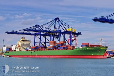
Container Ship

Current Trip
| Trip Time | 7 days |
|---|---|
| Trip Distance | 2353.14 nm |
| AVG Speed | 14 Knots |
| MAX Speed | 18.5 Knots |
| Draught | 11.1 m |
| AVG Wind | 8.4 knots |
| MAX Wind | 17.6 knots |
| MIN Temp | 26°C / 78.8°F |
| MAX Temp | 30.6°C / 87.08°F |
| Position Received | 3 m ago |
Current Position
| Longitude | 114.12495° |
|---|---|
| Latitude | 22.33307° |
| Status | Moored |
| Speed | |
| Course | 343° |
| Area | South China Sea |
| Station | T-AIS |
| Position Received | 3 m ago |
Information
The current position of ANTWERP BRIDGE is in South China Sea with coordinates 22.33307° / 114.12495° as reported on 2025-06-08 14:36 by AIS to our vessel tracker app. The vessel's current speed is 0 Knots and is currently inside the port of HONG KONG.
The vessel ANTWERP BRIDGE (IMO: 9297527, MMSI: 441548000) is a Container Ship that was built in 2005 ( 20 years old ). It's sailing under the flag of [KR] Korea.
In this page you can find informations about the vessels current position, last detected port calls, and current voyage information. If the vessels is not in coverage by AIS you will find the latest position.
The current position of ANTWERP BRIDGE is detected by our AIS receivers and we are not responsible for the reliability of the data. The last position was recorded while the vessel was in Coverage by the Ais receivers of our vessel tracking app.
The current draught of ANTWERP BRIDGE as reported by AIS is 11.1 meters
Weather
| Temperature | 28°C / 82.4°F |
|---|---|
| Wind Speed | 8 knots |
| Direction | 179° S |
| Pressure | 1005.8 hPa |
| Humidity | 88.1 % |
| Cloud Coverage | 100 % |


Featured Company
Last Port Calls
| Port | Arrival | Departure | Time In Port |
|---|---|---|---|
| 2025-06-08 22:00 | |||
| 2025-05-31 01:21 | 2025-06-01 02:09 | 1 d | |
| 2025-05-29 02:31 | 2025-05-29 17:33 | 15 h | |
| 2025-05-24 14:44 | 2025-05-25 01:49 | 11 h | |
| 2025-05-20 15:46 | 2025-05-21 13:12 | 21 h | |
| 2025-05-19 12:00 | 2025-05-20 12:21 | 1 d | |
| 2025-05-17 16:23 | 2025-05-18 10:59 | 18 h | |
| 2025-05-16 09:32 | 2025-05-17 04:39 | 19 h | |
| 2025-05-15 12:57 | 2025-05-15 23:50 | 10 h | |
| 2025-05-12 23:50 | 2025-05-13 22:18 | 22 h |
Most Visited Ports (Last year)
| Port | Arrivals | |
|---|---|---|
| 10 | ||
| 9 | ||
| 6 | ||
| 6 | ||
| 5 | ||
| 5 |
Last Trips
| Origin | Departure | Destination | Arrival | Distance | |
|---|---|---|---|---|---|
| 2025-06-01 02:09 | 2025-06-08 22:00 | 2353.14 nm | |||
| 2025-05-29 17:33 | 2025-05-31 01:21 | 569.16 nm | |||
| 2025-05-25 01:49 | 2025-05-29 02:31 | 1460.78 nm | |||
| 2025-05-21 13:12 | 2025-05-24 14:44 | 1198.93 nm | |||
| 2025-05-20 12:21 | 2025-05-20 15:46 | 25.81 nm | |||
| 2025-05-18 10:59 | 2025-05-19 12:00 | 89.34 nm | |||
| 2025-05-17 04:39 | 2025-05-17 16:23 | 61.45 nm | |||
| 2025-05-15 23:50 | 2025-05-16 09:32 | 110.07 nm | |||
| 2025-05-13 22:18 | 2025-05-15 12:57 | 440.94 nm | |||
| 2025-05-10 15:34 | 2025-05-12 23:50 | 238.32 nm |
Events
| Time | Event | Details | Position / Dest | Info |
|---|---|---|---|---|
| 2025-06-08 14:21 | STOP Moving |
22.33291 / 114.12480
[HK] HONG KONG
|
Speed: 0.2 kn Course: 347° |
|
| 2025-06-08 14:18 | Status Changed | Moored Under way using engine |
22.33260 / 114.12439
[HK] HONG KONG
|
Speed: 1 kn Course: 354° |
| 2025-06-08 14:00 | PORT ARRIVAL |
|
22.31861 / 114.10744
[HK] HONG KONG
|
Speed: 8.2 kn Course: 59.2° |
| 2025-06-08 13:43 | Draught Changed | 11.1 9.6 |
22.26737 / 114.11456
HKHKG
|
Speed: 15.1 kn Course: 330.5° |
| 2025-06-08 13:43 | Destination Changed | HKHKG IDSUB |
22.26737 / 114.11456
HKHKG
|
Speed: 15.1 kn Course: 330.5° |
| 2025-06-08 13:43 | ETA Changed | 2025/06/08 13:30 2025/06/02 01:00 |
22.26737 / 114.11456
HKHKG
|
Speed: 15.1 kn Course: 330.5° |
| 2025-06-08 13:41 | Change Sea Area | Chinese part of the South China Sea Indonesian part of the Java Sea |
22.26046 / 114.11877
South China Sea
|
Speed: 15 kn Course: 330.5° |
| 2025-06-08 13:41 | Status Changed | Under way using engine Default |
22.25938 / 114.11944
IDSUB
|
Speed: 14.8 kn Course: 320° |
| 2025-06-08 13:31 | IN Coverage |
22.26046 / 114.11877
South China Sea
|
Speed: 15 kn Course: 330.5° |
|
| 2025-06-03 04:29 | OUT of Coverage |
-7.17928 / 112.68497
Java Sea
|
Speed: 6.2 kn Course: 332.6° |