

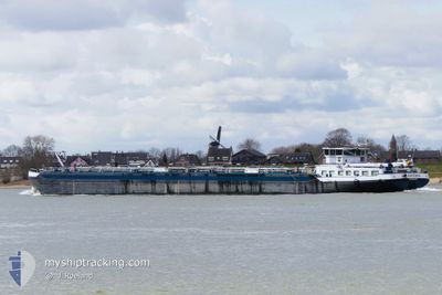
ANVERSA
Tanker

Current Trip
| Time Travelled | 18 h, 6 mins |
|---|---|
| Remaining Time | --- |
| Distance Travelled | 14.48 nm |
| Remaining Distance | --- |
| AVG Speed | 5.2 Knots |
| MAX Speed | 6 Knots |
| AVG Wind | 7.9 knots |
| MAX Wind | 10.3 knots |
| MIN Temp | 15.9°C / 60.62°F |
| MAX Temp | 22.3°C / 72.14°F |
| Draught | 2.7 m |
| Position Received | 12 h, 46 m ago |
Current Position
| Longitude | 3.40907° |
|---|---|
| Latitude | 50.91172° |
| Status | Under way using engine |
| Speed | 4.1 Knots |
| Course | 235.8° |
| Area | North Sea |
| Station | T-AIS |
| Position Received | 12 h, 46 m ago |
Information
The current position of ANVERSA is in North Sea with coordinates 50.91172° / 3.40907° as reported on 2025-05-14 12:27 by AIS to our vessel tracker app. The vessel's current speed is 4.1 Knots
The vessel ANVERSA (MMSI: 205259790) is a Tanker It's sailing under the flag of [BE] Belgium.
In this page you can find informations about the vessels current position, last detected port calls, and current voyage information. If the vessels is not in coverage by AIS you will find the latest position.
The current position of ANVERSA is detected by our AIS receivers and we are not responsible for the reliability of the data. The last position was recorded while the vessel was in Coverage by the Ais receivers of our vessel tracking app.
The current draught of ANVERSA as reported by AIS is 2.7 meters
Weather
| Temperature | 21°C / 69.8°F |
|---|---|
| Wind Speed | 14 knots |
| Direction | 8° N |
| Pressure | 1018.8 hPa |
| Humidity | 43.3 % |
| Cloud Coverage | 84 % |


Featured Company
Last Port Calls
| Port | Arrival | Departure | Time In Port |
|---|---|---|---|
| 2025-05-13 21:19 | 2025-05-14 09:07 | 11 h | |
| 2025-05-12 14:58 | 2025-05-13 18:02 | 1 d | |
| 2025-05-09 20:32 | 2025-05-12 14:07 | 2 d | |
| 2025-05-09 17:12 | 2025-05-09 19:29 | 2 h | |
| 2025-05-08 09:04 | 2025-05-08 11:21 | 2 h | |
| 2025-05-07 18:13 | 2025-05-08 06:24 | 12 h | |
| 2025-05-07 12:38 | 2025-05-07 17:34 | 4 h | |
| 2025-05-06 21:36 | 2025-05-07 12:06 | 14 h | |
| 2025-05-06 19:17 | 2025-05-06 21:18 | 2 h | |
| 2025-05-02 22:56 | 2025-05-06 03:46 | 3 d |
Most Visited Ports (Last year)
| Port | Arrivals | |
|---|---|---|
| 64 | ||
| 55 | ||
| 27 | ||
| 20 | ||
| 17 | ||
| 14 |
Last Trips
| Origin | Departure | Destination | Arrival | Distance | |
|---|---|---|---|---|---|
| 2025-05-13 18:02 | 2025-05-13 21:19 | 20.13 nm | |||
| 2025-05-12 14:07 | 2025-05-12 14:58 | 8.81 nm | |||
| 2025-05-09 19:29 | 2025-05-09 20:32 | 8.65 nm | |||
| 2025-05-08 11:21 | 2025-05-09 17:12 | 40.79 nm | |||
| 2025-05-08 06:24 | 2025-05-08 09:04 | 19.88 nm | |||
| 2025-05-07 17:34 | 2025-05-07 18:13 | 9.13 nm | |||
| 2025-05-07 12:06 | 2025-05-07 12:38 | 5.06 nm | |||
| 2025-05-06 21:18 | 2025-05-06 21:36 | 2.25 nm | |||
| 2025-05-06 03:46 | 2025-05-06 19:17 | 26.82 nm | |||
| 2025-05-02 15:43 | 2025-05-02 22:56 | 23.81 nm |
Events
| Time | Event | Details | Position / Dest | Info |
|---|---|---|---|---|
| 2025-05-14 15:12 | START Moving | 3.94 nm, East of IZEGEM |
50.90921 / 3.30969
ROESELARE UNITANKG
|
Speed: 4.7 kn Course: -1° |
| 2025-05-14 12:31 | Status Changed | Default Under way using engine |
50.90852 / 3.40252
ROESELARE UNITANKG
|
Speed: 4.1 kn Course: 235.8° |
| 2025-05-14 12:27 | Status Changed | Under way using engine Default |
50.91172 / 3.40907
ROESELARE UNITANKG
|
Speed: Course: -1° |
| 2025-05-14 12:27 | START Moving | 6.26 nm, South West of DEINZE |
50.91172 / 3.40907
ROESELARE UNITANKG
|
Speed: 4.1 kn Course: 235.8° |
| 2025-05-14 12:27 | IN Coverage |
50.91172 / 3.40907
North Sea
ROESELARE UNITANKG
|
Speed: 4.1 kn Course: 235.8° |
|
| 2025-05-14 12:27 | OUT of Coverage |
50.91172 / 3.40907
North Sea
ROESELARE UNITANKG
|
Speed: 4.1 kn Course: 235.8° |
|
| 2025-05-14 10:34 | Status Changed | Default Under way using engine |
50.91495 / 3.41775
ROESELARE UNITANKG
|
Speed: 2.6 kn Course: 511° |
| 2025-05-14 10:23 | Status Changed | Under way using engine Default |
50.91584 / 3.41944
ROESELARE UNITANKG
|
Speed: Course: -1° |
| 2025-05-14 10:23 | OUT of Coverage |
50.91584 / 3.41944
North Sea
ROESELARE UNITANKG
|
Speed: 2.6 kn Course: 226.9° |
|
| 2025-05-14 10:13 | STOP Moving | 5.65 nm, South West of DEINZE |
50.91744 / 3.42303
ROESELARE UNITANKG
|
Speed: Course: -1° |