
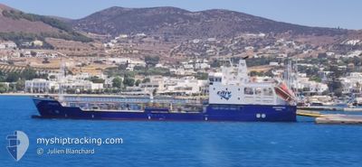
APILIOTIS
Oil Products Tanker
Current Trip
| Time Travelled | 17 h, 23 mins |
|---|---|
| Remaining Time | --- |
| Distance Travelled | 67.07 nm |
| Remaining Distance | --- |
| AVG Speed | 10.4 Knots |
| MAX Speed | 10.9 Knots |
| AVG Wind | 10.1 knots |
| MAX Wind | 14.1 knots |
| MIN Temp | 1.6°C / 34.88°F |
| MAX Temp | 7.3°C / 45.14°F |
| Draught | 4.5 m |
| Position Received | 10 h, 46 m ago |
Current Position
| Longitude | 25.45952° |
|---|---|
| Latitude | 39.64834° |
| Status | Under way using engine |
| Speed | 10.1 Knots |
| Course | 300.1° |
| Area | Aegean Sea |
| Station | T-AIS |
| Position Received | 10 h, 46 m ago |
Info
Information
The current position of APILIOTIS is in Aegean Sea with coordinates 39.64834° / 25.45952° as reported on 2025-02-13 01:58 by AIS to our vessel tracker app. The vessel's current speed is 10.1 Knots
The vessel APILIOTIS (IMO: 9324370, MMSI: 240438000) is a Oil Products Tanker that was built in 2006 ( 19 years old ). It's sailing under the flag of [GR] Greece.
In this page you can find informations about the vessels current position, last detected port calls, and current voyage information. If the vessels is not in coverage by AIS you will find the latest position.
The current position of APILIOTIS is detected by our AIS receivers and we are not responsible for the reliability of the data. The last position was recorded while the vessel was in Coverage by the Ais receivers of our vessel tracking app.
The current draught of APILIOTIS as reported by AIS is 4.5 meters
Weather
| Temperature | 8.4°C / 47.12°F |
|---|---|
| Wind Speed | 8 knots |
| Direction | 102° ESE |
| Pressure | 1027.7 hPa |
| Humidity | 61.4 % |
| Cloud Coverage | 96 % |
Featured Company
Last Port Calls
| Port | Arrival | Departure | Time In Port |
|---|---|---|---|
| 2025-02-12 06:29 | 2025-02-12 21:21 | 14 h | |
| 2025-02-11 22:41 | |||
| 2025-02-10 14:27 | 2025-02-10 18:40 | 4 h | |
| 2025-02-10 06:56 | 2025-02-10 13:11 | 6 h | |
| 2025-02-08 18:06 | 2025-02-08 22:24 | 4 h | |
| 2025-02-08 03:31 | 2025-02-08 16:02 | 12 h | |
| 2025-02-07 23:17 | 2025-02-08 00:36 | 1 h | |
| 2025-02-07 15:14 | 2025-02-07 19:00 | 3 h | |
| 2025-02-07 11:32 | 2025-02-07 11:50 | 17 m | |
| 2025-02-07 07:28 | 2025-02-07 09:44 | 2 h |
Last Trips
| Origin | Departure | Destination | Arrival | Distance | |
|---|---|---|---|---|---|
| 2025-02-11 22:41 | 2025-02-12 06:29 | 67.61 nm | |||
| 2025-02-10 13:11 | 2025-02-10 14:27 | 11.73 nm | |||
| 2025-02-08 22:24 | 2025-02-10 06:56 | 45.51 nm | |||
| 2025-02-08 16:02 | 2025-02-08 18:06 | 16.60 nm | |||
| 2025-02-08 00:36 | 2025-02-08 03:31 | 28.22 nm | |||
| 2025-02-07 19:00 | 2025-02-07 23:17 | 36.93 nm | |||
| 2025-02-07 11:50 | 2025-02-07 15:14 | 35.57 nm | |||
| 2025-02-07 09:44 | 2025-02-07 11:32 | 1.21 nm | |||
| 2025-02-06 10:50 | 2025-02-07 07:28 | 73.98 nm | |||
| 2025-02-05 15:22 | 2025-02-06 10:33 | 48.32 nm |
Events
| Time | Event | Details | Position / Dest | Info |
|---|---|---|---|---|
| 2025-02-13 02:12 | Status Changed | Default Under way using engine |
39.66744 / 25.41203
MYRINA
|
Speed: 10.1 kn Course: 300.1° |
| 2025-02-13 01:58 | OUT of Coverage |
39.64834 / 25.45952
Aegean Sea
MYRINA
|
Speed: 10.1 kn Course: 300.1° |
|
| 2025-02-12 23:37 | Detected in Sea | Greek part of the Aegean Sea |
39.46412 / 25.92531
Aegean Sea
MYRINA
|
Speed: 10.4 kn Course: 295° |
| 2025-02-12 22:49 | Change Sea Area | Turkish part of the Aegean Sea Greek part of the Aegean Sea |
39.40348 / 26.08388
Aegean Sea
MYRINA
|
Speed: 10.6 kn Course: 293.4° |
| 2025-02-12 21:31 | Status Changed | Under way using engine Default |
39.41161 / 26.36822
MYRINA
|
Speed: 10.2 kn Course: 335° |
| 2025-02-12 21:31 | IN Coverage |
39.41161 / 26.36822
Aegean Sea
MYRINA
|
Speed: 9.4 kn Course: 296.5° |
|
| 2025-02-12 20:20 | Status Changed | Default Under way using engine |
39.24825 / 26.50592
MYRINA
|
Speed: 10.2 kn Course: 334.2° |
| 2025-02-12 20:10 | OUT of Coverage |
39.22240 / 26.52204
Aegean Sea
MYRINA
|
Speed: 10.2 kn Course: 334.2° |
|
| 2025-02-12 20:00 | Destination Changed | MYRINA MYTILINI |
39.19494 / 26.53865
MYRINA
|
Speed: 10 kn Course: 335.7° |
| 2025-02-12 20:00 | ETA Changed | 2025/02/13 04:30 2025/02/12 04:00 |
39.19494 / 26.53865
MYRINA
|
Speed: 10 kn Course: 335.7° |