

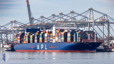
APL CHANGI
Container Ship

Current Trip
| Time Travelled | 17 days |
|---|---|
| Remaining Time | 12 days |
| Distance Travelled | 7009.30 nm |
| Remaining Distance | 4527.26 nm |
| AVG Speed | 16.4 Knots |
| MAX Speed | 20.6 Knots |
| AVG Wind | 12.1 knots |
| MAX Wind | 33.5 knots |
| MIN Temp | 12.9°C / 55.22°F |
| MAX Temp | 28.4°C / 83.12°F |
| Draught | 12.1 m |
| Position Received | 11 h, 25 m ago |
Current Position
| Longitude | 31.77236° |
|---|---|
| Latitude | -29.60263° |
| Status | Under way using engine |
| Speed | 11.5 Knots |
| Course | 84.5° |
| Area | Indian Ocean |
| Station | T-AIS |
| Position Received | 11 h, 25 m ago |
Information
The current position of APL CHANGI is in Indian Ocean with coordinates -29.60263° / 31.77236° as reported on 2025-05-31 07:27 by AIS to our vessel tracker app. The vessel's current speed is 11.5 Knots and is heading at the port of PORT KLANG. The estimated time of arrival as calculated by MyShipTracking vessel tracking app is 2025-06-13 17:02 LT
The vessel APL CHANGI (IMO: 9631981, MMSI: 566882000) is a Container Ship that was built in 2013 ( 12 years old ). It's sailing under the flag of [SG] Singapore.
In this page you can find informations about the vessels current position, last detected port calls, and current voyage information. If the vessels is not in coverage by AIS you will find the latest position.
The current position of APL CHANGI is detected by our AIS receivers and we are not responsible for the reliability of the data. The last position was recorded while the vessel was in Coverage by the Ais receivers of our vessel tracking app.
The current draught of APL CHANGI as reported by AIS is 12.1 meters
Weather
| Temperature | 21°C / 69.8°F |
|---|---|
| Wind Speed | 7 knots |
| Direction | 46° NE |
| Pressure | 1025.3 hPa |
| Humidity | 66.3 % |
| Cloud Coverage | --- |


Featured Company
Last Port Calls
| Port | Arrival | Departure | Time In Port |
|---|---|---|---|
| 2025-05-12 17:12 | 2025-05-13 19:50 | 1 d | |
| 2025-05-10 08:24 | 2025-05-12 07:03 | 1 d | |
| 2025-05-03 12:41 | 2025-05-05 03:54 | 1 d | |
| 2025-04-28 09:44 | 2025-04-29 11:26 | 1 d | |
| 2025-04-25 06:28 | 2025-04-27 21:23 | 2 d | |
| 2025-04-23 19:39 | 2025-04-24 19:06 | 23 h | |
| 2025-04-19 09:42 | 2025-04-20 20:45 | 1 d | |
| 2025-03-23 11:12 | 2025-03-24 03:10 | 15 h | |
| 2025-03-18 19:18 | 2025-03-19 21:17 | 1 d | |
| 2025-03-15 00:10 | 2025-03-16 12:34 | 1 d |
Most Visited Ports (Last year)
| Port | Arrivals | |
|---|---|---|
| 5 | ||
| 5 | ||
| 4 | ||
| 3 | ||
| 3 | ||
| 3 |
Last Trips
| Origin | Departure | Destination | Arrival | Distance | |
|---|---|---|---|---|---|
| 2025-05-12 08:03 | 2025-05-12 19:12 | 112.45 nm | |||
| 2025-05-05 05:54 | 2025-05-10 09:24 | 1386.65 nm | |||
| 2025-04-29 12:26 | 2025-05-03 14:41 | 1260.48 nm | |||
| 2025-04-27 23:23 | 2025-04-28 10:44 | 163.77 nm | |||
| 2025-04-24 21:06 | 2025-04-25 08:28 | 164.78 nm | |||
| 2025-04-20 21:45 | 2025-04-23 21:39 | 1215.22 nm | |||
| 2025-03-24 11:10 | 2025-04-19 10:42 | 10772.62 nm | |||
| 2025-03-20 05:17 | 2025-03-23 19:12 | 1498.55 nm | |||
| 2025-03-16 20:34 | 2025-03-19 03:18 | 827.57 nm | |||
| 2025-03-05 07:21 | 2025-03-15 08:10 | 2521.70 nm |
Events
| Time | Event | Details | Position / Dest | Info |
|---|---|---|---|---|
| 2025-05-31 07:36 | Status Changed | Default Under way using engine |
-29.60278 / 31.80841
MYPKG
|
Speed: 11.5 kn Course: 84.5° |
| 2025-05-31 07:27 | OUT of Coverage |
-29.60263 / 31.77236
Indian Ocean
MYPKG
|
Speed: 11.5 kn Course: 84.5° |
|
| 2025-05-31 07:26 | Status Changed | Under way using engine Default |
-29.60291 / 31.76869
MYPKG
|
Speed: 12.6 kn Course: 97° |
| 2025-05-31 07:20 | Status Changed | Default Under way using engine |
-29.60175 / 31.74671
MYPKG
|
Speed: 12.4 kn Course: 85.2° |
| 2025-05-31 07:08 | Status Changed | Under way using engine Default |
-29.60496 / 31.69842
MYPKG
|
Speed: 14.2 kn Course: 82° |
| 2025-05-31 07:01 | Status Changed | Default Under way using engine |
-29.60875 / 31.66772
MYPKG
|
Speed: 14.3 kn Course: 73.6° |
| 2025-05-31 04:28 | Change Sea Area | South African part of the Indian Ocean South African part of the South Atlantic Ocean |
-29.97664 / 31.07375
Indian Ocean
MYPKG
|
Speed: 16.8 kn Course: 29.2° |
| 2025-05-31 04:28 | Status Changed | Under way using engine Default |
-29.97705 / 31.07348
MYPKG
|
Speed: 16.9 kn Course: 29° |
| 2025-05-31 04:24 | IN Coverage |
-29.97664 / 31.07375
Indian Ocean
MYPKG
|
Speed: 16.8 kn Course: 29.2° |
|
| 2025-05-29 04:42 | OUT of Coverage |
-34.40313 / 17.83408
South Atlantic Ocean
MYPKG
|
Speed: 17 kn Course: 149° |