

AQUALOYALTY
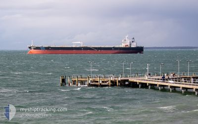
Crude Oil Tanker

Current Trip
| Time Travelled | 1 day |
|---|---|
| Remaining Time | --- |
| Distance Travelled | 2.91 nm |
| Remaining Distance | --- |
| AVG Speed | 4.2 Knots |
| MAX Speed | 4.6 Knots |
| AVG Wind | 2.8 knots |
| MAX Wind | 2.9 knots |
| MIN Temp | 25°C / 77°F |
| MAX Temp | 25.6°C / 78.08°F |
| Draught | 12 m |
| Position Received | Now |
Current Position
| Longitude | -97.49124° |
|---|---|
| Latitude | 27.82484° |
| Status | Moored |
| Speed | |
| Course | 295° |
| Area | Gulf of Mexico |
| Station | T-AIS |
| Position Received | Now |
Information
The current position of AQUALOYALTY is in Gulf of Mexico with coordinates 27.82484° / -97.49124° as reported on 2025-06-01 21:17 by AIS to our vessel tracker app. The vessel's current speed is 0 Knots
The vessel AQUALOYALTY (IMO: 9594664, MMSI: 636015177) is a Crude Oil Tanker that was built in 2012 ( 13 years old ). It's sailing under the flag of [LR] Liberia.
In this page you can find informations about the vessels current position, last detected port calls, and current voyage information. If the vessels is not in coverage by AIS you will find the latest position.
The current position of AQUALOYALTY is detected by our AIS receivers and we are not responsible for the reliability of the data. The last position was recorded while the vessel was in Coverage by the Ais receivers of our vessel tracking app.
The current draught of AQUALOYALTY as reported by AIS is 12 meters
Weather
| Temperature | 30.2°C / 86.36°F |
|---|---|
| Wind Speed | 9 knots |
| Direction | 115° ESE |
| Pressure | 1010.8 hPa |
| Humidity | 58.6 % |
| Cloud Coverage | 56 % |


Featured Company
Last Port Calls
| Port | Arrival | Departure | Time In Port |
|---|---|---|---|
| 2025-05-31 05:57 | 2025-05-31 06:42 | 45 m | |
| 2025-05-09 18:44 | 2025-05-10 06:19 | 11 h | |
| 2025-04-29 20:35 | 2025-04-29 21:35 | 1 h | |
| 2025-04-23 19:55 | 2025-04-25 10:13 | 1 d | |
| 2025-04-12 12:30 | 2025-04-13 21:20 | 1 d |
Most Visited Ports (Last year)
| Port | Arrivals | |
|---|---|---|
| 5 | ||
| 2 | ||
| 2 | ||
| 1 | ||
| 1 | ||
| 1 |
Last Trips
| Origin | Departure | Destination | Arrival | Distance | |
|---|---|---|---|---|---|
| 2025-05-09 23:19 | 2025-05-31 00:57 | 5175.36 nm | |||
| 2025-04-29 14:35 | 2025-05-09 11:44 | 1791.48 nm | |||
| 2025-04-25 03:13 | 2025-04-29 13:35 | 88.27 nm | |||
| 2025-04-13 14:20 | 2025-04-23 12:55 | 52.21 nm | |||
| 2025-02-09 17:33 | 2025-04-12 05:30 | 5911.51 nm |
Events
| Time | Event | Details | Position / Dest | Info |
|---|---|---|---|---|
| 2025-06-01 20:38 | Status Changed | Moored Default |
27.82485 / -97.49123
US CRP
|
Speed: Course: 295° |
| 2025-06-01 20:35 | Status Changed | Default Moored |
27.82484 / -97.49123
US CRP
|
Speed: Course: 295° |
| 2025-06-01 19:47 | Status Changed | Moored Default |
27.82484 / -97.49123
US CRP
|
Speed: Course: 295° |
| 2025-06-01 19:44 | Status Changed | Default Moored |
27.82484 / -97.49120
US CRP
|
Speed: Course: 295° |
| 2025-06-01 16:02 | Status Changed | Moored Default |
27.82484 / -97.49126
US CRP
|
Speed: Course: 295° |
| 2025-06-01 15:59 | Status Changed | Default Moored |
27.82483 / -97.49126
US CRP
|
Speed: Course: 295° |
| 2025-06-01 14:23 | Status Changed | Moored Default |
27.82486 / -97.49125
US CRP
|
Speed: 0.1 kn Course: 295° |
| 2025-06-01 14:17 | Status Changed | Default Moored |
27.82485 / -97.49123
US CRP
|
Speed: Course: 295° |
| 2025-06-01 13:50 | Status Changed | Moored Default |
27.82484 / -97.49126
US CRP
|
Speed: Course: 295° |
| 2025-06-01 13:47 | Status Changed | Default Moored |
27.82483 / -97.49122
US CRP
|
Speed: Course: 295° |