
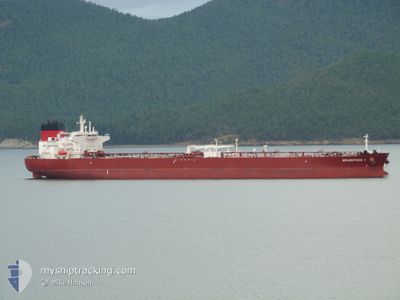
ARACHTHOS I
Tanker
Current Trip
| Time Travelled | 39 days |
|---|---|
| Remaining Time | --- |
| Distance Travelled | 7498.63 nm |
| Remaining Distance | 38.43 nm |
| AVG Speed | 11.7 Knots |
| MAX Speed | 15.2 Knots |
| AVG Wind | 11.3 knots |
| MAX Wind | 27.5 knots |
| MIN Temp | 2.4°C / 36.32°F |
| MAX Temp | 27.5°C / 81.5°F |
| Draught | 7.8 m |
| Position Received | 3 m ago |
Current Position
| Longitude | 2.62594° |
|---|---|
| Latitude | 51.44074° |
| Status | At anchor |
| Speed | 0.2 Knots |
| Course | 333° |
| Area | North Sea |
| Station | T-AIS |
| Position Received | 3 m ago |
Info
Information
The current position of ARACHTHOS I is in North Sea with coordinates 51.44074° / 2.62594° as reported on 2026-01-03 16:24 by AIS to our vessel tracker app. The vessel's current speed is 0.2 Knots and is heading at the port of VLISSINGEN. The estimated time of arrival as calculated by MyShipTracking vessel tracking app is 2026-01-03 15:00 LT
The vessel ARACHTHOS I (IMO: 9935143, MMSI: 636021090) is a Tanker It's sailing under the flag of [LR] Liberia.
In this page you can find informations about the vessels current position, last detected port calls, and current voyage information. If the vessels is not in coverage by AIS you will find the latest position.
The current position of ARACHTHOS I is detected by our AIS receivers and we are not responsible for the reliability of the data. The last position was recorded while the vessel was in Coverage by the Ais receivers of our vessel tracking app.
The current draught of ARACHTHOS I as reported by AIS is 7.8 meters
Weather
| Temperature | 5.1°C / 41.18°F |
|---|---|
| Wind Speed | 25 knots |
| Direction | 324° NW |
| Pressure | 1007.1 hPa |
| Humidity | 67.9 % |
| Cloud Coverage | 96 % |
Featured Company
Last Port Calls
| Port | Arrival | Departure | Time In Port |
|---|---|---|---|
| 2025-12-18 08:17 | 2025-12-18 17:33 | 9 h | |
| 2025-11-22 16:13 | 2025-11-24 19:34 | 2 d | |
| 2025-11-04 15:18 | 2025-11-06 11:15 | 1 d |
Most Visited Ports (Last year)
| Port | Arrivals | |
|---|---|---|
| 7 | ||
| 2 | ||
| 2 | ||
| 1 | ||
| 1 | ||
| 1 |
Last Trips
| Origin | Departure | Destination | Arrival | Distance | |
|---|---|---|---|---|---|
| 2025-11-25 03:34 | 2025-12-18 10:17 | 5473.03 nm | |||
| 2025-11-06 19:15 | 2025-11-23 00:13 | 67.22 nm | |||
| 2025-10-14 17:45 | 2025-11-04 23:18 | 4981.03 nm |
Events
| Time | Event | Details | Position / Dest | Info |
|---|---|---|---|---|
| 2026-01-03 15:36 | Status Changed | At anchor Under way using engine |
51.44264 / 2.62659
NLVLI
|
Speed: 0.9 kn Course: 285° |
| 2026-01-03 15:30 | STOP Moving | 17.68 nm, North West of OOSTENDE |
51.44353 / 2.62641
NLVLI
|
Speed: 0.3 kn Course: 293° |
| 2026-01-03 13:31 | Change Sea Area | Belgian part of the North Sea French part of the North Sea |
51.33265 / 2.36983
North Sea
NLVLI
|
Speed: 12.7 kn Course: 67° |
| 2026-01-03 10:58 | Change Sea Area | French part of the North Sea French part of the English Channel |
51.00377 / 1.61905
North Sea
NLVLI
|
Speed: 14.1 kn Course: 45.5° |
| 2026-01-03 08:37 | Status Changed | Under way using engine Default |
50.60493 / 1.19316
NLVLI
|
Speed: 12.6 kn Course: 47° |
| 2026-01-03 08:29 | Status Changed | Default Under way using engine |
50.58418 / 1.15824
NLVLI
|
Speed: 12.7 kn Course: 46.4° |
| 2026-01-03 08:14 | Status Changed | Under way using engine Default |
50.54798 / 1.09873
NLVLI
|
Speed: 12.7 kn Course: 46° |
| 2026-01-03 08:13 | Status Changed | Default Under way using engine |
50.54514 / 1.09402
NLVLI
|
Speed: 12.8 kn Course: 46.7° |
| 2026-01-03 08:07 | Status Changed | Under way using engine Default |
50.53212 / 1.07225
NLVLI
|
Speed: 12.7 kn Course: 47° |
| 2026-01-03 08:01 | Status Changed | Default Under way using engine |
50.51614 / 1.04495
NLVLI
|
Speed: 12.6 kn Course: 53.5° |