
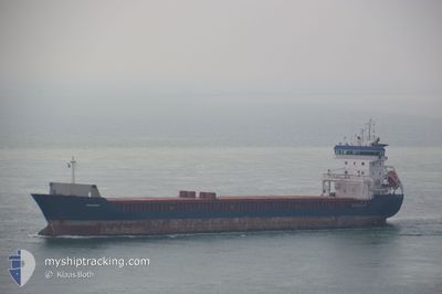
ARISTO
General Cargo
Current Trip
| Trip Time | 15 days |
|---|---|
| Trip Distance | 2967.93 nm |
| AVG Speed | 10.1 Knots |
| MAX Speed | 13.1 Knots |
| Draught | 4.8 m |
| AVG Wind | 11 knots |
| MAX Wind | 28 knots |
| MIN Temp | 1.7°C / 35.06°F |
| MAX Temp | 16°C / 60.8°F |
| Position Received | 7 d ago |
Current Position
| Longitude | -9.83538° |
|---|---|
| Latitude | 40.22708° |
| Status | Under way using engine |
| Speed | 10.7 Knots |
| Course | 2.6° |
| Area | North Atlantic Ocean |
| Station | T-AIS |
| Position Received | 7 d ago |
Info
Information
The current position of ARISTO is in North Atlantic Ocean with coordinates 40.22708° / -9.83538° as reported on 2025-02-05 08:24 by AIS to our vessel tracker app. The vessel's current speed is 10.7 Knots and is currently inside the port of AUGHINISH.
The vessel ARISTO (IMO: 9229116, MMSI: 305848000) is a General Cargo that was built in 2000 ( 25 years old ). It's sailing under the flag of [AG] Antigua Barbuda.
In this page you can find informations about the vessels current position, last detected port calls, and current voyage information. If the vessels is not in coverage by AIS you will find the latest position.
The current position of ARISTO is detected by our AIS receivers and we are not responsible for the reliability of the data. The last position was recorded while the vessel was in Coverage by the Ais receivers of our vessel tracking app.
The current draught of ARISTO as reported by AIS is 4.8 meters
Weather
| Temperature | 4.5°C / 40.1°F |
|---|---|
| Wind Speed | 10 knots |
| Direction | 113° ESE |
| Pressure | 1019.1 hPa |
| Humidity | 94 % |
| Cloud Coverage | 100 % |
Featured Company
Last Port Calls
| Port | Arrival | Departure | Time In Port |
|---|---|---|---|
| 2025-02-12 02:29 | |||
| 2025-01-24 09:25 | 2025-01-27 18:15 | 3 d | |
| 2025-01-01 13:02 | 2025-01-06 15:43 | 5 d | |
| 2024-12-26 04:54 | |||
| 2024-12-14 11:52 | 2024-12-16 13:58 | 2 d |
Last Trips
| Origin | Departure | Destination | Arrival | Distance | |
|---|---|---|---|---|---|
| 2025-01-27 19:15 | 2025-02-12 02:29 | 2967.93 nm | |||
| 2025-01-06 16:43 | 2025-01-24 10:25 | 4375.03 nm | |||
| 2024-12-16 13:58 | 2024-12-26 07:54 | 1948.98 nm | |||
| 2024-11-28 23:14 | 2024-12-14 11:52 | 1836.85 nm |
Events
| Time | Event | Details | Position / Dest | Info |
|---|---|---|---|---|
| 2025-02-12 02:29 | STOP Moving |
52.64504 / -9.05617
[IE] AUGHINISH
|
Speed: 0.2 kn Course: 264° |
|
| 2025-02-12 02:29 | PORT ARRIVAL |
|
52.64504 / -9.05617
[IE] AUGHINISH
|
Speed: 3.5 kn Course: 246° |
| 2025-02-12 00:31 | START Moving | 1.78 nm, South of CAPPA UPPER |
52.59787 / -9.49367
IEAUG
|
Speed: 7.6 kn Course: 63° |
| 2025-02-05 08:32 | Status Changed | Default Under way using engine |
40.24865 / -9.83572
IEAUG
|
Speed: 10.7 kn Course: 2.6° |
| 2025-02-05 08:24 | OUT of Coverage |
40.22708 / -9.83538
North Atlantic Ocean
IEAUG
|
Speed: 10.7 kn Course: 2.6° |
|
| 2025-02-05 06:26 | Status Changed | Under way using engine Default |
39.90132 / -9.84595
IEAUG
|
Speed: 9.8 kn Course: 358° |
| 2025-02-05 06:19 | Status Changed | Default Under way using engine |
39.88235 / -9.84598
IEAUG
|
Speed: 10 kn Course: 5° |
| 2025-02-05 06:09 | Status Changed | Under way using engine Default |
39.85465 / -9.84698
IEAUG
|
Speed: 9.7 kn Course: 5° |
| 2025-02-05 06:07 | Status Changed | Default Under way using engine |
39.84890 / -9.84747
IEAUG
|
Speed: 9.8 kn Course: 3.1° |
| 2025-02-05 04:09 | Status Changed | Under way using engine Default |
39.52407 / -9.86468
IEAUG
|
Speed: 9.8 kn Course: 359° |