

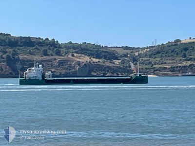
ARKLOW GRACE
Cargo
Current Trip
| Time Travelled | 4 days |
|---|---|
| Remaining Time | --- |
| Distance Travelled | 167.12 nm |
| Remaining Distance | --- |
| AVG Speed | 8.5 Knots |
| MAX Speed | 11 Knots |
| AVG Wind | 10.4 knots |
| MAX Wind | 18 knots |
| MIN Temp | 6.1°C / 42.98°F |
| MAX Temp | 16.4°C / 61.52°F |
| Draught | 3.9 m |
| Position Received | 2 d ago |
Current Position
| Longitude | -10.42383° |
|---|---|
| Latitude | 51.58995° |
| Status | Under way using engine |
| Speed | 9.5 Knots |
| Course | 321.9° |
| Area | North Atlantic Ocean |
| Station | T-AIS |
| Position Received | 2 d ago |
Information
The current position of ARKLOW GRACE is in North Atlantic Ocean with coordinates 51.58995° / -10.42383° as reported on 2025-06-06 07:44 by AIS to our vessel tracker app. The vessel's current speed is 9.5 Knots and is heading at the port of LIMERICK. The estimated time of arrival as calculated by MyShipTracking vessel tracking app is 2025-06-06 18:00 LT
The vessel ARKLOW GRACE (IMO: 9874117, MMSI: 244635000) is a Cargo It's sailing under the flag of [NL] Netherlands.
In this page you can find informations about the vessels current position, last detected port calls, and current voyage information. If the vessels is not in coverage by AIS you will find the latest position.
The current position of ARKLOW GRACE is detected by our AIS receivers and we are not responsible for the reliability of the data. The last position was recorded while the vessel was in Coverage by the Ais receivers of our vessel tracking app.
The current draught of ARKLOW GRACE as reported by AIS is 3.9 meters
Weather
| Temperature | 12.5°C / 54.5°F |
|---|---|
| Wind Speed | 15 knots |
| Direction | 277° W |
| Pressure | 1007.9 hPa |
| Humidity | 67.2 % |
| Cloud Coverage | 100 % |
Featured Company
Last Port Calls
| Port | Arrival | Departure | Time In Port |
|---|---|---|---|
| 2025-06-02 19:17 | 2025-06-03 20:03 | 1 d | |
| 2025-05-14 15:56 | |||
| 2025-05-03 03:19 | 2025-05-03 22:01 | 18 h | |
| 2025-04-29 23:29 | 2025-04-30 07:16 | 7 h | |
| 2025-04-18 19:43 | 2025-04-24 06:52 | 5 d | |
| 2025-04-10 16:08 | 2025-04-10 22:34 | 6 h | |
| 2025-04-01 21:02 |
Last Trips
| Origin | Departure | Destination | Arrival | Distance | |
|---|---|---|---|---|---|
| 2025-05-03 22:01 | 2025-06-02 19:17 | 3530.76 nm | |||
| 2025-05-03 22:01 | 2025-05-14 15:56 | 2312.67 nm | |||
| 2025-04-30 07:16 | 2025-05-03 03:19 | 176.65 nm | |||
| 2025-04-24 06:52 | 2025-04-29 23:29 | 1598.73 nm | |||
| 2025-04-10 22:34 | 2025-04-18 19:43 | 1599.63 nm | |||
| 2025-04-01 21:02 | 2025-04-10 16:08 | 1215.54 nm |
Events
| Time | Event | Details | Position / Dest | Info |
|---|---|---|---|---|
| 2025-06-06 07:44 | OUT of Coverage |
51.58995 / -10.42383
North Atlantic Ocean
IELMK
|
Speed: 9.5 kn Course: 321.9° |
|
| 2025-06-06 06:23 | ETA Changed | 2025/06/06 17:00 2025/06/06 16:00 |
51.48618 / -10.13776
IELMK
|
Speed: 9.4 kn Course: 294° |
| 2025-06-06 05:28 | Detected in Sea | Irish part of the North Atlantic Ocean |
51.42149 / -9.92707
North Atlantic Ocean
IELMK
|
Speed: 10 kn Course: 297.1° |
| 2025-06-05 16:43 | ETA Changed | 2025/06/06 16:00 2025/06/05 16:00 |
52.12957 / -6.98819
IELMK
|
Speed: 8 kn Course: 216.3° |
| 2025-06-05 16:20 | START Moving | 1.08 nm, East of DUNMORE EAST |
52.15123 / -6.96132
IELMK
|
Speed: 3.3 kn Course: 247° |
| 2025-06-05 16:09 | Status Changed | Under way using engine At anchor |
52.15121 / -6.95747
IELMK
|
Speed: 1 kn Course: 180° |
| 2025-06-05 16:01 | ETA Changed | 2025/06/05 16:00 2025/06/03 22:00 |
52.15209 / -6.95693
IELMK
|
Speed: 0.4 kn Course: 276° |
| 2025-06-05 15:48 | Destination Changed | IELMK FOR ORDER |
52.15255 / -6.95712
IELMK
|
Speed: 0.1 kn Course: 220° |
| 2025-06-04 18:26 | Status Changed | At anchor Under way using engine |
52.15240 / -6.95692
FOR ORDER
|
Speed: 0.2 kn Course: 234° |
| 2025-06-04 18:14 | STOP Moving | 1.19 nm, East of DUNMORE EAST |
52.15094 / -6.95840
FOR ORDER
|
Speed: 0.3 kn Course: 250° |