

ATA-M
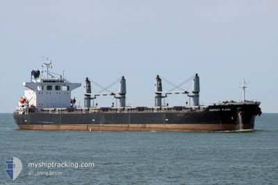
Bulk Carrier

Current Trip
MOGADISHU
| Time Travelled | 6 days |
|---|---|
| Remaining Time | --- |
| Distance Travelled | 1738.96 nm |
| Remaining Distance | --- |
| AVG Speed | 10.5 Knots |
| MAX Speed | 13.6 Knots |
| AVG Wind | 14.6 knots |
| MAX Wind | 35.8 knots |
| MIN Temp | 23.1°C / 73.58°F |
| MAX Temp | 28.4°C / 83.12°F |
| Draught | 10.9 m |
| Position Received | 24 d ago |
Current Position
| Longitude | 57.25333° |
|---|---|
| Latitude | 24.72521° |
| Status | Under way using engine |
| Speed | 11 Knots |
| Course | 124.5° |
| Area | Gulf of Oman |
| Station | T-AIS |
| Position Received | 24 d ago |
Information
The current position of ATA-M is in Gulf of Oman with coordinates 24.72521° / 57.25333° as reported on 2025-04-27 04:52 by AIS to our vessel tracker app. The vessel's current speed is 11 Knots
The vessel ATA-M (IMO: 9197662, MMSI: 370734000) is a Bulk Carrier that was built in 2001 ( 24 years old ). It's sailing under the flag of [PA] Panama.
In this page you can find informations about the vessels current position, last detected port calls, and current voyage information. If the vessels is not in coverage by AIS you will find the latest position.
The current position of ATA-M is detected by our AIS receivers and we are not responsible for the reliability of the data. The last position was recorded while the vessel was in Coverage by the Ais receivers of our vessel tracking app.
The current draught of ATA-M as reported by AIS is 10.9 meters
Weather
| Temperature | 23.5°C / 74.3°F |
|---|---|
| Wind Speed | 33 knots |
| Direction | 194° SSW |
| Pressure | 1018.8 hPa |
| Humidity | 68.4 % |
| Cloud Coverage | 72 % |


Featured Company
Most Visited Ports (Last year)
| Port | Arrivals | |
|---|---|---|
| 2 | ||
| 2 | ||
| 2 | ||
| 1 | ||
| 1 | ||
| 1 |
Last Trips
| Origin | Departure | Destination | Arrival | Distance | |
|---|---|---|---|---|---|
| 2025-04-26 15:02 | 2025-05-10 15:10 | 2006.83 nm | |||
| 2025-04-17 08:31 | 2025-04-24 18:34 | 1673.85 nm | |||
| 2025-04-09 10:55 | 2025-04-11 16:40 | 77.31 nm | |||
| 2025-04-01 08:54 | 2025-04-07 10:24 | 6.42 nm | |||
| 2025-02-06 09:50 | 2025-03-31 17:52 | 9160.23 nm |