
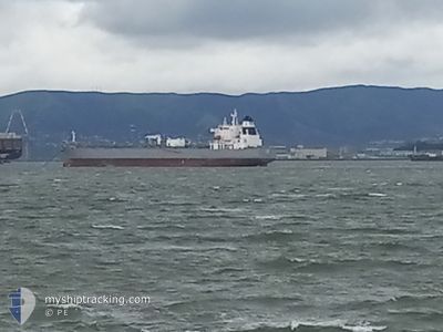
ATHINA
Tanker
Current Trip
| Time Travelled | 13 days |
|---|---|
| Remaining Time | --- |
| Distance Travelled | 3750.51 nm |
| Remaining Distance | --- |
| AVG Speed | 12.2 Knots |
| MAX Speed | 14 Knots |
| AVG Wind | 12.4 knots |
| MAX Wind | 38 knots |
| MIN Temp | 12.8°C / 55.04°F |
| MAX Temp | 28.1°C / 82.58°F |
| Draught | 12.3 m |
| Position Received | 7 d ago |
Current Position
| Longitude | -110.08600° |
|---|---|
| Latitude | 20.95490° |
| Status | Under way using engine |
| Speed | 12.4 Knots |
| Course | 138.2° |
| Area | North Pacific Ocean |
| Station | T-AIS |
| Position Received | 7 d ago |
Info
Information
The current position of ATHINA is in North Pacific Ocean with coordinates 20.95490° / -110.08600° as reported on 2025-12-27 23:35 by AIS to our vessel tracker app. The vessel's current speed is 12.4 Knots and is heading at the port of TANGIER.
The vessel ATHINA (MMSI: 311000937) is a Tanker It's sailing under the flag of [BS] Bahamas.
In this page you can find informations about the vessels current position, last detected port calls, and current voyage information. If the vessels is not in coverage by AIS you will find the latest position.
The current position of ATHINA is detected by our AIS receivers and we are not responsible for the reliability of the data. The last position was recorded while the vessel was in Coverage by the Ais receivers of our vessel tracking app.
The current draught of ATHINA as reported by AIS is 12.3 meters
Weather
| Temperature | 22.2°C / 71.96°F |
|---|---|
| Wind Speed | 8 knots |
| Direction | 131° SE |
| Pressure | 1013.3 hPa |
| Humidity | 72.9 % |
| Cloud Coverage | 100 % |
Featured Company
Last Port Calls
| Port | Arrival | Departure | Time In Port |
|---|---|---|---|
| 2025-12-20 10:05 | 2025-12-22 13:30 | 2 d | |
| 2025-11-30 21:58 | 2025-12-01 18:42 | 20 h | |
| 2025-11-21 12:06 | 2025-11-24 08:02 | 2 d | |
| 2025-11-01 16:54 | 2025-11-01 23:29 | 6 h | |
| 2025-11-01 16:43 |
Most Visited Ports (Last year)
| Port | Arrivals | |
|---|---|---|
| 5 | ||
| 5 | ||
| 2 | ||
| 2 | ||
| 2 | ||
| 2 |
Last Trips
| Origin | Departure | Destination | Arrival | Distance | |
|---|---|---|---|---|---|
| 2025-12-01 18:42 | 2025-12-20 10:05 | 3564.76 nm | |||
| 2025-11-24 08:02 | 2025-11-30 21:58 | 1493.01 nm | |||
| 2025-11-01 23:29 | 2025-11-21 12:06 | 4389.59 nm | |||
| 2025-11-01 16:43 | 2025-11-01 16:54 | 1.90 nm |
Events
| Time | Event | Details | Position / Dest | Info |
|---|---|---|---|---|
| 2025-12-28 03:20 | Destination Changed | CL QTUMATNG CL QTV |
20.32667 / -109.55500
CL QTUMATNG
|
Speed: 12 kn Course: 142° |
| 2025-12-27 23:44 | Status Changed | Default Under way using engine |
20.92500 / -110.05833
CL QTV
|
Speed: 12.4 kn Course: 138.2° |
| 2025-12-27 23:35 | OUT of Coverage |
20.95490 / -110.08600
North Pacific Ocean
CL QTV
|
Speed: 12.4 kn Course: 138.2° |
|
| 2025-12-27 23:35 | Status Changed | Under way using engine Default |
20.95490 / -110.08600
CL QTV
|
Speed: 12.4 kn Course: 138° |
| 2025-12-27 23:29 | IN Coverage |
20.95490 / -110.08600
North Pacific Ocean
CL QTV
|
Speed: 12.4 kn Course: 138.2° |
|
| 2025-12-27 22:44 | Status Changed | Default Under way using engine |
21.08667 / -110.20333
CL QTV
|
Speed: 12.8 kn Course: 143.1° |
| 2025-12-27 22:33 | Status Changed | Under way using engine Default |
21.12810 / -110.23700
CL QTV
|
Speed: 12.8 kn Course: 143° |
| 2025-12-27 22:33 | OUT of Coverage |
21.12810 / -110.23700
North Pacific Ocean
CL QTV
|
Speed: 12.8 kn Course: 143.1° |
|
| 2025-12-27 22:17 | IN Coverage |
21.12810 / -110.23700
North Pacific Ocean
CL QTV
|
Speed: 12.8 kn Course: 143.1° |
|
| 2025-12-27 20:47 | OUT of Coverage |
21.41890 / -110.48400
North Pacific Ocean
CL QTV
|
Speed: 13 kn Course: 139.9° |