
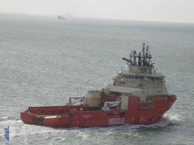
ATLANTIC KESTREL
Anchor Handling Vessel
Current Trip
SALVAGE AREA
| Time Travelled | 2 days |
|---|---|
| Remaining Time | --- |
| Distance Travelled | 83.27 nm |
| Remaining Distance | --- |
| AVG Speed | 6.2 Knots |
| MAX Speed | 13.6 Knots |
| AVG Wind | 10.8 knots |
| MAX Wind | 21.7 knots |
| MIN Temp | 2.1°C / 35.78°F |
| MAX Temp | 5.8°C / 42.44°F |
| Draught | 7 m |
| Position Received | 1 m ago |
Current Position
| Longitude | 0.55510° |
|---|---|
| Latitude | 53.43197° |
| Status | Under way using engine |
| Speed | 7.7 Knots |
| Course | 17.6° |
| Area | North Sea |
| Station | T-AIS |
| Position Received | 1 m ago |
Info
Information
The current position of ATLANTIC KESTREL is in North Sea with coordinates 53.43197° / 0.55510° as reported on 2025-03-15 00:21 by AIS to our vessel tracker app. The vessel's current speed is 7.7 Knots
The vessel ATLANTIC KESTREL (IMO: 9557446, MMSI: 316023651) is a Anchor Handling Vessel that was built in 2012 ( 13 years old ). It's sailing under the flag of [CA] Canada.
In this page you can find informations about the vessels current position, last detected port calls, and current voyage information. If the vessels is not in coverage by AIS you will find the latest position.
The current position of ATLANTIC KESTREL is detected by our AIS receivers and we are not responsible for the reliability of the data. The last position was recorded while the vessel was in Coverage by the Ais receivers of our vessel tracking app.
The current draught of ATLANTIC KESTREL as reported by AIS is 7 meters
Weather
| Temperature | 5.7°C / 42.26°F |
|---|---|
| Wind Speed | 10 knots |
| Direction | 50° NE |
| Pressure | 1019.9 hPa |
| Humidity | 78.1 % |
| Cloud Coverage | 26 % |
Featured Company
Last Port Calls
| Port | Arrival | Departure | Time In Port |
|---|---|---|---|
| 2025-03-11 17:49 | 2025-03-12 00:43 | 6 h | |
| 2025-03-08 09:03 | 2025-03-10 23:48 | 2 d | |
| 2025-03-04 04:21 | 2025-03-05 17:26 | 1 d | |
| 2025-02-22 21:38 | 2025-02-27 00:52 | 4 d | |
| 2025-02-14 21:15 | 2025-02-22 10:59 | 7 d | |
| 2025-01-30 15:25 | 2025-02-04 18:30 | 5 d | |
| 2025-01-22 20:32 | 2025-01-27 12:40 | 4 d | |
| 2025-01-10 20:35 | 2025-01-19 04:51 | 8 d | |
| 2025-01-10 10:47 |
Last Trips
| Origin | Departure | Destination | Arrival | Distance | |
|---|---|---|---|---|---|
| 2025-03-10 23:48 | 2025-03-11 17:49 | 230.84 nm | |||
| 2025-03-05 17:26 | 2025-03-08 09:03 | 9.92 nm | |||
| 2025-02-27 00:52 | 2025-03-04 04:21 | 449.74 nm | |||
| 2025-02-22 10:59 | 2025-02-22 21:38 | 62.51 nm | |||
| 2025-02-04 18:30 | 2025-02-14 21:15 | 366.20 nm | |||
| 2025-01-27 12:40 | 2025-01-30 15:25 | 15.04 nm | |||
| 2025-01-19 04:51 | 2025-01-22 20:32 | 15.61 nm | |||
| 2025-01-10 10:47 | 2025-01-10 20:35 | 29.48 nm |
Events
| Time | Event | Details | Position / Dest | Info |
|---|---|---|---|---|
| 2025-03-15 00:16 | START Moving |
53.42397 / .54627
SALVAGE AREA
|
Speed: 3.7 kn Course: 106° |
|
| 2025-03-14 15:51 | STOP Moving |
53.41957 / .50683
SALVAGE AREA
|
Speed: 0.2 kn Course: 16° |
|
| 2025-03-14 15:33 | START Moving |
53.43905 / .51379
SALVAGE AREA
|
Speed: 3.1 kn Course: 17° |
|
| 2025-03-14 13:52 | STOP Moving |
53.44058 / .51864
SALVAGE AREA
|
Speed: 0.3 kn Course: 190° |
|
| 2025-03-14 13:23 | START Moving |
53.46120 / .51636
SALVAGE AREA
|
Speed: 3.1 kn Course: 180° |
|
| 2025-03-14 10:39 | STOP Moving |
53.46249 / .51886
SALVAGE AREA
|
Speed: 0.3 kn Course: 3° |
|
| 2025-03-14 08:30 | START Moving |
53.41928 / .58117
SALVAGE AREA
|
Speed: 3.2 kn Course: 328° |
|
| 2025-03-14 03:50 | Status Changed | Under way using engine Default |
53.41809 / .55413
SALVAGE AREA
|
Speed: 0.1 kn Course: 269° |
| 2025-03-14 03:46 | Status Changed | Default Under way using engine |
53.41810 / .55415
SALVAGE AREA
|
Speed: 0.1 kn Course: 0° |
| 2025-03-13 21:54 | Status Changed | Under way using engine Default |
53.41718 / .57939
SALVAGE AREA
|
Speed: 0.3 kn Course: 209° |