

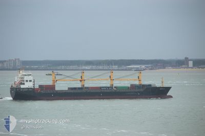
ATLANTIC RUNNER II
General Cargo

Current Trip
| Time Travelled | 45 days |
|---|---|
| Remaining Time | --- |
| Distance Travelled | 11676.48 nm |
| Remaining Distance | --- |
| AVG Speed | 12.3 Knots |
| MAX Speed | 17.4 Knots |
| AVG Wind | 12 knots |
| MAX Wind | 26 knots |
| MIN Temp | 15.4°C / 59.72°F |
| MAX Temp | 31°C / 87.8°F |
| Draught | 8.5 m |
| Position Received | 5 h, 10 m ago |
Current Position
| Longitude | -18.70712° |
|---|---|
| Latitude | 14.06507° |
| Status | Under way using engine |
| Speed | 12 Knots |
| Course | 359.6° |
| Area | North Atlantic Ocean |
| Station | T-AIS |
| Position Received | 5 h, 10 m ago |
Information
The current position of ATLANTIC RUNNER II is in North Atlantic Ocean with coordinates 14.06507° / -18.70712° as reported on 2025-06-11 02:55 by AIS to our vessel tracker app. The vessel's current speed is 12 Knots and is heading at the port of CUXHAVEN. The estimated time of arrival as calculated by MyShipTracking vessel tracking app is 2025-06-20 22:00 LT
The vessel ATLANTIC RUNNER II (IMO: 9509619, MMSI: 538010196) is a General Cargo that was built in 2010 ( 15 years old ). It's sailing under the flag of [MH] Marshall Is.
In this page you can find informations about the vessels current position, last detected port calls, and current voyage information. If the vessels is not in coverage by AIS you will find the latest position.
The current position of ATLANTIC RUNNER II is detected by our AIS receivers and we are not responsible for the reliability of the data. The last position was recorded while the vessel was in Coverage by the Ais receivers of our vessel tracking app.
The current draught of ATLANTIC RUNNER II as reported by AIS is 8.5 meters
Weather
| Temperature | 22.9°C / 73.22°F |
|---|---|
| Wind Speed | 14 knots |
| Direction | 314° NW |
| Pressure | 1011.4 hPa |
| Humidity | 80.7 % |
| Cloud Coverage | --- |


Featured Company
Most Visited Ports (Last year)
| Port | Arrivals | |
|---|---|---|
| 1 | ||
| 1 | ||
| 1 | ||
| 1 | ||
| 1 | ||
| 1 |
Last Trips
| Origin | Departure | Destination | Arrival | Distance |
|---|
Events
| Time | Event | Details | Position / Dest | Info |
|---|---|---|---|---|
| 2025-06-11 03:00 | Status Changed | Default Under way using engine |
14.08452 / -18.70730
DECUX
|
Speed: 12 kn Course: 359.6° |
| 2025-06-11 02:55 | OUT of Coverage |
14.06507 / -18.70712
North Atlantic Ocean
DECUX
|
Speed: 12 kn Course: 359.6° |
|
| 2025-06-11 02:47 | Status Changed | Under way using engine Default |
14.03833 / -18.70653
DECUX
|
Speed: 12.2 kn Course: 359° |
| 2025-06-11 02:38 | Status Changed | Default Under way using engine |
14.00801 / -18.70620
DECUX
|
Speed: 12.2 kn Course: 359.9° |
| 2025-06-11 02:35 | Status Changed | Under way using engine Default |
13.99829 / -18.70603
DECUX
|
Speed: 12.2 kn Course: 0° |
| 2025-06-11 02:12 | Status Changed | Default Under way using engine |
13.92190 / -18.70401
DECUX
|
Speed: 12.2 kn Course: 357.7° |
| 2025-06-11 02:03 | Status Changed | Under way using engine Default |
13.88972 / -18.70311
DECUX
|
Speed: 12.2 kn Course: 359° |
| 2025-06-11 02:03 | IN Coverage |
13.89484 / -18.70319
North Atlantic Ocean
DECUX
|
Speed: 12.1 kn Course: 357.6° |
|
| 2025-06-11 01:04 | Status Changed | Default Under way using engine |
13.68525 / -18.70348
DECUX
|
Speed: 12.5 kn Course: 0.3° |
| 2025-06-11 01:00 | OUT of Coverage |
13.66874 / -18.70348
North Atlantic Ocean
DECUX
|
Speed: 12.5 kn Course: 0.3° |